
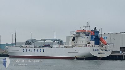
COOL EXPRESS
Cargo
Current Trip
| Time Travelled | 12 days |
|---|---|
| Remaining Time | --- |
| Distance Travelled | 4987.99 nm |
| Remaining Distance | --- |
| AVG Speed | 16.9 Knop |
| MAX Speed | 19.7 Knop |
| AVG Wind | 16.2 knots |
| MAX Wind | 27.6 knots |
| MIN Temp | 4°C / 39.2°F |
| MAX Temp | 26.9°C / 80.42°F |
| Djupgående | 8.4 m |
| Position mottagen | 4 d sen |
Current Position
| Longitud | -26.50674° |
|---|---|
| Latitude | 35.91348° |
| Status | Under way using engine |
| Fart | 16 Knop |
| Kurs | 240° |
| Område | North Atlantic Ocean |
| Station | T-AIS |
| Position mottagen | 4 d sen |
Info
Information
The current position of COOL EXPRESS is in North Atlantic Ocean with coordinates 35.91348° / -26.50674° as reported on 2024-05-07 16:18 by AIS to our vessel tracker app. The vessel's current speed is 16 Knop and is heading at the port of CRISTOBAL. The estimated time of arrival as calculated by MyShipTracking vessel tracking app is 2024-05-16 06:00 LT
The vessel COOL EXPRESS (IMO: 9836878, MMSI: 351074000) is a Cargo It's sailing under the flag of [PA] Panama.
In this page you can find informations about the vessels current position, last detected port calls, and current voyage information. If the vessels is not in coverage by AIS you will find the latest position.
The current position of COOL EXPRESS is detected by our AIS receivers and we are not responsible for the reliability of the data. The last position was recorded while the vessel was in Coverage by the Ais receivers of our vessel tracking app.
The current draught of COOL EXPRESS as reported by AIS is 8.4 meters
Weather
| Temperature | 26.9°C / 80.42°F |
|---|---|
| Wind Speed | 7 knots |
| Direction | 112° ESE |
| Pressure | 1016.6 hPa |
| Humidity | 79.1 % |
| Cloud Coverage | 4 % |
Featured Company
Last Port Calls
| Port | Arrival | Departure | Time In Port |
|---|---|---|---|
| 2024-04-21 14:58 | 2024-04-29 22:16 | 8 d | |
| 2024-04-01 06:42 | 2024-04-02 12:22 | 1 d | |
| 2024-03-08 19:19 |
Most Visited Ports (Last year)
| Port | Arrivals | |
|---|---|---|
| 5 | ||
| 5 | ||
| 5 | ||
| 5 | ||
| 5 | ||
| 2 |
Last Trips
| Origin | Departure | Destination | Arrival | Distance | |
|---|---|---|---|---|---|
| 2024-04-02 07:22 | 2024-04-21 17:58 | 7205.81 nm | |||
| 2024-03-08 22:19 | 2024-04-01 01:42 | 7496.58 nm |
Events
| Tid | Event | Detaljer | Position / Dest | Information |
|---|---|---|---|---|
| 2024-05-07 16:26 | Status ändrad | Default Under way using engine |
35.89661 / -26.54309
PACTB
|
Fart: 16 kn Kurs: 240° |
| 2024-05-07 16:18 | UTANFÖR täckningsområde |
35.91348 / -26.50674
North Atlantic Ocean
PACTB
|
Fart: 16 kn Kurs: 240° |
|
| 2024-05-07 15:43 | Status ändrad | Under way using engine Default |
35.99142 / -26.34628
PACTB
|
Fart: 15.4 kn Kurs: 238° |
| 2024-05-07 15:40 | Status ändrad | Default Under way using engine |
35.99880 / -26.33188
PACTB
|
Fart: 15.2 kn Kurs: 237.7° |
| 2024-05-07 15:32 | Status ändrad | Under way using engine Default |
36.01818 / -26.29423
PACTB
|
Fart: 15.4 kn Kurs: 237° |
| 2024-05-07 15:23 | Status ändrad | Default Under way using engine |
36.03758 / -26.25626
PACTB
|
Fart: 15.4 kn Kurs: 238° |
| 2024-05-07 15:16 | Status ändrad | Under way using engine Default |
36.05386 / -26.22441
PACTB
|
Fart: 15.5 kn Kurs: 238° |
| 2024-05-07 15:13 | Status ändrad | Default Under way using engine |
36.06119 / -26.21004
PACTB
|
Fart: 15.1 kn Kurs: 240.1° |
| 2024-05-07 15:01 | Status ändrad | Under way using engine Default |
36.08904 / -26.15448
PACTB
|
Fart: 15.5 kn Kurs: 241° |
| 2024-05-07 14:55 | Status ändrad | Default Under way using engine |
36.10223 / -26.12631
PACTB
|
Fart: 15.6 kn Kurs: 240.8° |