
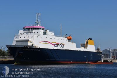
COMMODORE GOODWILL
Ro-Ro Cargo
Current Trip
| Time Travelled | 8 h, 28 mins |
|---|---|
| Remaining Time | 38 mins |
| Distance Travelled | 99.83 nm |
| Remaining Distance | 8.95 nm |
| AVG Speed | 12.2 Knop |
| MAX Speed | 19.9 Knop |
| AVG Wind | 9.8 knots |
| MAX Wind | 13 knots |
| MIN Temp | 12.9°C / 55.22°F |
| MAX Temp | 15.6°C / 60.08°F |
| Djupgående | 4.8 m |
| Position mottagen | Nu |
Current Position
| Longitud | -2.36917° |
|---|---|
| Latitude | 49.46833° |
| Status | Under way using engine |
| Fart | 10.8 Knop |
| Kurs | 234° |
| Område | English Channel |
| Station | T-AIS |
| Position mottagen | Nu |
Info
Information
The current position of COMMODORE GOODWILL is in English Channel with coordinates 49.46833° / -2.36917° as reported on 2024-05-11 02:24 by AIS to our vessel tracker app. The vessel's current speed is 10.8 Knop and is heading at the port of GUERNSEY. The estimated time of arrival as calculated by MyShipTracking vessel tracking app is 2024-05-11 03:03 LT
The vessel COMMODORE GOODWILL (IMO: 9117985, MMSI: 309536000) is a Ro-Ro Cargo that was built in 1996 ( 28 År gammal ). It's sailing under the flag of [BS] Bahamas.
In this page you can find informations about the vessels current position, last detected port calls, and current voyage information. If the vessels is not in coverage by AIS you will find the latest position.
The current position of COMMODORE GOODWILL is detected by our AIS receivers and we are not responsible for the reliability of the data. The last position was recorded while the vessel was in Coverage by the Ais receivers of our vessel tracking app.
The current draught of COMMODORE GOODWILL as reported by AIS is 4.8 meters
Weather
| Temperature | 13.6°C / 56.48°F |
|---|---|
| Wind Speed | 10 knots |
| Direction | 86° E |
| Pressure | 1018.8 hPa |
| Humidity | 89.6 % |
| Cloud Coverage | 52 % |
Featured Company
Last Port Calls
| Port | Arrival | Departure | Time In Port |
|---|---|---|---|
| 2024-05-10 15:43 | 2024-05-10 17:57 | 2 h | |
| 2024-05-10 05:50 | 2024-05-10 07:45 | 1 h | |
| 2024-05-10 02:52 | 2024-05-10 03:54 | 1 h | |
| 2024-05-09 15:23 | 2024-05-09 18:40 | 3 h | |
| 2024-05-09 06:29 | 2024-05-09 08:22 | 1 h | |
| 2024-05-09 05:42 | 2024-05-09 06:26 | 43 m | |
| 2024-05-09 02:20 | 2024-05-09 04:07 | 1 h | |
| 2024-05-08 15:20 | 2024-05-08 18:53 | 3 h | |
| 2024-05-08 04:58 | 2024-05-08 07:42 | 2 h | |
| 2024-05-08 01:57 | 2024-05-08 03:27 | 1 h |
Most Visited Ports (Last year)
| Port | Arrivals | |
|---|---|---|
| 269 | ||
| 260 | ||
| 223 | ||
| 43 | ||
| 4 | ||
| 2 |
Last Trips
| Origin | Departure | Destination | Arrival | Distance | |
|---|---|---|---|---|---|
| 2024-05-10 08:45 | 2024-05-10 16:43 | 123.14 nm | |||
| 2024-05-10 04:54 | 2024-05-10 06:50 | 28.16 nm | |||
| 2024-05-09 19:40 | 2024-05-10 03:52 | 113.02 nm | |||
| 2024-05-09 09:22 | 2024-05-09 16:23 | 122.95 nm | |||
| 2024-05-09 07:26 | 2024-05-09 07:29 | 0.93 nm | |||
| 2024-05-09 05:07 | 2024-05-09 06:42 | 28.23 nm | |||
| 2024-05-08 19:53 | 2024-05-09 03:20 | 115.46 nm | |||
| 2024-05-08 08:42 | 2024-05-08 16:20 | 123.99 nm | |||
| 2024-05-08 04:27 | 2024-05-08 05:58 | 27.92 nm | |||
| 2024-05-07 20:25 | 2024-05-08 02:57 | 110.87 nm |
Events
| Tid | Event | Detaljer | Position / Dest | Information |
|---|---|---|---|---|
| 2024-05-11 00:29 | Byter havsområde | Guernsey part of the English Channel French part of the English Channel |
49.72167 / -2.05533
English Channel
GUERNSEY
|
Fart: 13.5 kn Kurs: 201° |
| 2024-05-10 23:24 | Status ändrad | Under way using engine Default |
49.88233 / -1.83000
GUERNSEY
|
Fart: 11.3 kn Kurs: 223° |
| 2024-05-10 23:22 | Status ändrad | Default Under way using engine |
49.88517 / -1.82600
GUERNSEY
|
Fart: 11.2 kn Kurs: 223° |
| 2024-05-10 23:22 | Status ändrad | Under way using engine Default |
49.88583 / -1.82483
GUERNSEY
|
Fart: 11.4 kn Kurs: 216° |
| 2024-05-10 23:22 | Byter havsområde | French part of the English Channel United Kingdom part of the English Channel |
49.88583 / -1.82483
English Channel
GUERNSEY
|
Fart: 11.2 kn Kurs: 223° |
| 2024-05-10 23:06 | I täckningsområde |
49.88583 / -1.82483
English Channel
GUERNSEY
|
Fart: 11.2 kn Kurs: 223° |
|
| 2024-05-10 21:50 | Status ändrad | Default Under way using engine |
50.13500 / -1.56817
GUERNSEY
|
Fart: 11.4 kn Kurs: 212° |
| 2024-05-10 21:45 | Status ändrad | Under way using engine Default |
50.14933 / -1.55450
GUERNSEY
|
Fart: 11.4 kn Kurs: 212° |
| 2024-05-10 21:45 | UTANFÖR täckningsområde |
50.14933 / -1.55450
English Channel
GUERNSEY
|
Fart: 11.4 kn Kurs: 212° |
|
| 2024-05-10 21:42 | ETA ändrat | 2024/05/11 03:15 2024/05/11 02:30 |
50.16750 / -1.53700
GUERNSEY
|
Fart: 11.6 kn Kurs: 212° |