
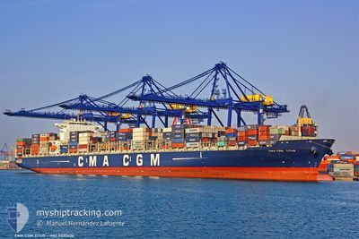
CMA CGM TITUS
Container Ship
Current Trip
| Trip Time | 6 days |
|---|---|
| Trip Distance | 906.42 nm |
| AVG Speed | 10.1 Knop |
| MAX Speed | 15.4 Knop |
| Djupgående | 14.7 m |
| AVG Wind | 11.4 knots |
| MAX Wind | 27 knots |
| MIN Temp | 16.1°C / 60.98°F |
| MAX Temp | 28.1°C / 82.58°F |
| Position mottagen | 2 d sen |
Current Position
| Longitud | --- |
|---|---|
| Latitude | --- |
| Status | Under way using engine |
| Fart | 10.4 Knop |
| Kurs | 12.9° |
| Område | Mediterranean Sea - Eastern Basin |
| Station | T-AIS |
| Position mottagen | 2 d sen |
Info
Information
The current position of CMA CGM TITUS is in Mediterranean Sea - Eastern Basin with coordinates 31.31165° / 32.37042° as reported on 2025-12-02 16:21 by AIS to our vessel tracker app. The vessel's current speed is 10.4 Knop and is currently inside the port of ALEXANDRIA.
The vessel CMA CGM TITUS (IMO: 9450636, MMSI: 249075000) is a Container Ship that was built in 2011 ( 14 År gammal ). It's sailing under the flag of [MT] Malta.
In this page you can find informations about the vessels current position, last detected port calls, and current voyage information. If the vessels is not in coverage by AIS you will find the latest position.
The current position of CMA CGM TITUS is detected by our AIS receivers and we are not responsible for the reliability of the data. The last position was recorded while the vessel was in Coverage by the Ais receivers of our vessel tracking app.
The current draught of CMA CGM TITUS as reported by AIS is 14.7 meters
Weather
| Temperature | 19.8°C / 67.64°F |
|---|---|
| Wind Speed | 11 knots |
| Direction | 285° WNW |
| Pressure | 1012.2 hPa |
| Humidity | 58.8 % |
| Cloud Coverage | --- |
Featured Company
Last Port Calls
| Port | Arrival | Departure | Time In Port |
|---|---|---|---|
| 2025-12-05 10:25 | |||
| 2025-12-02 08:36 | 2025-12-02 17:54 | 9 h | |
| 2025-11-28 10:46 | 2025-11-29 10:45 | 23 h | |
| 2025-11-18 16:55 | 2025-11-20 01:06 | 1 d | |
| 2025-11-15 00:18 | 2025-11-15 19:59 | 19 h | |
| 2025-11-12 11:10 | 2025-11-13 22:02 | 1 d | |
| 2025-11-07 20:55 | 2025-11-09 12:25 | 1 d | |
| 2025-10-28 23:54 | 2025-10-30 04:47 | 1 d | |
| 2025-10-26 05:14 | 2025-10-26 14:22 | 9 h | |
| 2025-10-23 19:07 | 2025-10-25 08:06 | 1 d |
Most Visited Ports (Last year)
| Port | Arrivals | |
|---|---|---|
| 6 | ||
| 5 | ||
| 5 | ||
| 5 | ||
| 5 | ||
| 5 |
Last Trips
| Origin | Departure | Destination | Arrival | Distance | |
|---|---|---|---|---|---|
| 2025-11-29 10:45 | 2025-12-05 10:25 | 906.42 nm | |||
| 2025-11-29 10:45 | 2025-12-02 08:36 | 633.02 nm | |||
| 2025-11-20 01:06 | 2025-11-28 10:46 | 2651.70 nm | |||
| 2025-11-15 19:59 | 2025-11-18 16:55 | 1030.66 nm | |||
| 2025-11-13 22:02 | 2025-11-15 00:18 | 429.18 nm | |||
| 2025-11-09 12:25 | 2025-11-12 11:10 | 998.23 nm | |||
| 2025-10-30 04:47 | 2025-11-07 20:55 | 2263.32 nm | |||
| 2025-10-25 08:06 | 2025-10-28 23:54 | 988.21 nm | |||
| 2025-10-25 08:06 | 2025-10-26 05:14 | 270.28 nm | |||
| 2025-10-15 16:54 | 2025-10-23 19:07 | 1736.49 nm |
Events
| Tid | Event | Detaljer | Position / Dest | Information |
|---|---|---|---|---|
| 2025-12-05 09:01 | STOPPAR förflyttning |
31.18453 / 29.86629
[EG] ALEXANDRIA
|
Fart: 0.3 kn Kurs: 35° |
|
| 2025-12-05 08:25 | ANLÄNDER HAMN |
|
31.16258 / 29.84570
[EG] ALEXANDRIA
|
Fart: 4.7 kn Kurs: 76° |
| 2025-12-05 06:29 | STARTAR förflyttning | 2.86 nm, North West of EL DEKHEILA |
31.18819 / 29.77912
EGZZ1>EGALY
|
Fart: 3.4 kn Kurs: 263° |
| 2025-12-05 05:33 | STOPPAR förflyttning | 3.22 nm, North West of EL DEKHEILA |
31.19469 / 29.77865
EGZZ1>EGALY
|
Fart: 0.3 kn Kurs: 168° |
| 2025-12-05 01:45 | STARTAR förflyttning | 6.5 nm, North West of EL DEKHEILA |
31.23436 / 29.73199
EGZZ1>EGALY
|
Fart: 3.1 kn Kurs: 116° |
| 2025-12-03 07:47 | STOPPAR förflyttning | 6.36 nm, North West of EL DEKHEILA |
31.22878 / 29.72818
EGZZ1>EGALY
|
Fart: 0.3 kn Kurs: 64° |
| 2025-12-02 16:28 | Status ändrad | Default Under way using engine |
31.33258 / 32.37628
EGZZ1>EGALY
|
Fart: 10.4 kn Kurs: 12.9° |
| 2025-12-02 16:21 | UTANFÖR täckningsområde |
31.31165 / 32.37042
Mediterranean Sea - Eastern Basin
|
Fart: 10.4 kn Kurs: 12.9° |
|
| 2025-12-02 16:11 | Upptäckt i hav | Egyptian part of the Mediterranean Sea - Eastern Basin |
31.28129 / 32.36071
Mediterranean Sea - Eastern Basin
|
Fart: 11.6 kn Kurs: 15° |
| 2025-12-02 16:07 | Status ändrad | Under way using engine Default |
31.26873 / 32.35719
EGZZ1>EGALY
|
Fart: 11.4 kn Kurs: 13° |