
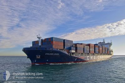
CMA CGM LOUGA
Cargo A
Current Trip
| Time Travelled | 4 days |
|---|---|
| Remaining Time | 10 h, 41 mins |
| Distance Travelled | 1584.27 nm |
| Remaining Distance | 189.99 nm |
| AVG Speed | 15.8 Knop |
| MAX Speed | 19 Knop |
| AVG Wind | 12.9 knots |
| MAX Wind | 20 knots |
| MIN Temp | 10.4°C / 50.72°F |
| MAX Temp | 19.3°C / 66.74°F |
| Djupgående | 9.8 m |
| Position mottagen | 7 m sen |
Current Position
| Longitud | --- |
|---|---|
| Latitude | --- |
| Status | Under way using engine |
| Fart | 16.7 Knop |
| Kurs | 135.6° |
| Område | South Pacific Ocean |
| Station | T-AIS |
| Position mottagen | 7 m sen |
Info
Information
The current position of CMA CGM LOUGA is in South Pacific Ocean with coordinates -35.04215° / 174.62169° as reported on 2025-12-05 20:16 by AIS to our vessel tracker app. The vessel's current speed is 16.7 Knop and is heading at the port of TAURANGA. The estimated time of arrival as calculated by MyShipTracking vessel tracking app is 2025-12-06 20:05 LT
The vessel CMA CGM LOUGA (IMO: 9745550, MMSI: 248655000) is a Cargo A It's sailing under the flag of [MT] Malta.
In this page you can find informations about the vessels current position, last detected port calls, and current voyage information. If the vessels is not in coverage by AIS you will find the latest position.
The current position of CMA CGM LOUGA is detected by our AIS receivers and we are not responsible for the reliability of the data. The last position was recorded while the vessel was in Coverage by the Ais receivers of our vessel tracking app.
The current draught of CMA CGM LOUGA as reported by AIS is 9.8 meters
Weather
| Temperature | 17.7°C / 63.86°F |
|---|---|
| Wind Speed | 4 knots |
| Direction | 236° SW |
| Pressure | 1018.6 hPa |
| Humidity | 80.6 % |
| Cloud Coverage | 13 % |
Featured Company
Last Port Calls
| Port | Arrival | Departure | Time In Port |
|---|---|---|---|
| 2025-11-30 18:32 | 2025-12-01 22:59 | 1 d | |
| 2025-11-26 05:54 | 2025-11-26 16:55 | 11 h | |
| 2025-11-01 20:38 | 2025-11-02 19:14 | 22 h | |
| 2025-10-28 18:24 | 2025-10-29 07:59 | 13 h | |
| 2025-10-26 05:28 | 2025-10-26 06:51 | 1 h | |
| 2025-10-16 09:04 | 2025-10-17 19:21 | 1 d | |
| 2025-10-15 05:45 | 2025-10-15 21:11 | 15 h | |
| 2025-10-14 02:28 | 2025-10-14 20:44 | 18 h | |
| 2025-10-13 02:52 | 2025-10-14 01:41 | 22 h | |
| 2025-10-02 18:30 | 2025-10-06 09:01 | 3 d |
Last Trips
| Origin | Departure | Destination | Arrival | Distance | |
|---|---|---|---|---|---|
| 2025-11-26 16:55 | 2025-11-30 18:32 | 1611.15 nm | |||
| 2025-11-02 19:14 | 2025-11-26 05:54 | 7718.67 nm | |||
| 2025-10-29 07:59 | 2025-11-01 20:38 | 1151.91 nm | |||
| 2025-10-26 06:51 | 2025-10-28 18:24 | 727.58 nm | |||
| 2025-10-17 19:21 | 2025-10-26 05:28 | 3271.15 nm | |||
| 2025-10-15 21:11 | 2025-10-16 09:04 | 172.29 nm | |||
| 2025-10-14 20:44 | 2025-10-15 05:45 | 140.61 nm | |||
| 2025-10-14 01:41 | 2025-10-14 02:28 | 3.05 nm | |||
| 2025-10-06 09:01 | 2025-10-13 02:52 | 1410.95 nm | |||
| 2025-09-29 23:24 | 2025-10-02 18:30 | 1012.20 nm |
Events
| Tid | Event | Detaljer | Position / Dest | Information |
|---|---|---|---|---|
| 2025-12-05 20:16 | Status ändrad | Under way using engine Default |
-35.04215 / 174.62169
NZTRG
|
Fart: 16.7 kn Kurs: 138° |
| 2025-12-05 20:10 | Status ändrad | Default Under way using engine |
-35.02018 / 174.59874
NZTRG
|
Fart: 16.8 kn Kurs: 140.5° |
| 2025-12-05 20:06 | Status ändrad | Under way using engine Default |
-35.00382 / 174.58254
NZTRG
|
Fart: 16.8 kn Kurs: 134° |
| 2025-12-05 19:58 | Status ändrad | Default Under way using engine |
-34.97877 / 174.55319
NZTRG
|
Fart: 17.3 kn Kurs: 135.9° |
| 2025-12-05 17:48 | ETA ändrat | 2025/12/06 08:30 2025/12/06 17:00 |
-34.62379 / 173.95535
NZTRG
|
Fart: 16.9 kn Kurs: 124.3° |
| 2025-12-05 17:17 | Byter havsområde | New Zealand part of the South Pacific Ocean Australian part of the Bass Strait |
-34.53853 / 173.80918
South Pacific Ocean
NZTRG
|
Fart: 16.9 kn Kurs: 125.4° |
| 2025-12-05 17:15 | Status ändrad | Under way using engine Default |
-34.53501 / 173.80316
NZTRG
|
Fart: 17 kn Kurs: 125° |
| 2025-12-05 17:03 | I täckningsområde |
-34.53853 / 173.80918
South Pacific Ocean
NZTRG
|
Fart: 16.9 kn Kurs: 125.4° |
|
| 2025-12-02 04:12 | Status ändrad | Default Under way using engine |
-38.43775 / 144.60213
NZTRG
|
Fart: 15.9 kn Kurs: 163.9° |
| 2025-12-02 04:03 | UTANFÖR täckningsområde |
-38.40146 / 144.58839
Bass Strait
NZTRG
|
Fart: 15.9 kn Kurs: 163.9° |