
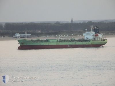
CHEM MIA
Oil/Chemical Tanker
Current Trip
PE CLL
| Time Travelled | 2 days |
|---|---|
| Remaining Time | --- |
| Distance Travelled | 807.94 nm |
| Remaining Distance | --- |
| AVG Speed | 12.6 Knop |
| MAX Speed | 13.8 Knop |
| AVG Wind | 11.7 knots |
| MAX Wind | 17 knots |
| MIN Temp | 19.1°C / 66.38°F |
| MAX Temp | 27.8°C / 82.04°F |
| Djupgående | 9.7 m |
| Position mottagen | 24 d sen |
Current Position
| Longitud | -58.64177° |
|---|---|
| Latitude | -39.99868° |
| Status | Under way using engine |
| Fart | 12.3 Knop |
| Kurs | 242° |
| Område | South Atlantic Ocean |
| Station | T-AIS |
| Position mottagen | 24 d sen |
Info
Information
The current position of CHEM MIA is in South Atlantic Ocean with coordinates -39.99868° / -58.64177° as reported on 2024-04-08 07:37 by AIS to our vessel tracker app. The vessel's current speed is 12.3 Knop
The vessel CHEM MIA (IMO: 9407093, MMSI: 636019172) is a Oil/Chemical Tanker that was built in 2008 ( 16 År gammal ). It's sailing under the flag of [LR] Liberia.
In this page you can find informations about the vessels current position, last detected port calls, and current voyage information. If the vessels is not in coverage by AIS you will find the latest position.
The current position of CHEM MIA is detected by our AIS receivers and we are not responsible for the reliability of the data. The last position was recorded while the vessel was in Coverage by the Ais receivers of our vessel tracking app.
The current draught of CHEM MIA as reported by AIS is 9.7 meters
Weather
| Temperature | 23.8°C / 74.84°F |
|---|---|
| Wind Speed | 5 knots |
| Direction | 242° WSW |
| Pressure | 1009.5 hPa |
| Humidity | 85.1 % |
| Cloud Coverage | 100 % |
Featured Company
Last Port Calls
| Port | Arrival | Departure | Time In Port |
|---|---|---|---|
| 2024-04-29 04:09 | 2024-04-30 02:41 | 22 h | |
| 2024-04-22 08:05 | 2024-04-25 02:45 | 2 d | |
| 2024-03-23 02:03 | 2024-04-02 00:26 | 9 d | |
| 2024-03-15 19:04 | 2024-03-15 19:55 | 50 m | |
| 2024-03-08 18:10 | 2024-03-09 17:17 | 23 h | |
| 2024-03-07 10:36 | |||
| 2024-03-03 02:12 | 2024-03-04 04:22 | 1 d |
Most Visited Ports (Last year)
| Port | Arrivals | |
|---|---|---|
| 7 | ||
| 4 | ||
| 4 | ||
| 3 | ||
| 3 | ||
| 2 |
Last Trips
| Origin | Departure | Destination | Arrival | Distance | |
|---|---|---|---|---|---|
| 2024-04-24 21:45 | 2024-04-28 23:09 | 17.03 nm | |||
| 2024-04-01 21:26 | 2024-04-22 03:05 | 4503.27 nm | |||
| 2024-03-15 16:55 | 2024-03-22 23:03 | 1262.82 nm | |||
| 2024-03-09 14:17 | 2024-03-15 16:04 | 1248.41 nm | |||
| 2024-03-07 07:36 | 2024-03-08 15:10 | 311.27 nm | |||
| 2024-02-27 10:18 | 2024-03-02 23:12 | 1060.35 nm |
Events
| Tid | Event | Detaljer | Position / Dest | Information |
|---|---|---|---|---|
| 2024-05-02 18:25 | STOPPAR förflyttning | 1.72 nm, North East of MANTA |
-.92287 / -80.69850
PE CLL
|
Fart: 0.1 kn Kurs: 297° |
| 2024-04-30 02:41 | AVGÅTT HAMN |
|
-12.04647 / -77.16354
PE CLL
|
Fart: 7.1 kn Kurs: 275° |
| 2024-04-30 02:33 | STARTAR förflyttning |
-12.04711 / -77.14767
[PE] CALLAO
|
Fart: 4 kn Kurs: 261° |
|
| 2024-04-29 04:39 | STOPPAR förflyttning |
-12.04700 / -77.14435
[PE] CALLAO
|
Fart: Kurs: 274° |
|
| 2024-04-29 04:09 | ANLÄNDER HAMN |
|
-12.04678 / -77.14944
[PE] CALLAO
|
Fart: 9.1 kn Kurs: 100° |
| 2024-04-29 03:49 | STARTAR förflyttning | 2.13 nm, North West of CALLAO |
-12.03725 / -77.18632
PE CLL
|
Fart: 6.9 kn Kurs: 166° |
| 2024-04-29 03:05 | STOPPAR förflyttning | 2.36 nm, North West of CALLAO |
-12.03507 / -77.18958
PE CLL
|
Fart: 0.2 kn Kurs: 120° |
| 2024-04-29 02:21 | STARTAR förflyttning | 3.48 nm, North of CALLAO |
-12.00136 / -77.17637
PE CLL
|
Fart: 3.7 kn Kurs: 220° |
| 2024-04-26 03:01 | STOPPAR förflyttning | 3.66 nm, North of CALLAO |
-11.99842 / -77.17715
PE CLL
|
Fart: 0.3 kn Kurs: 144° |
| 2024-04-26 02:13 | STARTAR förflyttning | 3.58 nm, North West of CALLAO |
-12.02958 / -77.21003
PE CLL
|
Fart: 6.2 kn Kurs: 62° |