
ORCINUS
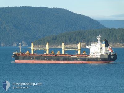
Bulk Carrier
Current Trip
| Time Travelled | 17 days |
|---|---|
| Remaining Time | 1 day |
| Distance Travelled | 4462.19 nm |
| Remaining Distance | 484.27 nm |
| AVG Speed | 10.3 Knop |
| MAX Speed | 14 Knop |
| AVG Wind | 13 knots |
| MAX Wind | 35.6 knots |
| MIN Temp | 9.5°C / 49.1°F |
| MAX Temp | 19.5°C / 67.1°F |
| Djupgående | 9.8 m |
| Position mottagen | 7 d sen |
Current Position
| Longitud | -29.50930° |
|---|---|
| Latitude | 39.81845° |
| Status | Under way using engine |
| Fart | 10.5 Knop |
| Kurs | 285° |
| Område | North Atlantic Ocean |
| Station | T-AIS |
| Position mottagen | 7 d sen |
Info
Information
The current position of ORCINUS is in North Atlantic Ocean with coordinates 39.81845° / -29.50930° as reported on 2024-04-26 17:29 by AIS to our vessel tracker app. The vessel's current speed is 10.5 Knop and is heading at the port of NEW YORK. The estimated time of arrival as calculated by MyShipTracking vessel tracking app is 2024-05-05 16:48 LT
The vessel ORCINUS (IMO: 9467952, MMSI: 636017052) is a Bulk Carrier that was built in 2010 ( 14 År gammal ). It's sailing under the flag of [LR] Liberia.
In this page you can find informations about the vessels current position, last detected port calls, and current voyage information. If the vessels is not in coverage by AIS you will find the latest position.
The current position of ORCINUS is detected by our AIS receivers and we are not responsible for the reliability of the data. The last position was recorded while the vessel was in Coverage by the Ais receivers of our vessel tracking app.
The current draught of ORCINUS as reported by AIS is 9.8 meters
Weather
| Temperature | 13.7°C / 56.66°F |
|---|---|
| Wind Speed | 15 knots |
| Direction | 15° NNE |
| Pressure | 1016 hPa |
| Humidity | 72.5 % |
| Cloud Coverage | 65 % |
Featured Company
Last Port Calls
| Port | Arrival | Departure | Time In Port |
|---|---|---|---|
| 2024-04-12 12:17 | 2024-04-15 18:28 | 3 d | |
| 2024-04-04 13:54 | 2024-04-09 15:30 | 5 d | |
| 2024-03-11 04:26 | 2024-03-16 21:16 | 5 d | |
| 2024-03-04 06:19 | 2024-03-08 12:39 | 4 d |
Most Visited Ports (Last year)
| Port | Arrivals | |
|---|---|---|
| 3 | ||
| 2 | ||
| 2 | ||
| 1 | ||
| 1 | ||
| 1 |
Last Trips
| Origin | Departure | Destination | Arrival | Distance | |
|---|---|---|---|---|---|
| 2024-04-09 18:30 | 2024-04-12 15:17 | 744.97 nm | |||
| 2024-03-16 17:16 | 2024-04-04 16:54 | 5353.02 nm | |||
| 2024-03-08 07:39 | 2024-03-11 00:26 | 779.78 nm | |||
| 2024-02-12 18:50 | 2024-03-04 01:19 | 4797.92 nm |
Events
| Tid | Event | Detaljer | Position / Dest | Information |
|---|---|---|---|---|
| 2024-04-26 17:34 | Status ändrad | Default Under way using engine |
39.82184 / -29.52652
US NYC
|
Fart: 10.5 kn Kurs: 285° |
| 2024-04-26 17:29 | Status ändrad | Under way using engine Default |
39.81845 / -29.50930
US NYC
|
Fart: 10.6 kn Kurs: 283° |
| 2024-04-26 17:29 | UTANFÖR täckningsområde |
39.81845 / -29.50930
North Atlantic Ocean
US NYC
|
Fart: 10.5 kn Kurs: 285° |
|
| 2024-04-26 17:14 | Status ändrad | Default Under way using engine |
39.80752 / -29.45206
US NYC
|
Fart: 11.2 kn Kurs: 281° |
| 2024-04-26 16:57 | Status ändrad | Under way using engine Default |
39.79673 / -29.38754
US NYC
|
Fart: 11.1 kn Kurs: 283° |
| 2024-04-26 16:51 | Status ändrad | Default Under way using engine |
39.79247 / -29.36206
US NYC
|
Fart: 11.1 kn Kurs: 282.2° |
| 2024-04-26 10:51 | Status ändrad | Under way using engine Default |
39.55689 / -27.99365
US NYC
|
Fart: 10.5 kn Kurs: 279° |
| 2024-04-26 10:50 | Status ändrad | Default Under way using engine |
39.55667 / -27.99191
US NYC
|
Fart: 10.3 kn Kurs: 281.2° |
| 2024-04-26 09:07 | Status ändrad | Under way using engine Default |
39.47371 / -27.61891
US NYC
|
Fart: 10.8 kn Kurs: 282° |
| 2024-04-26 09:05 | Status ändrad | Default Under way using engine |
39.47240 / -27.61135
US NYC
|
Fart: 10.9 kn Kurs: 282.2° |