
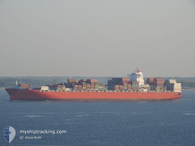
CCNI ANDES
Cargo
Current Trip
| Trip Time | 1 day |
|---|---|
| Trip Distance | 480.89 nm |
| AVG Speed | 15.1 Knop |
| MAX Speed | 18.3 Knop |
| Djupgående | 11.7 m |
| AVG Wind | 17.3 knots |
| MAX Wind | 24.8 knots |
| MIN Temp | 16.8°C / 62.24°F |
| MAX Temp | 19.7°C / 67.46°F |
| Position mottagen | 1 d sen |
Current Position
| Longitud | 128.81180° |
|---|---|
| Latitude | 35.07621° |
| Status | Under way using engine |
| Fart | 1.5 Knop |
| Kurs | 83° |
| Område | Japan Sea |
| Station | T-AIS |
| Position mottagen | 1 d sen |
Info
Information
The current position of CCNI ANDES is in Japan Sea with coordinates 35.07621° / 128.81180° as reported on 2024-05-11 22:39 by AIS to our vessel tracker app. The vessel's current speed is 1.5 Knop and is currently inside the port of BUSAN NEW PORT.
The vessel CCNI ANDES (IMO: 9718935, MMSI: 636092898) is a Cargo It's sailing under the flag of [LR] Liberia.
In this page you can find informations about the vessels current position, last detected port calls, and current voyage information. If the vessels is not in coverage by AIS you will find the latest position.
The current position of CCNI ANDES is detected by our AIS receivers and we are not responsible for the reliability of the data. The last position was recorded while the vessel was in Coverage by the Ais receivers of our vessel tracking app.
The current draught of CCNI ANDES as reported by AIS is 11.7 meters
Weather
| Temperature | 16.9°C / 62.42°F |
|---|---|
| Wind Speed | 8 knots |
| Direction | 133° SE |
| Pressure | 1014.6 hPa |
| Humidity | 65.4 % |
| Cloud Coverage | 1 % |
Featured Company
Last Port Calls
| Port | Arrival | Departure | Time In Port |
|---|---|---|---|
| 2024-05-12 07:44 | |||
| 2024-05-10 08:47 | 2024-05-11 00:44 | 15 h | |
| 2024-05-02 07:52 | 2024-05-03 01:41 | 17 h | |
| 2024-04-27 23:43 | 2024-04-28 22:40 | 22 h | |
| 2024-03-27 17:30 | 2024-03-30 03:41 | 2 d | |
| 2024-03-23 03:27 | 2024-03-25 02:17 | 1 d |
Most Visited Ports (Last year)
| Port | Arrivals | |
|---|---|---|
| 5 | ||
| 5 | ||
| 4 | ||
| 4 | ||
| 4 | ||
| 4 |
Last Trips
| Origin | Departure | Destination | Arrival | Distance | |
|---|---|---|---|---|---|
| 2024-05-11 00:44 | 2024-05-12 07:44 | 480.89 nm | |||
| 2024-05-03 01:41 | 2024-05-10 08:47 | 999.23 nm | |||
| 2024-04-28 22:40 | 2024-05-02 07:52 | 1507.58 nm | |||
| 2024-03-30 03:41 | 2024-04-27 23:43 | 12395.65 nm | |||
| 2024-03-25 02:17 | 2024-03-27 17:30 | 292.97 nm | |||
| 2024-02-25 00:34 | 2024-03-23 03:27 | 10837.40 nm |
Events
| Tid | Event | Detaljer | Position / Dest | Information |
|---|---|---|---|---|
| 2024-05-11 22:44 | Status ändrad | Default Under way using engine |
35.07688 / 128.81262
[KR] BUSAN NEW PORT
|
Fart: 1.5 kn Kurs: 83° |
| 2024-05-11 22:44 | STOPPAR förflyttning |
35.07688 / 128.81262
[KR] BUSAN NEW PORT
|
Fart: 0.3 kn Kurs: 84° |
|
| 2024-05-11 22:44 | ANLÄNDER HAMN |
|
35.07688 / 128.81262
[KR] BUSAN NEW PORT
|
Fart: 1.5 kn Kurs: 83° |
| 2024-05-11 22:39 | Status ändrad | Under way using engine Default |
35.07621 / 128.81180
KR PUS
|
Fart: 2.4 kn Kurs: 74° |
| 2024-05-11 22:39 | UTANFÖR täckningsområde |
35.07621 / 128.81180
Japan Sea
[KR] BUSAN NEW PORT
|
Fart: 1.5 kn Kurs: 65.4° |
|
| 2024-05-11 21:52 | Status ändrad | Default Under way using engine |
34.99792 / 128.80633
KR PUS
|
Fart: 9.7 kn Kurs: 346.6° |
| 2024-05-11 21:33 | Djupgående ändrat | 11.7 9.7 |
34.94719 / 128.82971
KR PUS
|
Fart: 11.2 kn Kurs: 338.9° |
| 2024-05-11 21:33 | Destination ändrad | KR PUS CN NGB |
34.94719 / 128.82971
KR PUS
|
Fart: 11.2 kn Kurs: 338.9° |
| 2024-05-11 21:33 | ETA ändrat | 2024/05/11 22:00 2024/05/06 01:00 |
34.94719 / 128.82971
KR PUS
|
Fart: 11.2 kn Kurs: 338.9° |
| 2024-05-11 20:16 | Status ändrad | Under way using engine Default |
34.71009 / 128.84207
CN NGB
|
Fart: 12.2 kn Kurs: 359° |