
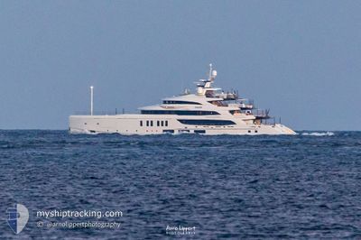
CALEX
Pleasure Craft
Current Trip
| Time Travelled | 2 days |
|---|---|
| Remaining Time | --- |
| Distance Travelled | 44.69 nm |
| Remaining Distance | --- |
| AVG Speed | 10.5 Knop |
| MAX Speed | 12.6 Knop |
| AVG Wind | 3.9 knots |
| MAX Wind | 8.4 knots |
| MIN Temp | 23.2°C / 73.76°F |
| MAX Temp | 24.9°C / 76.82°F |
| Djupgående | 3.5 m |
| Position mottagen | 1 d sen |
Current Position
| Longitud | 18.94282° |
|---|---|
| Latitude | 41.88508° |
| Status | Under way using engine |
| Fart | 11.9 Knop |
| Kurs | 329.1° |
| Område | Adriatic Sea |
| Station | T-AIS |
| Position mottagen | 1 d sen |
Info
Information
The current position of CALEX is in Adriatic Sea with coordinates 41.88508° / 18.94282° as reported on 2024-06-08 11:50 by AIS to our vessel tracker app. The vessel's current speed is 11.9 Knop and is heading at the port of TIVAT. The estimated time of arrival as calculated by MyShipTracking vessel tracking app is 2024-06-08 16:00 LT
The vessel CALEX (IMO: 9887061, MMSI: 319236800) is a Pleasure Craft It's sailing under the flag of [KY] Cayman Is.
In this page you can find informations about the vessels current position, last detected port calls, and current voyage information. If the vessels is not in coverage by AIS you will find the latest position.
The current position of CALEX is detected by our AIS receivers and we are not responsible for the reliability of the data. The last position was recorded while the vessel was in Coverage by the Ais receivers of our vessel tracking app.
The current draught of CALEX as reported by AIS is 3.5 meters
Weather
| Temperature | 24°C / 75.2°F |
|---|---|
| Wind Speed | 8 knots |
| Direction | 288° WNW |
| Pressure | 1013.8 hPa |
| Humidity | 72.9 % |
| Cloud Coverage | 48 % |
Featured Company
Last Port Calls
| Port | Arrival | Departure | Time In Port |
|---|---|---|---|
| 2024-06-08 03:28 | 2024-06-08 07:58 | 4 h | |
| 2024-05-31 04:56 | 2024-06-03 05:21 | 3 d | |
| 2024-05-12 09:31 | 2024-05-17 22:55 | 5 d | |
| 2024-05-08 12:37 | 2024-05-11 06:18 | 2 d | |
| 2024-05-08 08:17 | |||
| 2024-04-15 11:35 | 2024-04-15 17:20 | 5 h | |
| 2024-04-04 20:28 |
Last Trips
| Origin | Departure | Destination | Arrival | Distance | |
|---|---|---|---|---|---|
| 2024-06-03 08:21 | 2024-06-08 05:28 | 376.01 nm | |||
| 2024-05-18 01:55 | 2024-05-31 07:56 | 572.36 nm | |||
| 2024-05-11 08:18 | 2024-05-12 12:31 | 340.19 nm | |||
| 2024-05-08 10:17 | 2024-05-08 14:37 | 28.89 nm | |||
| 2024-04-04 16:28 | 2024-04-15 13:35 | 3257.07 nm |
Events
| Tid | Event | Detaljer | Position / Dest | Information |
|---|---|---|---|---|
| 2024-06-08 11:50 | UTANFÖR täckningsområde |
41.88508 / 18.94282
Adriatic Sea
ME TIV
|
Fart: 11.9 kn Kurs: 329.1° |
|
| 2024-06-08 10:17 | Byter havsområde | Montenegrin part of the Adriatic Sea Albanian part of the Adriatic Sea |
41.61415 / 19.15193
Adriatic Sea
ME TIV
|
Fart: 12.6 kn Kurs: 330.2° |
| 2024-06-08 07:58 | AVGÅTT HAMN |
|
41.30185 / 19.45819
ME TIV
|
Fart: 6.6 kn Kurs: 156° |
| 2024-06-08 07:55 | STARTAR förflyttning |
41.30527 / 19.45264
[AL] DURRES
|
Fart: 4.7 kn Kurs: 133° |
|
| 2024-06-08 07:54 | Status ändrad | Under way using engine Moored |
41.30611 / 19.45154
[AL] DURRES
|
Fart: 0.6 kn Kurs: 134° |
| 2024-06-08 07:45 | ETA ändrat | 2024/06/08 16:00 2024/06/08 05:00 |
41.30669 / 19.45023
[AL] DURRES
|
Fart: Kurs: 138° |
| 2024-06-08 07:38 | Destination ändrad | ME TIV AL DRZ |
41.30669 / 19.45023
[AL] DURRES
|
Fart: Kurs: 139° |
| 2024-06-08 03:55 | Status ändrad | Moored Under way using engine |
41.30674 / 19.45034
[AL] DURRES
|
Fart: Kurs: 139° |
| 2024-06-08 03:36 | STOPPAR förflyttning |
41.30693 / 19.45152
[AL] DURRES
|
Fart: 0.3 kn Kurs: 255° |
|
| 2024-06-08 03:28 | ANLÄNDER HAMN |
|
41.30271 / 19.45653
[AL] DURRES
|
Fart: 4.6 kn Kurs: 332° |