
BTG DENALI
Cargo
Current Trip
| Time Travelled | 42 days |
|---|---|
| Remaining Time | --- |
| Distance Travelled | 10497.65 nm |
| Remaining Distance | --- |
| AVG Speed | 10 Knop |
| MAX Speed | 12.7 Knop |
| AVG Wind | 12.9 knots |
| MAX Wind | 29.1 knots |
| MIN Temp | 15.7°C / 60.26°F |
| MAX Temp | 30.9°C / 87.62°F |
| Djupgående | 13.2 m |
| Position mottagen | 5 d sen |
Current Position
| Longitud | 104.06437° |
|---|---|
| Latitude | 1.24877° |
| Status | Under way using engine |
| Fart | 9.7 Knop |
| Kurs | 82.2° |
| Område | Singapore Strait |
| Station | T-AIS |
| Position mottagen | 5 d sen |
Info
Information
The current position of BTG DENALI is in Singapore Strait with coordinates 1.24877° / 104.06437° as reported on 2024-06-10 10:51 by AIS to our vessel tracker app. The vessel's current speed is 9.7 Knop and is heading at the port of ZHOUSHAN. The estimated time of arrival as calculated by MyShipTracking vessel tracking app is 2024-06-19 04:00 LT
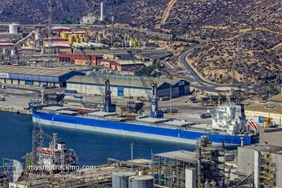
The vessel BTG DENALI (IMO: 9687851, MMSI: 311000358) is a Cargo It's sailing under the flag of [BS] Bahamas.
In this page you can find informations about the vessels current position, last detected port calls, and current voyage information. If the vessels is not in coverage by AIS you will find the latest position.
The current position of BTG DENALI is detected by our AIS receivers and we are not responsible for the reliability of the data. The last position was recorded while the vessel was in Coverage by the Ais receivers of our vessel tracking app.
The current draught of BTG DENALI as reported by AIS is 13.2 meters
Weather
| Temperature | 28.8°C / 83.84°F |
|---|---|
| Wind Speed | 9 knots |
| Direction | 184° S |
| Pressure | 1007 hPa |
| Humidity | 86.4 % |
| Cloud Coverage | 94 % |
Featured Company
Last Trips
| Origin | Departure | Destination | Arrival | Distance | |
|---|---|---|---|---|---|
| 2024-03-15 14:42 | 2024-05-01 16:14 | 6057.49 nm |
Events
| Tid | Event | Detaljer | Position / Dest | Information |
|---|---|---|---|---|
| 2024-06-10 10:57 | Status ändrad | Default Under way using engine |
1.25053 / 104.08115
CN ZOS
|
Fart: 9.7 kn Kurs: 82.2° |
| 2024-06-10 10:51 | UTANFÖR täckningsområde |
1.24877 / 104.06437
Singapore Strait
CN ZOS
|
Fart: 9.7 kn Kurs: 82.2° |
|
| 2024-06-10 10:23 | Byter havsområde | Indonesian part of the Singapore Strait Singaporean part of the Singapore Strait |
1.25048 / 103.98810
Singapore Strait
CN ZOS
|
Fart: 9.5 kn Kurs: 104.3° |
| 2024-06-10 10:20 | Destination ändrad | CN ZOS SG SIN |
1.25286 / 103.97968
CN ZOS
|
Fart: 9 kn Kurs: 105.7° |
| 2024-06-10 10:20 | ETA ändrat | 2024/06/18 20:00 2024/06/09 20:00 |
1.25286 / 103.97968
CN ZOS
|
Fart: 9 kn Kurs: 105.7° |
| 2024-06-10 09:52 | STARTAR förflyttning | 4.88 nm, East of SINGAPORE |
1.27839 / 103.93303
SG SIN
|
Fart: 3.1 kn Kurs: 124° |
| 2024-06-10 09:37 | Status ändrad | Under way using engine At anchor |
1.28136 / 103.93160
SG SIN
|
Fart: 0.2 kn Kurs: 124° |
| 2024-06-09 20:17 | Status ändrad | At anchor Under way using engine |
1.28066 / 103.93502
SG SIN
|
Fart: 0.9 kn Kurs: 274° |
| 2024-06-09 20:13 | STOPPAR förflyttning | 4.99 nm, East of SINGAPORE |
1.28035 / 103.93449
SG SIN
|
Fart: 0.3 kn Kurs: 264° |
| 2024-06-09 19:29 | Byter havsområde | Singaporean part of the Singapore Strait Indonesian part of the Singapore Strait |
1.23285 / 103.94331
Singapore Strait
SG SIN
|
Fart: 5 kn Kurs: 25.3° |