
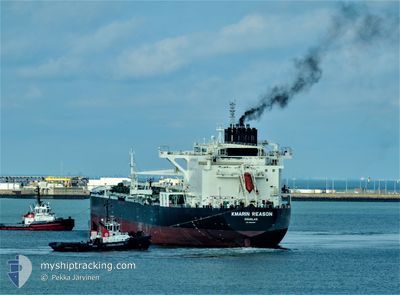
KMARIN REASON
Tanker D
Current Trip
| Time Travelled | 2 days |
|---|---|
| Remaining Time | --- |
| Distance Travelled | 747.67 nm |
| Remaining Distance | --- |
| AVG Speed | 12.2 Knop |
| MAX Speed | 13.6 Knop |
| AVG Wind | 10.8 knots |
| MAX Wind | 16 knots |
| MIN Temp | 25.1°C / 77.18°F |
| MAX Temp | 29.9°C / 85.82°F |
| Djupgående | 8.7 m |
| Position mottagen | 21 d sen |
Current Position
| Longitud | 116.88153° |
|---|---|
| Latitude | -35.52446° |
| Status | Under way using engine |
| Fart | 11.9 Knop |
| Kurs | 278.1° |
| Område | Indian Ocean |
| Station | T-AIS |
| Position mottagen | 21 d sen |
Info
Information
The current position of KMARIN REASON is in Indian Ocean with coordinates -35.52446° / 116.88153° as reported on 2024-04-07 07:07 by AIS to our vessel tracker app. The vessel's current speed is 11.9 Knop and is heading at the port of FUJAIRAH. The estimated time of arrival as calculated by MyShipTracking vessel tracking app is 2024-04-23 08:00 LT
The vessel KMARIN REASON (IMO: 9683087, MMSI: 235108534) is a Tanker D It's sailing under the flag of [GB] United Kingdom.
In this page you can find informations about the vessels current position, last detected port calls, and current voyage information. If the vessels is not in coverage by AIS you will find the latest position.
The current position of KMARIN REASON is detected by our AIS receivers and we are not responsible for the reliability of the data. The last position was recorded while the vessel was in Coverage by the Ais receivers of our vessel tracking app.
The current draught of KMARIN REASON as reported by AIS is 8.7 meters
Weather
| Temperature | 28.8°C / 83.84°F |
|---|---|
| Wind Speed | 7 knots |
| Direction | 163° SSE |
| Pressure | 1007.6 hPa |
| Humidity | 73.7 % |
| Cloud Coverage | 100 % |
Featured Company
Last Port Calls
| Port | Arrival | Departure | Time In Port |
|---|---|---|---|
| 2024-04-24 12:42 | 2024-04-25 14:37 | 1 d | |
| 2024-04-21 08:24 | |||
| 2024-03-29 04:46 | 2024-03-31 12:19 | 2 d | |
| 2024-03-11 00:55 | 2024-03-12 22:06 | 1 d | |
| 2024-03-04 00:33 | 2024-03-05 22:48 | 1 d | |
| 2024-02-28 22:51 | 2024-02-29 18:42 | 19 h | |
| 2024-02-17 00:27 | 2024-02-18 00:23 | 23 h | |
| 2024-02-10 01:02 | 2024-02-11 02:18 | 1 d |
Last Trips
| Origin | Departure | Destination | Arrival | Distance | |
|---|---|---|---|---|---|
| 2024-04-21 13:54 | 2024-04-24 16:42 | 1069.94 nm | |||
| 2024-03-13 07:06 | 2024-03-29 15:46 | 5089.65 nm | |||
| 2024-03-06 07:48 | 2024-03-11 09:55 | 21.56 nm | |||
| 2024-03-01 03:42 | 2024-03-04 09:33 | 629.95 nm | |||
| 2024-02-18 09:23 | 2024-02-29 07:51 | 1132.53 nm | |||
| 2024-02-11 11:18 | 2024-02-17 09:27 | 452.32 nm | |||
| 2024-01-21 09:35 | 2024-02-10 10:02 | 6244.63 nm |
Events
| Tid | Event | Detaljer | Position / Dest | Information |
|---|---|---|---|---|
| 2024-04-26 00:44 | STARTAR förflyttning | 8.34 nm, North East of AL DUQM |
19.73733 / 57.83629
AU BTB>AE FJR
|
Fart: 3.1 kn Kurs: 134° |
| 2024-04-25 15:57 | STOPPAR förflyttning | 8.42 nm, North East of AL DUQM |
19.74126 / 57.83590
AU BTB>AE FJR
|
Fart: 0.2 kn Kurs: 195° |
| 2024-04-25 14:37 | AVGÅTT HAMN |
|
19.69408 / 57.72675
AU BTB>AE FJR
|
Fart: 4.9 kn Kurs: 46° |
| 2024-04-25 14:14 | STARTAR förflyttning |
19.68396 / 57.69997
[OM] AL DUQM
|
Fart: 3.2 kn Kurs: 89° |
|
| 2024-04-24 13:21 | STOPPAR förflyttning |
19.68731 / 57.69628
[OM] AL DUQM
|
Fart: 0.1 kn Kurs: 184° |
|
| 2024-04-24 12:42 | ANLÄNDER HAMN |
|
19.68798 / 57.72366
[OM] AL DUQM
|
Fart: 9.1 kn Kurs: 207° |
| 2024-04-21 08:24 | AVGÅTT HAMN |
|
12.92346 / 74.79155
AU BTB>AE FJR
|
Fart: 6.7 kn Kurs: 259° |
| 2024-04-21 08:09 | STARTAR förflyttning |
12.92261 / 74.81269
[IN] PANAMBUR
|
Fart: 3.6 kn Kurs: 357° |