
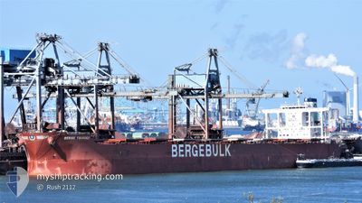
BERGE TSURUGI
Bulk Carrier
Current Trip
CN NBG
| Time Travelled | --- |
|---|---|
| Remaining Time | --- |
| Distance Travelled | 10066.81 nm |
| Remaining Distance | --- |
| AVG Speed | 9.9 Knop |
| MAX Speed | 13.8 Knop |
| AVG Wind | 11.1 knots |
| MAX Wind | 24 knots |
| MIN Temp | 19.9°C / 67.82°F |
| MAX Temp | 29.8°C / 85.64°F |
| Djupgående | 18.4 m |
| Position mottagen | 2024-03-12 03:02 |
Current Position
| Longitud | 19.09796° |
|---|---|
| Latitude | -34.84797° |
| Status | Under way using engine |
| Fart | 10.1 Knop |
| Kurs | 108.3° |
| Område | South Atlantic Ocean |
| Station | T-AIS |
| Position mottagen | 2024-03-12 03:02 |
Info
Information
The current position of BERGE TSURUGI is in South Atlantic Ocean with coordinates -34.84797° / 19.09796° as reported on 2024-03-12 03:02 by AIS to our vessel tracker app. The vessel's current speed is 10.1 Knop
The vessel BERGE TSURUGI (IMO: 9599810, MMSI: 636019376) is a Bulk Carrier that was built in 2012 ( 12 År gammal ). It's sailing under the flag of [LR] Liberia.
In this page you can find informations about the vessels current position, last detected port calls, and current voyage information. If the vessels is not in coverage by AIS you will find the latest position.
The current position of BERGE TSURUGI is detected by our AIS receivers and we are not responsible for the reliability of the data. The last position was recorded while the vessel was in Coverage by the Ais receivers of our vessel tracking app.
The current draught of BERGE TSURUGI as reported by AIS is 18.4 meters
Weather
| Temperature | 17.4°C / 63.32°F |
|---|---|
| Wind Speed | 10 knots |
| Direction | 116° ESE |
| Pressure | 1009.8 hPa |
| Humidity | 95.8 % |
| Cloud Coverage | 100 % |
Featured Company
Last Port Calls
Last Trips
| Origin | Departure | Destination | Arrival | Distance |
|---|
Events
| Tid | Event | Detaljer | Position / Dest | Information |
|---|---|---|---|---|
| 2024-04-27 14:11 | STOPPAR förflyttning | 7.66 nm, South East of TAICANG |
31.59068 / 121.31846
CN NBG
|
Fart: 0.3 kn Kurs: 331° |
| 2024-04-27 08:20 | STARTAR förflyttning | 0.89 nm, West of ZHANGJIAGANG |
31.97041 / 120.39593
CN NBG
|
Fart: 3.3 kn Kurs: 270° |
| 2024-04-25 08:43 | STOPPAR förflyttning | 0.76 nm, South West of ZHANGJIAGANG |
31.96873 / 120.39979
CN NBG
|
Fart: Kurs: 272° |
| 2024-04-25 00:24 | STARTAR förflyttning | 6.62 nm, South East of TAICANG |
31.60167 / 121.30282
CN NBG
|
Fart: 3.9 kn Kurs: 294° |
| 2024-04-24 07:08 | STOPPAR förflyttning | 6.63 nm, South East of TAICANG |
31.60593 / 121.30605
CN NBG
|
Fart: 0.2 kn Kurs: 156° |
| 2024-04-23 20:08 | STARTAR förflyttning |
31.25732 / 122.69303
CN NBG
|
Fart: 3.6 kn Kurs: 74° |
|
| 2024-04-22 19:30 | STOPPAR förflyttning |
31.25761 / 122.68751
CN NBG
|
Fart: Kurs: 287° |
|
| 2024-04-22 00:16 | STARTAR förflyttning | 7.7 nm, South West of ZHOUSHAN |
29.89550 / 122.07715
CN NBG
|
Fart: 3.2 kn Kurs: 24° |
| 2024-04-20 09:44 | STOPPAR förflyttning | 7.85 nm, South West of ZHOUSHAN |
29.89294 / 122.07553
CN NBG
|
Fart: 0.1 kn Kurs: 74° |
| 2024-04-20 04:40 | STARTAR förflyttning |
29.76145 / 122.56970
CN NBG
|
Fart: 4.1 kn Kurs: 203° |