
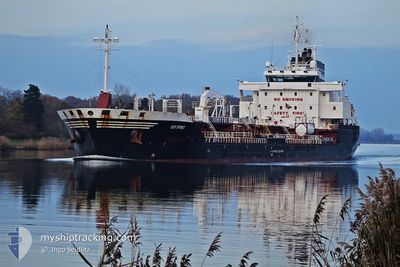
BDP SPIRIT
Oil/Chemical Tanker
Current Trip
| Time Travelled | 7 days |
|---|---|
| Remaining Time | --- |
| Distance Travelled | 1209.33 nm |
| Remaining Distance | --- |
| AVG Speed | 10 Knop |
| MAX Speed | 12.6 Knop |
| AVG Wind | 10.4 knots |
| MAX Wind | 31.9 knots |
| MIN Temp | 10.6°C / 51.08°F |
| MAX Temp | 18.4°C / 65.12°F |
| Djupgående | 8 m |
| Position mottagen | 2024-03-19 16:38 |
Current Position
| Longitud | -15.19688° |
|---|---|
| Latitude | 27.48089° |
| Status | Under way using engine |
| Fart | 11.1 Knop |
| Kurs | 183.6° |
| Område | North Atlantic Ocean |
| Station | T-AIS |
| Position mottagen | 2024-03-19 16:38 |
Info
Information
The current position of BDP SPIRIT is in North Atlantic Ocean with coordinates 27.48089° / -15.19688° as reported on 2024-03-19 16:38 by AIS to our vessel tracker app. The vessel's current speed is 11.1 Knop
The vessel BDP SPIRIT (IMO: 9424053, MMSI: 538009703) is a Oil/Chemical Tanker that was built in 2009 ( 15 År gammal ). It's sailing under the flag of [MH] Marshall Is.
In this page you can find informations about the vessels current position, last detected port calls, and current voyage information. If the vessels is not in coverage by AIS you will find the latest position.
The current position of BDP SPIRIT is detected by our AIS receivers and we are not responsible for the reliability of the data. The last position was recorded while the vessel was in Coverage by the Ais receivers of our vessel tracking app.
The current draught of BDP SPIRIT as reported by AIS is 8 meters
Weather
| Temperature | 14.4°C / 57.92°F |
|---|---|
| Wind Speed | 30 knots |
| Direction | 259° W |
| Pressure | 1010.5 hPa |
| Humidity | 90.3 % |
| Cloud Coverage | 100 % |
Featured Company
Last Port Calls
| Port | Arrival | Departure | Time In Port |
|---|---|---|---|
| 2024-05-29 09:13 | 2024-05-29 21:09 | 11 h |
Most Visited Ports (Last year)
| Port | Arrivals | |
|---|---|---|
| 3 | ||
| 2 | ||
| 2 | ||
| 1 | ||
| 1 | ||
| 1 |
Last Trips
| Origin | Departure | Destination | Arrival | Distance | |
|---|---|---|---|---|---|
| 2024-03-16 16:34 | 2024-05-29 09:13 | 2507.91 nm |
Events
| Tid | Event | Detaljer | Position / Dest | Information |
|---|---|---|---|---|
| 2024-06-01 16:29 | STARTAR förflyttning | 4.21 nm, North West of WALVIS BAY |
-22.87776 / 14.46417
NA WVB
|
Fart: 3.7 kn Kurs: 11° |
| 2024-05-31 15:04 | STOPPAR förflyttning | 4.63 nm, North West of WALVIS BAY |
-22.87028 / 14.46316
NA WVB
|
Fart: 0.1 kn Kurs: 212° |
| 2024-05-31 14:26 | STARTAR förflyttning | 3.64 nm, North West of WALVIS BAY |
-22.88985 / 14.46247
NA WVB
|
Fart: 4.1 kn Kurs: 4° |
| 2024-05-31 05:52 | STOPPAR förflyttning | 3.53 nm, North West of WALVIS BAY |
-22.89095 / 14.46444
NA WVB
|
Fart: Kurs: 109° |
| 2024-05-31 05:25 | STARTAR förflyttning | 4.15 nm, North West of WALVIS BAY |
-22.87847 / 14.46485
NA WVB
|
Fart: 3.3 kn Kurs: 199° |
| 2024-05-30 17:42 | STOPPAR förflyttning | 4.49 nm, North West of WALVIS BAY |
-22.87183 / 14.46533
NA WVB
|
Fart: 0.2 kn Kurs: 214° |
| 2024-05-30 17:25 | STARTAR förflyttning | 4.59 nm, North of WALVIS BAY |
-22.86625 / 14.47623
NA WVB
|
Fart: 4.3 kn Kurs: 233° |
| 2024-05-30 05:29 | STOPPAR förflyttning | 4.39 nm, North of WALVIS BAY |
-22.86976 / 14.47577
NA WVB
|
Fart: 0.1 kn Kurs: 34° |
| 2024-05-30 05:01 | STARTAR förflyttning | 3.77 nm, North West of WALVIS BAY |
-22.88169 / 14.47327
NA WVB
|
Fart: 3.4 kn Kurs: 19° |
| 2024-05-29 19:51 | STOPPAR förflyttning | 3.68 nm, North West of WALVIS BAY |
-22.88385 / 14.47229
NA WVB
|
Fart: 0.3 kn Kurs: 218° |