
BBG NOVA
Cargo
Current Trip
SANTAMARTA
| Time Travelled | 9 days |
|---|---|
| Remaining Time | --- |
| Distance Travelled | 1936.50 nm |
| Remaining Distance | --- |
| AVG Speed | 8.6 Knop |
| MAX Speed | 11 Knop |
| AVG Wind | 14.3 knots |
| MAX Wind | 22 knots |
| MIN Temp | 26.1°C / 78.98°F |
| MAX Temp | 28.9°C / 84.02°F |
| Djupgående | 9.4 m |
| Position mottagen | 9 d sen |
Current Position
| Longitud | -74.28763° |
|---|---|
| Latitude | 11.09152° |
| Status | Under way using engine |
| Fart | 8.6 Knop |
| Kurs | 106.6° |
| Område | Caribbean Sea |
| Station | T-AIS |
| Position mottagen | 9 d sen |
Info
Information
The current position of BBG NOVA is in Caribbean Sea with coordinates 11.09152° / -74.28763° as reported on 2024-05-06 14:53 by AIS to our vessel tracker app. The vessel's current speed is 8.6 Knop
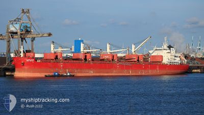
The vessel BBG NOVA (IMO: 9705342, MMSI: 636017382) is a Cargo It's sailing under the flag of [LR] Liberia.
In this page you can find informations about the vessels current position, last detected port calls, and current voyage information. If the vessels is not in coverage by AIS you will find the latest position.
The current position of BBG NOVA is detected by our AIS receivers and we are not responsible for the reliability of the data. The last position was recorded while the vessel was in Coverage by the Ais receivers of our vessel tracking app.
The current draught of BBG NOVA as reported by AIS is 9.4 meters
Weather
| Temperature | 28.1°C / 82.58°F |
|---|---|
| Wind Speed | 13 knots |
| Direction | 87° E |
| Pressure | 1011.7 hPa |
| Humidity | 77 % |
| Cloud Coverage | 60 % |
Featured Company
Last Port Calls
| Port | Arrival | Departure | Time In Port |
|---|---|---|---|
| 2024-05-06 15:28 | 2024-05-07 08:44 | 17 h | |
| 2024-04-16 03:30 | 2024-04-20 06:10 | 4 d | |
| 2024-03-10 17:59 | 2024-03-22 15:03 | 11 d | |
| 2024-03-04 20:42 | 2024-03-07 15:38 | 2 d |
Last Trips
Events
| Tid | Event | Detaljer | Position / Dest | Information |
|---|---|---|---|---|
| 2024-05-07 12:26 | STARTAR förflyttning | 4.41 nm, North West of PUERTO DRUMMOND |
11.12146 / -74.27929
SANTAMARTA
|
Fart: 5.4 kn Kurs: 356° |
| 2024-05-07 09:34 | STOPPAR förflyttning | 4.25 nm, North West of PUERTO DRUMMOND |
11.12000 / -74.27666
SANTAMARTA
|
Fart: Kurs: -1° |
| 2024-05-07 09:01 | STARTAR förflyttning | 3.01 nm, North West of PUERTO DRUMMOND |
11.08833 / -74.27834
SANTAMARTA
|
Fart: 9 kn Kurs: -1° |
| 2024-05-07 08:44 | AVGÅTT HAMN |
|
11.08833 / -74.27834
SANTAMARTA
|
Fart: 2 kn Kurs: -1° |
| 2024-05-06 15:28 | STOPPAR förflyttning |
11.07167 / -74.23500
[CO] PUERTO DRUMMOND
|
Fart: Kurs: -1° |
|
| 2024-05-06 15:28 | ANLÄNDER HAMN |
|
11.07167 / -74.23500
[CO] PUERTO DRUMMOND
|
Fart: 2 kn Kurs: -1° |
| 2024-05-06 14:57 | Status ändrad | Default Under way using engine |
11.08796 / -74.27719
SANTAMARTA
|
Fart: 8.6 kn Kurs: 106.6° |
| 2024-05-06 14:53 | UTANFÖR täckningsområde |
11.09152 / -74.28763
Caribbean Sea
[CO] PUERTO DRUMMOND
|
Fart: 8.6 kn Kurs: 106.6° |