
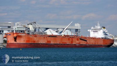
BARRAMUNDI
Tanker
Current Trip
NL AMS
| Time Travelled | 16 h, 11 mins |
|---|---|
| Remaining Time | --- |
| Distance Travelled | 21.43 nm |
| Remaining Distance | --- |
| AVG Speed | 6.6 Knop |
| MAX Speed | 9.6 Knop |
| AVG Wind | 25.1 knots |
| MAX Wind | 34.8 knots |
| MIN Temp | 8.8°C / 47.84°F |
| MAX Temp | 14.7°C / 58.46°F |
| Djupgående | 9.7 m |
| Position mottagen | 1 m sen |
Current Position
| Longitud | 4.25895° |
|---|---|
| Latitude | 52.53135° |
| Status | At anchor |
| Fart | |
| Kurs | 210° |
| Område | North Sea |
| Station | T-AIS |
| Position mottagen | 1 m sen |
Info
Information
The current position of BARRAMUNDI is in North Sea with coordinates 52.53135° / 4.25895° as reported on 2024-04-29 06:09 by AIS to our vessel tracker app. The vessel's current speed is 0 Knop
The vessel BARRAMUNDI (IMO: 9813113, MMSI: 538008009) is a Tanker It's sailing under the flag of [MH] Marshall Is.
In this page you can find informations about the vessels current position, last detected port calls, and current voyage information. If the vessels is not in coverage by AIS you will find the latest position.
The current position of BARRAMUNDI is detected by our AIS receivers and we are not responsible for the reliability of the data. The last position was recorded while the vessel was in Coverage by the Ais receivers of our vessel tracking app.
The current draught of BARRAMUNDI as reported by AIS is 9.7 meters
Weather
| Temperature | 9.9°C / 49.82°F |
|---|---|
| Wind Speed | 14 knots |
| Direction | 205° SSW |
| Pressure | 1017.7 hPa |
| Humidity | 85 % |
| Cloud Coverage | 2 % |
Featured Company
Last Trips
Events
| Tid | Event | Detaljer | Position / Dest | Information |
|---|---|---|---|---|
| 2024-04-28 18:00 | STOPPAR förflyttning | 12.61 nm, West of IJMUIDEN |
52.53103 / 4.26031
NL AMS
|
Fart: 0.2 kn Kurs: 218° |
| 2024-04-28 17:44 | Status ändrad | At anchor Under way using engine |
52.52906 / 4.25814
NL AMS
|
Fart: 0.9 kn Kurs: 220° |
| 2024-04-28 15:28 | STARTAR förflyttning | 0.69 nm, East of IJMUIDEN |
52.46761 / 4.60619
NL AMS
|
Fart: 3.2 kn Kurs: 274° |
| 2024-04-28 15:02 | STOPPAR förflyttning | 0.84 nm, East of IJMUIDEN |
52.46739 / 4.61047
NL AMS
|
Fart: 0.3 kn Kurs: 276° |
| 2024-04-28 14:00 | AVGÅTT HAMN |
|
52.43163 / 4.73573
NL AMS
|
Fart: 5.3 kn Kurs: 282° |
| 2024-04-28 13:50 | STARTAR förflyttning |
52.42374 / 4.74761
[NL] AMSTERDAM
|
Fart: 3.1 kn Kurs: 344° |
|
| 2024-04-28 13:45 | Status ändrad | Under way using engine Moored |
52.42121 / 4.74941
[NL] AMSTERDAM
|
Fart: 0.8 kn Kurs: 341° |
| 2024-04-28 13:41 | Status ändrad | Moored Default |
52.42077 / 4.74994
[NL] AMSTERDAM
|
Fart: 0.1 kn Kurs: 349° |
| 2024-04-28 13:38 | Status ändrad | Default Moored |
52.42076 / 4.74997
[NL] AMSTERDAM
|
Fart: Kurs: 350° |
| 2024-04-28 12:26 | Status ändrad | Moored Default |
52.42076 / 4.74996
[NL] AMSTERDAM
|
Fart: Kurs: 350° |