
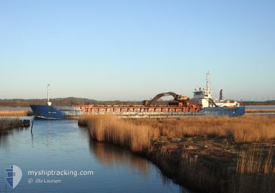
BAL BULK
General Cargo
Current Trip
| Time Travelled | 1 day |
|---|---|
| Remaining Time | 4 h, 47 mins |
| Distance Travelled | 283.77 nm |
| Remaining Distance | 45.62 nm |
| AVG Speed | 8.9 Knop |
| MAX Speed | 10.5 Knop |
| AVG Wind | 6.8 knots |
| MAX Wind | 10.9 knots |
| MIN Temp | 9.5°C / 49.1°F |
| MAX Temp | 14.7°C / 58.46°F |
| Djupgående | 3 m |
| Position mottagen | Nu |
Current Position
| Longitud | 10.56380° |
|---|---|
| Latitude | 59.11337° |
| Status | Under way using engine |
| Fart | 9.2 Knop |
| Kurs | 218.7° |
| Område | Skaggerak |
| Station | T-AIS |
| Position mottagen | Nu |
Info
Information
The current position of BAL BULK is in Skaggerak with coordinates 59.11337° / 10.56380° as reported on 2024-05-12 13:37 by AIS to our vessel tracker app. The vessel's current speed is 9.2 Knop and is heading at the port of KRAGERO. The estimated time of arrival as calculated by MyShipTracking vessel tracking app is 2024-05-12 20:24 LT
The vessel BAL BULK (IMO: 8912493, MMSI: 231613000) is a General Cargo that was built in 1990 ( 34 År gammal ). It's sailing under the flag of [FO] Faroe Is.
In this page you can find informations about the vessels current position, last detected port calls, and current voyage information. If the vessels is not in coverage by AIS you will find the latest position.
The current position of BAL BULK is detected by our AIS receivers and we are not responsible for the reliability of the data. The last position was recorded while the vessel was in Coverage by the Ais receivers of our vessel tracking app.
The current draught of BAL BULK as reported by AIS is 3 meters
Weather
| Temperature | 11.9°C / 53.42°F |
|---|---|
| Wind Speed | 10 knots |
| Direction | 205° SSW |
| Pressure | 1024.7 hPa |
| Humidity | 86.4 % |
| Cloud Coverage | 69 % |
Featured Company
Last Port Calls
| Port | Arrival | Departure | Time In Port |
|---|---|---|---|
| 2024-05-08 23:36 | 2024-05-10 17:40 | 1 d | |
| 2024-05-08 00:28 | 2024-05-08 13:01 | 12 h | |
| 2024-05-03 15:22 | 2024-05-04 10:30 | 19 h | |
| 2024-04-28 23:04 | 2024-04-29 07:12 | 8 h | |
| 2024-04-28 08:31 | 2024-04-28 14:07 | 5 h | |
| 2024-04-25 23:28 | 2024-04-26 00:54 | 1 h | |
| 2024-04-24 15:52 | 2024-04-25 00:03 | 8 h | |
| 2024-04-22 19:31 | 2024-04-23 14:52 | 19 h | |
| 2024-04-19 22:09 | 2024-04-20 11:24 | 13 h | |
| 2024-04-19 05:54 | 2024-04-19 14:49 | 8 h |
Last Trips
| Origin | Departure | Destination | Arrival | Distance | |
|---|---|---|---|---|---|
| 2024-05-08 13:01 | 2024-05-08 23:36 | 109.68 nm | |||
| 2024-05-04 10:30 | 2024-05-08 00:28 | 620.26 nm | |||
| 2024-04-29 07:12 | 2024-05-03 15:22 | 566.22 nm | |||
| 2024-04-28 14:07 | 2024-04-28 23:04 | 85.96 nm | |||
| 2024-04-26 00:54 | 2024-04-28 08:31 | 286.23 nm | |||
| 2024-04-25 00:03 | 2024-04-25 23:28 | 247.44 nm | |||
| 2024-04-23 14:52 | 2024-04-24 15:52 | 187.96 nm | |||
| 2024-04-20 11:24 | 2024-04-22 19:31 | 391.28 nm | |||
| 2024-04-19 14:49 | 2024-04-19 22:09 | 66.70 nm | |||
| 2024-04-15 13:41 | 2024-04-19 05:54 | 616.69 nm |
Events
| Tid | Event | Detaljer | Position / Dest | Information |
|---|---|---|---|---|
| 2024-05-12 10:45 | STARTAR förflyttning | 1.89 nm, East of HOLMESTRAND |
59.48852 / 10.38237
NOKRA
|
Fart: 3.1 kn Kurs: 151° |
| 2024-05-12 10:34 | Status ändrad | Under way using engine Moored |
59.49047 / 10.38198
NOKRA
|
Fart: Kurs: 325° |
| 2024-05-11 23:42 | Djupgående ändrat | 3 4.8 |
59.49048 / 10.38185
NOKRA
|
Fart: Kurs: 324° |
| 2024-05-11 23:42 | Destination ändrad | NOKRA NOLAO |
59.49048 / 10.38185
NOKRA
|
Fart: Kurs: 324° |
| 2024-05-11 23:42 | ETA ändrat | 2024/05/12 19:00 2024/05/10 22:00 |
59.49048 / 10.38185
NOKRA
|
Fart: Kurs: 324° |
| 2024-05-11 23:37 | Status ändrad | Moored Under way using engine |
59.49050 / 10.38187
NOLAO
|
Fart: Kurs: 324° |
| 2024-05-11 23:26 | STOPPAR förflyttning | 1.87 nm, East of HOLMESTRAND |
59.49037 / 10.38205
NOLAO
|
Fart: 0.3 kn Kurs: 327° |
| 2024-05-11 23:14 | STARTAR förflyttning | 2.35 nm, East of HOLMESTRAND |
59.47990 / 10.39470
NOLAO
|
Fart: 3.1 kn Kurs: 324° |
| 2024-05-11 20:16 | STOPPAR förflyttning | 2.13 nm, East of HOLMESTRAND |
59.48198 / 10.38822
NOLAO
|
Fart: 0.3 kn Kurs: 322° |
| 2024-05-11 15:40 | Byter havsområde | Norwegian part of the Skaggerak Swedish part of the Skaggerak |
58.90770 / 10.70810
Skaggerak
|
Fart: 9.1 kn Kurs: 355.5° |