
AUTAI
Cargo
Current Trip
| Trip Time | 1 day |
|---|---|
| Trip Distance | 36.38 nm |
| AVG Speed | 9.2 Knop |
| MAX Speed | 12 Knop |
| Djupgående | 10.7 m |
| AVG Wind | 7.9 knots |
| MAX Wind | 12.9 knots |
| MIN Temp | 14°C / 57.2°F |
| MAX Temp | 18.2°C / 64.76°F |
| Position mottagen | 12 d sen |
Current Position
| Longitud | 120.07279° |
|---|---|
| Latitude | 22.71527° |
| Status | Under way using engine |
| Fart | 10.2 Knop |
| Kurs | 327.7° |
| Område | South China Sea |
| Station | T-AIS |
| Position mottagen | 12 d sen |
Info
Information
The current position of AUTAI is in South China Sea with coordinates 22.71527° / 120.07279° as reported on 2024-04-27 11:59 by AIS to our vessel tracker app. The vessel's current speed is 10.2 Knop and is currently inside the port of TIANJIN.
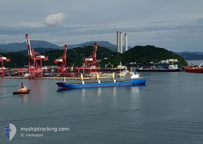
The vessel AUTAI (IMO: 9554705, MMSI: 355621000) is a Cargo It's sailing under the flag of [PA] Panama.
In this page you can find informations about the vessels current position, last detected port calls, and current voyage information. If the vessels is not in coverage by AIS you will find the latest position.
The current position of AUTAI is detected by our AIS receivers and we are not responsible for the reliability of the data. The last position was recorded while the vessel was in Coverage by the Ais receivers of our vessel tracking app.
The current draught of AUTAI as reported by AIS is 10.7 meters
Weather
| Temperature | 22.5°C / 72.5°F |
|---|---|
| Wind Speed | 12 knots |
| Direction | 188° S |
| Pressure | 1004 hPa |
| Humidity | 53.1 % |
| Cloud Coverage | 93 % |
Featured Company
Last Port Calls
| Port | Arrival | Departure | Time In Port |
|---|---|---|---|
| 2024-05-07 20:04 | |||
| 2024-05-05 00:21 | 2024-05-05 21:35 | 21 h | |
| 2024-04-29 05:20 | 2024-04-30 09:24 | 1 d | |
| 2024-04-26 23:14 | 2024-04-27 10:15 | 11 h | |
| 2024-03-26 08:40 | 2024-03-29 18:59 | 3 d | |
| 2024-03-12 06:58 | 2024-03-15 15:13 | 3 d |
Last Trips
| Origin | Departure | Destination | Arrival | Distance | |
|---|---|---|---|---|---|
| 2024-05-06 05:35 | 2024-05-08 04:04 | 36.38 nm | |||
| 2024-04-30 17:24 | 2024-05-05 08:21 | 1014.62 nm | |||
| 2024-04-27 18:15 | 2024-04-29 13:20 | 265.45 nm | |||
| 2024-03-30 01:59 | 2024-04-27 07:14 | 2928.11 nm | |||
| 2024-03-15 23:13 | 2024-03-26 15:40 | 2670.34 nm | |||
| 2024-02-27 09:27 | 2024-03-12 14:58 | 820.97 nm |
Events
| Tid | Event | Detaljer | Position / Dest | Information |
|---|---|---|---|---|
| 2024-05-07 20:04 | STOPPAR förflyttning |
38.98515 / 117.73918
[CN] TIANJIN
|
Fart: Kurs: 292° |
|
| 2024-05-07 20:04 | ANLÄNDER HAMN |
|
38.98515 / 117.73918
[CN] TIANJIN
|
Fart: 0.9 kn Kurs: 309° |
| 2024-05-07 18:17 | STARTAR förflyttning | 15.14 nm, East of TIANJIN |
38.91531 / 118.06014
CN JLY
|
Fart: 6.4 kn Kurs: 311° |
| 2024-05-05 22:50 | STOPPAR förflyttning | 15.34 nm, East of TIANJIN |
38.91058 / 118.06271
CN JLY
|
Fart: Kurs: 287° |
| 2024-05-05 21:35 | AVGÅTT HAMN |
|
38.95530 / 117.88196
CN JLY
|
Fart: 12.5 kn Kurs: 99° |
| 2024-05-05 20:43 | STARTAR förflyttning |
39.04111 / 117.76899
[CN] TIANJIN
|
Fart: 6.3 kn Kurs: 177° |
|
| 2024-05-05 00:21 | STOPPAR förflyttning |
39.04682 / 117.77217
[CN] TIANJIN
|
Fart: Kurs: 114° |
|
| 2024-05-05 00:21 | ANLÄNDER HAMN |
|
39.04682 / 117.77217
[CN] TIANJIN
|
Fart: 2.8 kn Kurs: 73° |
| 2024-05-04 21:24 | STARTAR förflyttning | 18.4 nm, West of CAOFEIDIAN |
38.94167 / 118.19923
CN JLY
|
Fart: 3.6 kn Kurs: 280° |
| 2024-05-04 09:38 | STOPPAR förflyttning | 18.16 nm, West of CAOFEIDIAN |
38.94059 / 118.20492
CN JLY
|
Fart: 0.2 kn Kurs: 263° |