
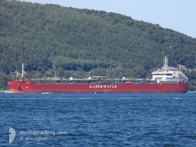
ATRIA
Tanker
Current Trip
| Time Travelled | 7 days |
|---|---|
| Remaining Time | 4 h, 9 mins |
| Distance Travelled | 1449.47 nm |
| Remaining Distance | 323.58 nm |
| AVG Speed | 9.1 Knop |
| MAX Speed | 9.1 Knop |
| AVG Wind | 4.8 knots |
| MAX Wind | 26 knots |
| MIN Temp | 6.6°C / 43.88°F |
| MAX Temp | 20.7°C / 69.26°F |
| Djupgående | 6.7 m |
| Position mottagen | 1 d sen |
Current Position
| Longitud | --- |
|---|---|
| Latitude | --- |
| Status | Under way using engine |
| Fart | 8.5 Knop |
| Kurs | 91.3° |
| Område | Mediterranean Sea - Eastern Basin |
| Station | T-AIS |
| Position mottagen | 1 d sen |
Info
Information
The current position of ATRIA is in Mediterranean Sea - Eastern Basin with coordinates 35.84347° / 29.68502° as reported on 2025-12-04 05:23 by AIS to our vessel tracker app. The vessel's current speed is 8.5 Knop and is heading at the port of ISKENDERUN. The estimated time of arrival as calculated by MyShipTracking vessel tracking app is 2025-12-05 21:31 LT
The vessel ATRIA (IMO: 9492842, MMSI: 636023432) is a Tanker It's sailing under the flag of [LR] Liberia.
In this page you can find informations about the vessels current position, last detected port calls, and current voyage information. If the vessels is not in coverage by AIS you will find the latest position.
The current position of ATRIA is detected by our AIS receivers and we are not responsible for the reliability of the data. The last position was recorded while the vessel was in Coverage by the Ais receivers of our vessel tracking app.
The current draught of ATRIA as reported by AIS is 6.7 meters
Weather
| Temperature | 20.4°C / 68.72°F |
|---|---|
| Wind Speed | 26 knots |
| Direction | 56° NE |
| Pressure | 1013.7 hPa |
| Humidity | 55.7 % |
| Cloud Coverage | 86 % |
Featured Company
Last Port Calls
| Port | Arrival | Departure | Time In Port |
|---|---|---|---|
| 2025-11-28 01:16 | 2025-11-28 13:09 | 11 h | |
| 2025-11-27 06:41 | 2025-11-28 00:45 | 18 h | |
| 2025-11-26 22:15 | 2025-11-27 04:04 | 5 h | |
| 2025-11-22 15:22 | 2025-11-22 16:52 | 1 h | |
| 2025-10-28 08:20 | 2025-10-30 02:55 | 1 d | |
| 2025-10-24 11:53 | 2025-10-27 10:12 | 2 d | |
| 2025-10-16 10:23 | 2025-10-16 10:25 | 2 m | |
| 2025-10-14 12:37 | 2025-10-16 02:54 | 1 d |
Last Trips
| Origin | Departure | Destination | Arrival | Distance | |
|---|---|---|---|---|---|
| 2025-11-28 00:45 | 2025-11-28 01:16 | 13.79 nm | |||
| 2025-11-27 04:04 | 2025-11-27 06:41 | 28.25 nm | |||
| 2025-11-22 16:52 | 2025-11-26 22:15 | 532.09 nm | |||
| 2025-10-30 02:55 | 2025-11-22 15:22 | 1239.70 nm | |||
| 2025-10-27 10:12 | 2025-10-28 08:20 | 90.98 nm | |||
| 2025-10-16 10:25 | 2025-10-24 11:53 | 1305.69 nm | |||
| 2025-10-16 02:54 | 2025-10-16 10:23 | 37.80 nm | |||
| 2025-08-08 02:07 | 2025-10-14 12:37 | 2137.38 nm |
Events
| Tid | Event | Detaljer | Position / Dest | Information |
|---|---|---|---|---|
| 2025-12-04 05:23 | UTANFÖR täckningsområde |
35.84347 / 29.68502
Mediterranean Sea - Eastern Basin
TR ISK
|
Fart: 8.5 kn Kurs: 91.3° |
|
| 2025-12-04 04:55 | Upptäckt i hav | Greek part of the Mediterranean Sea - Eastern Basin |
35.84404 / 29.60354
Mediterranean Sea - Eastern Basin
TR ISK
|
Fart: 8.3 kn Kurs: 88.4° |
| 2025-12-04 04:55 | I täckningsområde |
35.84404 / 29.60354
Mediterranean Sea - Eastern Basin
TR ISK
|
Fart: 8.3 kn Kurs: 88.4° |
|
| 2025-12-04 00:53 | UTANFÖR täckningsområde |
35.82796 / 28.89523
Mediterranean Sea - Eastern Basin
TR ISK
|
Fart: 8.7 kn Kurs: 88° |
|
| 2025-12-04 00:13 | Upptäckt i hav | Turkish part of the Mediterranean Sea - Eastern Basin |
35.82529 / 28.77572
Mediterranean Sea - Eastern Basin
TR ISK
|
Fart: 8.8 kn Kurs: 88.8° |
| 2025-12-03 19:50 | Status ändrad | Under way using engine Default |
35.80636 / 27.98017
TR ISK
|
Fart: 9 kn Kurs: 90° |
| 2025-12-03 19:42 | Status ändrad | Default Under way using engine |
35.80658 / 27.95458
TR ISK
|
Fart: 9 kn Kurs: 89.9° |
| 2025-12-03 19:40 | Upptäckt i hav | Greek part of the Mediterranean Sea - Eastern Basin |
35.80656 / 27.94778
Mediterranean Sea - Eastern Basin
TR ISK
|
Fart: 9 kn Kurs: 89.9° |
| 2025-12-03 19:40 | Status ändrad | Under way using engine Default |
35.80656 / 27.94778
TR ISK
|
Fart: 9.1 kn Kurs: 88° |
| 2025-12-03 19:40 | I täckningsområde |
35.80656 / 27.94778
Mediterranean Sea - Eastern Basin
TR ISK
|
Fart: 9 kn Kurs: 89.9° |