
ATLANTIC OCEANIC
Offshore Supply Ship
Current Trip
| Trip Time | 4 days |
|---|---|
| Trip Distance | 84.97 nm |
| AVG Speed | 9.1 Knop |
| MAX Speed | 9.9 Knop |
| Djupgående | 3.5 m |
| AVG Wind | 8.1 knots |
| MAX Wind | 10.5 knots |
| MIN Temp | 19.3°C / 66.74°F |
| MAX Temp | 24.1°C / 75.38°F |
| Position mottagen | 3 h, 30 m sen |
Current Position
| Longitud | -76.31325° |
|---|---|
| Latitude | 36.86367° |
| Status | Moored |
| Fart | |
| Kurs | 229° |
| Område | North Atlantic Ocean |
| Station | T-AIS |
| Position mottagen | 3 h, 30 m sen |
Info
Information
The current position of ATLANTIC OCEANIC is in North Atlantic Ocean with coordinates 36.86367° / -76.31325° as reported on 2024-06-01 13:34 by AIS to our vessel tracker app. The vessel's current speed is 0 Knop and is currently inside the port of NORFOLK.
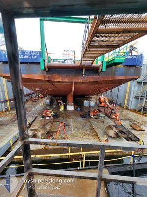
The vessel ATLANTIC OCEANIC (IMO: 9285275, MMSI: 366907000) is a Offshore Supply Ship that was built in 2004 ( 20 År gammal ). It's sailing under the flag of [US] USA.
In this page you can find informations about the vessels current position, last detected port calls, and current voyage information. If the vessels is not in coverage by AIS you will find the latest position.
The current position of ATLANTIC OCEANIC is detected by our AIS receivers and we are not responsible for the reliability of the data. The last position was recorded while the vessel was in Coverage by the Ais receivers of our vessel tracking app.
The current draught of ATLANTIC OCEANIC as reported by AIS is 3.5 meters
Weather
| Temperature | 19.7°C / 67.46°F |
|---|---|
| Wind Speed | 6 knots |
| Direction | 266° W |
| Pressure | 1025.3 hPa |
| Humidity | 46.2 % |
| Cloud Coverage | 7 % |
Featured Company
Last Port Calls
| Port | Arrival | Departure | Time In Port |
|---|---|---|---|
| 2024-06-01 02:22 | |||
| 2024-05-27 06:50 | 2024-05-27 22:23 | 15 h | |
| 2024-05-19 10:58 | |||
| 2024-05-09 18:34 |
Most Visited Ports (Last year)
| Port | Arrivals | |
|---|---|---|
| 5 | ||
| 3 | ||
| 2 | ||
| 1 |
Events
| Tid | Event | Detaljer | Position / Dest | Information |
|---|---|---|---|---|
| 2024-06-01 13:34 | UTANFÖR täckningsområde |
36.86367 / -76.31325
North Atlantic Ocean
[US] NORFOLK
|
Fart: Kurs: 199° |
|
| 2024-06-01 07:55 | Status ändrad | Moored Under way using engine |
36.86308 / -76.31368
[US] NORFOLK
|
Fart: 1 kn Kurs: 227° |
| 2024-06-01 07:34 | STOPPAR förflyttning |
36.86120 / -76.31734
[US] NORFOLK
|
Fart: Kurs: 224° |
|
| 2024-06-01 06:22 | ANLÄNDER HAMN |
|
37.00612 / -76.27089
[US] NORFOLK
|
Fart: 9.5 kn Kurs: 257.6° |
| 2024-06-01 06:14 | ETA ändrat | 2025/05/28 02:00 2024/05/28 02:00 |
37.00914 / -76.24478
CVOW WDA
|
Fart: 9.6 kn Kurs: 281.3° |
| 2024-06-01 04:02 | I täckningsområde |
36.95085 / -75.84735
North Atlantic Ocean
|
Fart: 9 kn Kurs: 251° |
|
| 2024-05-31 04:12 | UTANFÖR täckningsområde |
36.88587 / -75.52156
North Atlantic Ocean
|
Fart: 0.1 kn Kurs: 47.5° |
|
| 2024-05-31 02:56 | I täckningsområde |
36.88380 / -75.51782
North Atlantic Ocean
|
Fart: 0.5 kn Kurs: 281.2° |
|
| 2024-05-29 21:36 | UTANFÖR täckningsområde |
36.91846 / -75.45884
North Atlantic Ocean
|
Fart: 0.7 kn Kurs: 340.7° |
|
| 2024-05-29 21:13 | I täckningsområde |
36.91408 / -75.45725
North Atlantic Ocean
|
Fart: 0.2 kn Kurs: 345.7° |