
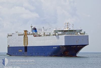
ASTURIAS
Vehicles Carrier
Current Trip
| Time Travelled | 18 h, 41 mins |
|---|---|
| Remaining Time | 13 mins |
| Distance Travelled | 191.86 nm |
| Remaining Distance | 6.68 nm |
| AVG Speed | 10.4 Knop |
| MAX Speed | 15.4 Knop |
| AVG Wind | 20.7 knots |
| MAX Wind | 24 knots |
| MIN Temp | 13.5°C / 56.3°F |
| MAX Temp | 16.1°C / 60.98°F |
| Djupgående | 7.7 m |
| Position mottagen | Nu |
Current Position
| Longitud | 3.12638° |
|---|---|
| Latitude | 51.39516° |
| Status | Under way using engine |
| Fart | 14.5 Knop |
| Kurs | 105.4° |
| Område | North Sea |
| Station | T-AIS |
| Position mottagen | Nu |
Info
Information
The current position of ASTURIAS is in North Sea with coordinates 51.39516° / 3.12638° as reported on 2024-06-16 14:25 by AIS to our vessel tracker app. The vessel's current speed is 14.5 Knop and is heading at the port of ZEEBRUGGE. The estimated time of arrival as calculated by MyShipTracking vessel tracking app is 2024-06-16 14:39 LT
The vessel ASTURIAS (IMO: 9481049, MMSI: 538009723) is a Vehicles Carrier that was built in 2010 ( 14 År gammal ). It's sailing under the flag of [MH] Marshall Is.
In this page you can find informations about the vessels current position, last detected port calls, and current voyage information. If the vessels is not in coverage by AIS you will find the latest position.
The current position of ASTURIAS is detected by our AIS receivers and we are not responsible for the reliability of the data. The last position was recorded while the vessel was in Coverage by the Ais receivers of our vessel tracking app.
The current draught of ASTURIAS as reported by AIS is 7.7 meters
Weather
| Temperature | 15.2°C / 59.36°F |
|---|---|
| Wind Speed | 21 knots |
| Direction | 244° WSW |
| Pressure | 1004.4 hPa |
| Humidity | 73.6 % |
| Cloud Coverage | 38 % |
Featured Company
Last Port Calls
| Port | Arrival | Departure | Time In Port |
|---|---|---|---|
| 2024-06-13 20:28 | 2024-06-15 19:45 | 1 d | |
| 2024-06-10 21:03 | 2024-06-11 12:07 | 15 h | |
| 2024-06-07 20:42 | 2024-06-09 08:42 | 1 d | |
| 2024-06-06 18:09 | 2024-06-07 05:10 | 11 h | |
| 2024-06-04 05:19 | 2024-06-04 17:07 | 11 h | |
| 2024-05-30 13:44 | 2024-06-01 13:40 | 1 d | |
| 2024-05-28 20:27 | 2024-05-29 22:41 | 1 d | |
| 2024-05-27 03:11 | 2024-05-27 10:25 | 7 h | |
| 2024-05-24 18:13 | 2024-05-25 15:30 | 21 h | |
| 2024-05-21 13:17 | 2024-05-23 00:13 | 1 d |
Last Trips
| Origin | Departure | Destination | Arrival | Distance | |
|---|---|---|---|---|---|
| 2024-06-11 14:07 | 2024-06-13 22:28 | 720.27 nm | |||
| 2024-06-09 09:42 | 2024-06-10 23:03 | 532.04 nm | |||
| 2024-06-07 06:10 | 2024-06-07 21:42 | 189.20 nm | |||
| 2024-06-04 19:07 | 2024-06-06 19:09 | 567.46 nm | |||
| 2024-06-01 15:40 | 2024-06-04 07:19 | 865.83 nm | |||
| 2024-05-30 00:41 | 2024-05-30 15:44 | 198.52 nm | |||
| 2024-05-27 12:25 | 2024-05-28 22:27 | 447.08 nm | |||
| 2024-05-25 17:30 | 2024-05-27 05:11 | 488.41 nm | |||
| 2024-05-23 01:13 | 2024-05-24 20:13 | 532.68 nm | |||
| 2024-05-17 02:42 | 2024-05-21 14:17 | 1409.22 nm |
Events
| Tid | Event | Detaljer | Position / Dest | Information |
|---|---|---|---|---|
| 2024-06-16 11:41 | Upptäckt i hav | Belgian part of the North Sea |
51.32608 / 2.36552
North Sea
BE ZEE
|
Fart: 5.4 kn Kurs: 59.3° |
| 2024-06-16 07:05 | Byter havsområde | French part of the North Sea French part of the English Channel |
51.00114 / 1.61444
North Sea
BE ZEE
|
Fart: 8.1 kn Kurs: 47.4° |
| 2024-06-16 06:53 | ETA ändrat | 2024/06/16 13:30 2024/06/16 11:00 |
50.98315 / 1.58365
BE ZEE
|
Fart: 8.3 kn Kurs: 42.7° |
| 2024-06-16 05:08 | Byter havsområde | French part of the English Channel United Kingdom part of the English Channel |
50.65886 / 1.31715
English Channel
BE ZEE
|
Fart: 13.3 kn Kurs: 46.1° |
| 2024-06-16 05:05 | Status ändrad | Under way using engine Default |
50.65158 / 1.30544
BE ZEE
|
Fart: 13.2 kn Kurs: 46° |
| 2024-06-16 04:57 | I täckningsområde |
50.65886 / 1.31715
English Channel
BE ZEE
|
Fart: 13.3 kn Kurs: 46.1° |
|
| 2024-06-16 03:05 | Status ändrad | Default Under way using engine |
50.43075 / .72792
BE ZEE
|
Fart: 13.1 kn Kurs: 71.8° |
| 2024-06-16 02:59 | UTANFÖR täckningsområde |
50.42348 / .69253
English Channel
BE ZEE
|
Fart: 13.1 kn Kurs: 71.8° |
|
| 2024-06-16 00:47 | Byter havsområde | United Kingdom part of the English Channel French part of the English Channel |
50.24503 / .04672
English Channel
BE ZEE
|
Fart: 11.3 kn Kurs: 7.5° |
| 2024-06-15 19:45 | AVGÅTT HAMN |
|
49.48612 / .08749
BE ZEE
|
Fart: 9.7 kn Kurs: 285° |