
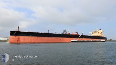
ASCONA
Tanker
Current Trip
| Time Travelled | 1 day |
|---|---|
| Remaining Time | --- |
| Distance Travelled | 527.14 nm |
| Remaining Distance | --- |
| AVG Speed | 11.6 Knop |
| MAX Speed | 13.8 Knop |
| AVG Wind | 6.9 knots |
| MAX Wind | 12.3 knots |
| MIN Temp | 27.9°C / 82.22°F |
| MAX Temp | 31.1°C / 87.98°F |
| Djupgående | 20.7 m |
| Position mottagen | 1 m sen |
Current Position
| Longitud | 56.90884° |
|---|---|
| Latitude | 24.99948° |
| Status | Under way using engine |
| Fart | 12.9 Knop |
| Kurs | 149.9° |
| Område | Gulf of Oman |
| Station | T-AIS |
| Position mottagen | 1 m sen |
Info
Information
The current position of ASCONA is in Gulf of Oman with coordinates 24.99948° / 56.90884° as reported on 2024-05-22 05:22 by AIS to our vessel tracker app. The vessel's current speed is 12.9 Knop and is heading at the port of YEOSU. The estimated time of arrival as calculated by MyShipTracking vessel tracking app is 2024-06-09 18:00 LT
The vessel ASCONA (IMO: 9828338, MMSI: 241622000) is a Tanker It's sailing under the flag of [GR] Greece.
In this page you can find informations about the vessels current position, last detected port calls, and current voyage information. If the vessels is not in coverage by AIS you will find the latest position.
The current position of ASCONA is detected by our AIS receivers and we are not responsible for the reliability of the data. The last position was recorded while the vessel was in Coverage by the Ais receivers of our vessel tracking app.
The current draught of ASCONA as reported by AIS is 20.7 meters
Weather
| Temperature | 31°C / 87.8°F |
|---|---|
| Wind Speed | 3 knots |
| Direction | 66° ENE |
| Pressure | 1005.5 hPa |
| Humidity | 58 % |
| Cloud Coverage | 3 % |
Featured Company
Last Port Calls
| Port | Arrival | Departure | Time In Port |
|---|---|---|---|
| 2024-05-18 14:57 | 2024-05-20 09:06 | 1 d | |
| 2024-04-25 11:31 | 2024-04-27 06:00 | 1 d | |
| 2024-03-07 06:37 |
Last Trips
| Origin | Departure | Destination | Arrival | Distance | |
|---|---|---|---|---|---|
| 2024-04-27 12:00 | 2024-05-18 17:57 | 5340.63 nm | |||
| 2024-03-07 15:37 | 2024-04-25 17:31 | 12205.19 nm |
Events
| Tid | Event | Detaljer | Position / Dest | Information |
|---|---|---|---|---|
| 2024-05-22 05:05 | Byter havsområde | Omani part of the Gulf of Oman United Arab Emirates part of the Gulf of Oman |
25.05245 / 56.87715
Gulf of Oman
KRYOS
|
Fart: 12.8 kn Kurs: 161.3° |
| 2024-05-22 02:05 | Upptäckt i hav | United Arab Emirates part of the Gulf of Oman |
25.67062 / 56.71435
Gulf of Oman
KRYOS
|
Fart: 12.6 kn Kurs: 170.8° |
| 2024-05-22 00:33 | Upptäckt i hav | Omani part of the Gulf of Oman |
25.99578 / 56.67166
Gulf of Oman
KRYOS
|
Fart: 12.9 kn Kurs: 174.1° |
| 2024-05-21 23:43 | Status ändrad | Under way using engine Default |
26.17588 / 56.65011
KRYOS
|
Fart: 13.2 kn Kurs: 172° |
| 2024-05-21 23:43 | I täckningsområde |
26.17588 / 56.65011
Persian Gulf
KRYOS
|
Fart: 12.8 kn Kurs: 170.9° |
|
| 2024-05-21 22:04 | Status ändrad | Default Under way using engine |
26.52097 / 56.56972
KRYOS
|
Fart: 12.3 kn Kurs: 145° |
| 2024-05-21 21:57 | Status ändrad | Under way using engine Default |
26.54259 / 56.55327
KRYOS
|
Fart: 12.4 kn Kurs: 109° |
| 2024-05-21 21:57 | UTANFÖR täckningsområde |
26.54259 / 56.55327
Persian Gulf
KRYOS
|
Fart: 12.3 kn Kurs: 145° |
|
| 2024-05-21 21:34 | Status ändrad | Default Under way using engine |
26.56151 / 56.47657
KRYOS
|
Fart: 12.7 kn Kurs: 75.2° |
| 2024-05-21 20:54 | Status ändrad | Under way using engine Default |
26.50830 / 56.32450
KRYOS
|
Fart: 13 kn Kurs: 65° |