
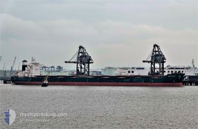
APOLLONIUS
Cargo
Current Trip
| Time Travelled | 52 days |
|---|---|
| Remaining Time | 21 h, 43 mins |
| Distance Travelled | 9050.69 nm |
| Remaining Distance | 285.84 nm |
| AVG Speed | 10.8 Knop |
| MAX Speed | 13.7 Knop |
| AVG Wind | 14.8 knots |
| MAX Wind | 34 knots |
| MIN Temp | 12°C / 53.6°F |
| MAX Temp | 29.2°C / 84.56°F |
| Djupgående | 18.3 m |
| Position mottagen | 1 m sen |
Current Position
| Longitud | -2.27912° |
|---|---|
| Latitude | 49.92333° |
| Status | Under way using engine |
| Fart | 12.2 Knop |
| Kurs | 73.5° |
| Område | English Channel |
| Station | T-AIS |
| Position mottagen | 1 m sen |
Info
Information
The current position of APOLLONIUS is in English Channel with coordinates 49.92333° / -2.27912° as reported on 2024-05-05 20:40 by AIS to our vessel tracker app. The vessel's current speed is 12.2 Knop and is heading at the port of ROTTERDAM. The estimated time of arrival as calculated by MyShipTracking vessel tracking app is 2024-05-06 18:24 LT
The vessel APOLLONIUS (IMO: 9718234, MMSI: 538006904) is a Cargo It's sailing under the flag of [MH] Marshall Is.
In this page you can find informations about the vessels current position, last detected port calls, and current voyage information. If the vessels is not in coverage by AIS you will find the latest position.
The current position of APOLLONIUS is detected by our AIS receivers and we are not responsible for the reliability of the data. The last position was recorded while the vessel was in Coverage by the Ais receivers of our vessel tracking app.
The current draught of APOLLONIUS as reported by AIS is 18.3 meters
Weather
| Temperature | 12.4°C / 54.32°F |
|---|---|
| Wind Speed | 6 knots |
| Direction | 74° ENE |
| Pressure | 1005.7 hPa |
| Humidity | 80.5 % |
| Cloud Coverage | 11 % |
Featured Company
Most Visited Ports (Last year)
| Port | Arrivals | |
|---|---|---|
| 4 | ||
| 2 | ||
| 2 | ||
| 1 | ||
| 1 | ||
| 1 |
Last Trips
| Origin | Departure | Destination | Arrival | Distance | |
|---|---|---|---|---|---|
| 2024-01-07 04:55 | 2024-03-12 11:48 | 4206.05 nm |
Events
| Tid | Event | Detaljer | Position / Dest | Information |
|---|---|---|---|---|
| 2024-05-05 19:56 | ETA ändrat | 2024/05/06 18:00 2024/05/06 14:00 |
49.88294 / -2.49438
ROTTERDAM
|
Fart: 12.7 kn Kurs: 74.8° |
| 2024-05-05 16:59 | Status ändrad | Under way using engine Default |
49.62940 / -3.37526
ROTTERDAM
|
Fart: 13.4 kn Kurs: 59° |
| 2024-05-05 16:42 | Status ändrad | Default Under way using engine |
49.59924 / -3.45258
ROTTERDAM
|
Fart: 13.3 kn Kurs: 60.4° |
| 2024-05-05 16:32 | Status ändrad | Under way using engine Default |
49.58142 / -3.50041
ROTTERDAM
|
Fart: 13.4 kn Kurs: 61° |
| 2024-05-05 16:10 | Status ändrad | Default Under way using engine |
49.54133 / -3.60536
ROTTERDAM
|
Fart: 13.5 kn Kurs: 59.1° |
| 2024-05-05 15:58 | Byter havsområde | Guernsey part of the English Channel French part of the English Channel |
49.51939 / -3.66232
English Channel
ROTTERDAM
|
Fart: 13.5 kn Kurs: 59.2° |
| 2024-05-05 15:34 | Status ändrad | Under way using engine Default |
49.47368 / -3.77909
ROTTERDAM
|
Fart: 13.5 kn Kurs: 58° |
| 2024-05-05 15:19 | Status ändrad | Default Under way using engine |
49.44505 / -3.85374
ROTTERDAM
|
Fart: 13.5 kn Kurs: 59.2° |
| 2024-05-05 15:11 | Status ändrad | Under way using engine Default |
49.43058 / -3.89176
ROTTERDAM
|
Fart: 13.6 kn Kurs: 60° |
| 2024-05-05 14:50 | Status ändrad | Default Under way using engine |
49.39265 / -3.99010
ROTTERDAM
|
Fart: 13.6 kn Kurs: 59.1° |