
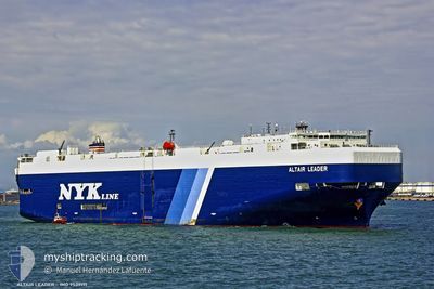
ALTAIR LEADER
Vehicles Carrier
Current Trip
| Time Travelled | 5 days |
|---|---|
| Remaining Time | 2 h, 43 mins |
| Distance Travelled | 2174.40 nm |
| Remaining Distance | 58.85 nm |
| AVG Speed | 16.6 Knop |
| MAX Speed | 18.7 Knop |
| AVG Wind | 9.6 knots |
| MAX Wind | 19.8 knots |
| MIN Temp | 19.1°C / 66.38°F |
| MAX Temp | 29.5°C / 85.1°F |
| Djupgående | 8.7 m |
| Position mottagen | 3 d sen |
Current Position
| Longitud | -79.58073° |
|---|---|
| Latitude | 8.77257° |
| Status | Under way using engine |
| Fart | 14.1 Knop |
| Kurs | 141.6° |
| Område | North Pacific Ocean |
| Station | T-AIS |
| Position mottagen | 3 d sen |
Info
Information
The current position of ALTAIR LEADER is in North Pacific Ocean with coordinates 8.77257° / -79.58073° as reported on 2024-04-25 03:28 by AIS to our vessel tracker app. The vessel's current speed is 14.1 Knop and is heading at the port of CALLAO. The estimated time of arrival as calculated by MyShipTracking vessel tracking app is 2024-04-28 09:09 LT
The vessel ALTAIR LEADER (IMO: 9539171, MMSI: 432817000) is a Vehicles Carrier that was built in 2011 ( 13 År gammal ). It's sailing under the flag of [JP] Japan.
In this page you can find informations about the vessels current position, last detected port calls, and current voyage information. If the vessels is not in coverage by AIS you will find the latest position.
The current position of ALTAIR LEADER is detected by our AIS receivers and we are not responsible for the reliability of the data. The last position was recorded while the vessel was in Coverage by the Ais receivers of our vessel tracking app.
The current draught of ALTAIR LEADER as reported by AIS is 8.7 meters
Weather
| Temperature | 19.1°C / 66.38°F |
|---|---|
| Wind Speed | 7 knots |
| Direction | 142° SE |
| Pressure | 1012.9 hPa |
| Humidity | 89.9 % |
| Cloud Coverage | 98 % |
Featured Company
Last Port Calls
| Port | Arrival | Departure | Time In Port |
|---|---|---|---|
| 2024-04-22 07:17 | 2024-04-22 12:18 | 5 h | |
| 2024-04-18 14:43 | 2024-04-19 02:18 | 11 h | |
| 2024-03-29 21:32 | 2024-03-30 09:53 | 12 h | |
| 2024-03-27 09:14 | 2024-03-28 08:41 | 23 h | |
| 2024-03-25 21:37 | 2024-03-27 06:18 | 1 d | |
| 2024-03-23 04:57 | 2024-03-24 08:25 | 1 d | |
| 2024-03-20 21:38 | 2024-03-21 06:11 | 8 h | |
| 2024-03-19 01:30 | 2024-03-19 12:11 | 10 h | |
| 2024-03-02 20:12 | 2024-03-03 11:29 | 15 h | |
| 2024-02-27 11:22 | 2024-02-28 08:14 | 20 h |
Most Visited Ports (Last year)
| Port | Arrivals | |
|---|---|---|
| 7 | ||
| 5 | ||
| 3 | ||
| 2 | ||
| 2 | ||
| 2 |
Last Trips
| Origin | Departure | Destination | Arrival | Distance | |
|---|---|---|---|---|---|
| 2024-04-18 20:18 | 2024-04-22 01:17 | 61.47 nm | |||
| 2024-03-30 18:53 | 2024-04-18 08:43 | 7012.51 nm | |||
| 2024-03-28 17:41 | 2024-03-30 06:32 | 253.60 nm | |||
| 2024-03-27 15:18 | 2024-03-27 18:14 | 42.17 nm | |||
| 2024-03-24 17:25 | 2024-03-26 06:37 | 431.01 nm | |||
| 2024-03-21 15:11 | 2024-03-23 13:57 | 455.79 nm | |||
| 2024-03-19 21:11 | 2024-03-21 06:38 | 304.50 nm | |||
| 2024-03-03 03:29 | 2024-03-19 10:30 | 5396.44 nm | |||
| 2024-02-28 02:14 | 2024-03-02 12:12 | 1369.45 nm | |||
| 2024-02-19 20:56 | 2024-02-27 05:22 | 1755.52 nm |
Events
| Tid | Event | Detaljer | Position / Dest | Information |
|---|---|---|---|---|
| 2024-04-25 03:34 | Status ändrad | Default Under way using engine |
8.75213 / -79.56406
PE_CLL
|
Fart: 14.1 kn Kurs: 141.6° |
| 2024-04-25 03:28 | Status ändrad | Under way using engine Default |
8.77257 / -79.58073
PE_CLL
|
Fart: 13.5 kn Kurs: 141° |
| 2024-04-25 03:28 | UTANFÖR täckningsområde |
8.77257 / -79.58073
North Pacific Ocean
PE_CLL
|
Fart: 14.1 kn Kurs: 141.6° |
|
| 2024-04-25 03:19 | I täckningsområde |
8.77257 / -79.58073
North Pacific Ocean
PE_CLL
|
Fart: 14.1 kn Kurs: 141.6° |
|
| 2024-04-25 03:14 | STARTAR förflyttning | 2.35 nm, West of TABOGA |
8.81251 / -79.59018
PE_CLL
|
Fart: 6.3 kn Kurs: 177° |
| 2024-04-24 21:06 | Status ändrad | Default At anchor |
8.81667 / -79.59167
PE_CLL
|
Fart: 0.1 kn Kurs: 52° |
| 2024-04-24 21:01 | UTANFÖR täckningsområde |
8.81778 / -79.59349
North Pacific Ocean
PE_CLL
|
Fart: 0.1 kn Kurs: 102.9° |
|
| 2024-04-24 20:55 | Status ändrad | At anchor Default |
8.81788 / -79.59381
PE_CLL
|
Fart: Kurs: -1° |
| 2024-04-24 20:40 | I täckningsområde |
8.81788 / -79.59381
North Pacific Ocean
PE_CLL
|
Fart: 0.2 kn Kurs: 130.8° |
|
| 2024-04-24 19:40 | UTANFÖR täckningsområde |
8.81795 / -79.59381
North Pacific Ocean
PE_CLL
|
Fart: Kurs: 85.7° |