
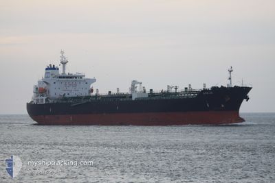
ALPINE LINK
Oil/Chemical Tanker
Current Trip
| Time Travelled | 25 days |
|---|---|
| Remaining Time | --- |
| Distance Travelled | 3053.99 nm |
| Remaining Distance | 10.06 nm |
| AVG Speed | 11.5 Knop |
| MAX Speed | 16.7 Knop |
| AVG Wind | 14.4 knots |
| MAX Wind | 28 knots |
| MIN Temp | 11.1°C / 51.98°F |
| MAX Temp | 25.2°C / 77.36°F |
| Djupgående | 11.3 m |
| Position mottagen | 15 d sen |
Current Position
| Longitud | -15.21898° |
|---|---|
| Latitude | 27.62915° |
| Status | Under way using engine |
| Fart | 13.5 Knop |
| Kurs | 201.9° |
| Område | North Atlantic Ocean |
| Station | T-AIS |
| Position mottagen | 15 d sen |
Info
Information
The current position of ALPINE LINK is in North Atlantic Ocean with coordinates 27.62915° / -15.21898° as reported on 2024-05-19 02:49 by AIS to our vessel tracker app. The vessel's current speed is 13.5 Knop and is heading at the port of DAKAR. The estimated time of arrival as calculated by MyShipTracking vessel tracking app is 2024-05-21 20:00 LT
The vessel ALPINE LINK (IMO: 9478614, MMSI: 538003758) is a Oil/Chemical Tanker that was built in 2010 ( 14 År gammal ). It's sailing under the flag of [MH] Marshall Is.
In this page you can find informations about the vessels current position, last detected port calls, and current voyage information. If the vessels is not in coverage by AIS you will find the latest position.
The current position of ALPINE LINK is detected by our AIS receivers and we are not responsible for the reliability of the data. The last position was recorded while the vessel was in Coverage by the Ais receivers of our vessel tracking app.
The current draught of ALPINE LINK as reported by AIS is 11.3 meters
Weather
| Temperature | 23°C / 73.4°F |
|---|---|
| Wind Speed | 10 knots |
| Direction | 341° NNW |
| Pressure | 1015.3 hPa |
| Humidity | 81.4 % |
| Cloud Coverage | 100 % |
Featured Company
Last Port Calls
| Port | Arrival | Departure | Time In Port |
|---|---|---|---|
| 2024-05-08 12:22 | 2024-05-08 14:02 | 1 h | |
| 2024-05-01 07:26 | 2024-05-08 10:08 | 7 d | |
| 2024-04-25 20:55 | 2024-04-27 22:34 | 2 d | |
| 2024-04-04 05:25 | 2024-04-06 03:30 | 1 d |
Most Visited Ports (Last year)
| Port | Arrivals | |
|---|---|---|
| 2 | ||
| 2 | ||
| 2 | ||
| 2 | ||
| 2 | ||
| 1 |
Last Trips
| Origin | Departure | Destination | Arrival | Distance | |
|---|---|---|---|---|---|
| 2024-05-08 10:08 | 2024-05-08 12:22 | 9.42 nm | |||
| 2024-04-27 22:34 | 2024-05-01 07:26 | 142.88 nm | |||
| 2024-04-06 03:30 | 2024-04-25 20:55 | 5223.08 nm | |||
| 2024-03-23 00:56 | 2024-04-04 05:25 | 677.20 nm |
Events
| Tid | Event | Detaljer | Position / Dest | Information |
|---|---|---|---|---|
| 2024-05-30 10:03 | STOPPAR förflyttning | 8.12 nm, South of RUFISQUE |
14.57601 / -17.28328
SN DKR
|
Fart: 0.3 kn Kurs: 351° |
| 2024-05-30 07:52 | STARTAR förflyttning | 6.18 nm, South East of GOREE |
14.59262 / -17.32725
SN DKR
|
Fart: 3.3 kn Kurs: 160° |
| 2024-05-24 10:19 | STOPPAR förflyttning | 5.8 nm, South East of GOREE |
14.60118 / -17.32733
SN DKR
|
Fart: 0.2 kn Kurs: 152° |