
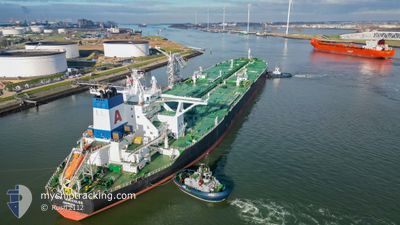
ALMI HERCULES
Tanker
Current Trip
| Time Travelled | 37 days |
|---|---|
| Remaining Time | --- |
| Distance Travelled | 10570.88 nm |
| Remaining Distance | --- |
| AVG Speed | 12.9 Knop |
| MAX Speed | 16.8 Knop |
| AVG Wind | 14 knots |
| MAX Wind | 29.9 knots |
| MIN Temp | 14.8°C / 58.64°F |
| MAX Temp | 29.4°C / 84.92°F |
| Djupgående | 20.6 m |
| Position mottagen | 8 d sen |
Current Position
| Longitud | 18.51798° |
|---|---|
| Latitude | -34.82934° |
| Status | Under way using engine |
| Fart | 12.9 Knop |
| Kurs | 113.3° |
| Område | South Atlantic Ocean |
| Station | T-AIS |
| Position mottagen | 8 d sen |
Info
Information
The current position of ALMI HERCULES is in South Atlantic Ocean with coordinates -34.82934° / 18.51798° as reported on 2024-05-07 01:20 by AIS to our vessel tracker app. The vessel's current speed is 12.9 Knop and is heading at the port of KAOHSIUNG. The estimated time of arrival as calculated by MyShipTracking vessel tracking app is 2024-05-29 22:00 LT
The vessel ALMI HERCULES (IMO: 9583732, MMSI: 636020453) is a Tanker It's sailing under the flag of [LR] Liberia.
In this page you can find informations about the vessels current position, last detected port calls, and current voyage information. If the vessels is not in coverage by AIS you will find the latest position.
The current position of ALMI HERCULES is detected by our AIS receivers and we are not responsible for the reliability of the data. The last position was recorded while the vessel was in Coverage by the Ais receivers of our vessel tracking app.
The current draught of ALMI HERCULES as reported by AIS is 20.6 meters
Weather
| Temperature | 26.4°C / 79.52°F |
|---|---|
| Wind Speed | 11 knots |
| Direction | 132° SE |
| Pressure | 1013.3 hPa |
| Humidity | 81 % |
| Cloud Coverage | 90 % |
Featured Company
Events
| Tid | Event | Detaljer | Position / Dest | Information |
|---|---|---|---|---|
| 2024-05-07 01:27 | Status ändrad | Default Under way using engine |
-34.84013 / 18.54471
USOCT>TWKHH
|
Fart: 12.9 kn Kurs: 113.3° |
| 2024-05-07 01:20 | UTANFÖR täckningsområde |
-34.82934 / 18.51798
South Atlantic Ocean
USOCT>TWKHH
|
Fart: 12.9 kn Kurs: 113.3° |
|
| 2024-05-07 00:51 | Status ändrad | Under way using engine Default |
-34.78294 / 18.40194
USOCT>TWKHH
|
Fart: 13.3 kn Kurs: 132° |
| 2024-05-07 00:39 | Status ändrad | Default Under way using engine |
-34.75357 / 18.35906
USOCT>TWKHH
|
Fart: 13.2 kn Kurs: 125.3° |
| 2024-05-06 23:12 | Status ändrad | Under way using engine Default |
-34.62648 / 18.00919
USOCT>TWKHH
|
Fart: 12 kn Kurs: 128° |
| 2024-05-06 22:54 | I täckningsområde |
-34.62961 / 18.01481
South Atlantic Ocean
USOCT>TWKHH
|
Fart: 12.1 kn Kurs: 120.2° |
|
| 2024-05-06 20:59 | Status ändrad | Default Under way using engine |
-34.17635 / 17.96452
USOCT>TWKHH
|
Fart: 12.6 kn Kurs: 171.3° |
| 2024-05-06 20:53 | Status ändrad | Under way using engine Default |
-34.15781 / 17.96250
USOCT>TWKHH
|
Fart: 12.6 kn Kurs: 169° |
| 2024-05-06 20:53 | UTANFÖR täckningsområde |
-34.15781 / 17.96250
South Atlantic Ocean
USOCT>TWKHH
|
Fart: 12.6 kn Kurs: 171.3° |
|
| 2024-05-06 20:50 | Status ändrad | Default Under way using engine |
-34.14714 / 17.96082
USOCT>TWKHH
|
Fart: 12.4 kn Kurs: 174.5° |