
ALLIANCE
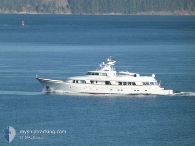
Pleasure Craft
Current Trip
| Trip Time | 1 day |
|---|---|
| Trip Distance | 55.45 nm |
| AVG Speed | 10 Knop |
| MAX Speed | 16.8 Knop |
| Djupgående | 3 m |
| AVG Wind | 6.2 knots |
| MAX Wind | 20.6 knots |
| MIN Temp | 8.2°C / 46.76°F |
| MAX Temp | 13.3°C / 55.94°F |
| Position mottagen | 1 m sen |
Current Position
| Longitud | -122.60585° |
|---|---|
| Latitude | 48.51305° |
| Status | Moored |
| Fart | |
| Kurs | 181° |
| Område | The Coastal Waters of Southeast Alaska and British Columbia |
| Station | T-AIS |
| Position mottagen | 1 m sen |
Info
Information
The current position of ALLIANCE is in The Coastal Waters of Southeast Alaska and British Columbia with coordinates 48.51305° / -122.60585° as reported on 2024-05-23 18:26 by AIS to our vessel tracker app. The vessel's current speed is 0 Knop and is currently inside the port of ANACORTES.
The vessel ALLIANCE (MMSI: 303639000) is a Pleasure Craft It's sailing under the flag of [US] USA.
In this page you can find informations about the vessels current position, last detected port calls, and current voyage information. If the vessels is not in coverage by AIS you will find the latest position.
The current position of ALLIANCE is detected by our AIS receivers and we are not responsible for the reliability of the data. The last position was recorded while the vessel was in Coverage by the Ais receivers of our vessel tracking app.
The current draught of ALLIANCE as reported by AIS is 3 meters
Weather
| Temperature | 12.8°C / 55.04°F |
|---|---|
| Wind Speed | 9 knots |
| Direction | 178° S |
| Pressure | 1019.3 hPa |
| Humidity | 67.7 % |
| Cloud Coverage | 39 % |
Featured Company
Last Port Calls
| Port | Arrival | Departure | Time In Port |
|---|---|---|---|
| 2024-05-23 15:53 | |||
| 2024-05-21 18:09 | 2024-05-22 01:16 | 7 h | |
| 2024-05-18 15:31 | 2024-05-20 21:08 | 2 d | |
| 2024-05-13 23:31 | 2024-05-15 21:40 | 1 d | |
| 2024-05-13 16:25 | 2024-05-13 18:54 | 2 h | |
| 2024-05-03 01:08 | 2024-05-03 02:16 | 1 h | |
| 2024-04-30 01:50 | 2024-04-30 03:14 | 1 h | |
| 2024-04-25 01:31 | 2024-04-25 03:14 | 1 h | |
| 2024-04-20 01:13 | 2024-04-20 02:18 | 1 h | |
| 2024-04-19 02:08 | 2024-04-19 03:07 | 58 m |
Most Visited Ports (Last year)
| Port | Arrivals | |
|---|---|---|
| 26 | ||
| 12 | ||
| 4 | ||
| 1 | ||
| 1 |
Last Trips
| Origin | Departure | Destination | Arrival | Distance | |
|---|---|---|---|---|---|
| 2024-05-21 18:16 | 2024-05-23 08:53 | 55.45 nm | |||
| 2024-05-20 14:08 | 2024-05-21 11:09 | 51.44 nm | |||
| 2024-05-15 14:40 | 2024-05-18 08:31 | 81.64 nm | |||
| 2024-05-13 11:54 | 2024-05-13 16:31 | 60.85 nm | |||
| 2024-05-02 19:16 | 2024-05-13 09:25 | 33.56 nm | |||
| 2024-04-29 20:14 | 2024-05-02 18:08 | 10.63 nm | |||
| 2024-04-24 20:14 | 2024-04-29 18:50 | 11.05 nm | |||
| 2024-04-19 19:18 | 2024-04-24 18:31 | 9.85 nm | |||
| 2024-04-18 20:07 | 2024-04-19 18:13 | 12.20 nm | |||
| 2024-04-09 14:00 | 2024-04-18 19:08 | 10.26 nm |
Events
| Tid | Event | Detaljer | Position / Dest | Information |
|---|---|---|---|---|
| 2024-05-23 16:02 | Status ändrad | Moored Under way using engine |
48.51306 / -122.60586
[US] ANACORTES
|
Fart: Kurs: 181° |
| 2024-05-23 15:53 | STOPPAR förflyttning |
48.51165 / -122.60560
[US] ANACORTES
|
Fart: 0.3 kn Kurs: 220° |
|
| 2024-05-23 15:53 | ANLÄNDER HAMN |
|
48.51160 / -122.60562
[US] ANACORTES
|
Fart: 0.6 kn Kurs: 238° |
| 2024-05-23 14:34 | STARTAR förflyttning | 7.55 nm, South East of ORCAS |
48.49730 / -122.82694
CRUISING
|
Fart: 8.1 kn Kurs: 333.9° |
| 2024-05-23 14:30 | Status ändrad | Under way using engine At anchor |
48.49540 / -122.82728
CRUISING
|
Fart: 0.3 kn Kurs: 130° |
| 2024-05-23 00:28 | Status ändrad | At anchor Under way using engine |
48.49538 / -122.82747
CRUISING
|
Fart: 0.4 kn Kurs: 127° |
| 2024-05-23 00:27 | STOPPAR förflyttning | 7.63 nm, South East of ORCAS |
48.49542 / -122.82757
CRUISING
|
Fart: Kurs: 120° |
| 2024-05-22 22:55 | Status ändrad | Under way using engine Moored |
48.62792 / -123.13221
CRUISING
|
Fart: 13.8 kn Kurs: 90.5° |
| 2024-05-22 22:40 | STARTAR förflyttning | 7.34 nm, North West of FRIDAY HARBOR |
48.61168 / -123.15863
CRUISING
|
Fart: 6.5 kn Kurs: 267.1° |
| 2024-05-22 16:15 | Status ändrad | Moored Under way using engine |
48.61161 / -123.15578
CRUISING
|
Fart: Kurs: 50° |