
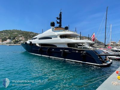
ALASKA
Yacht
Current Trip
ABBARTELLO
| Time Travelled | 2 days |
|---|---|
| Remaining Time | --- |
| Distance Travelled | 304.90 nm |
| Remaining Distance | --- |
| AVG Speed | 11.6 Knop |
| MAX Speed | 12.6 Knop |
| AVG Wind | 6.8 knots |
| MAX Wind | 13.7 knots |
| MIN Temp | 18.3°C / 64.94°F |
| MAX Temp | 20.8°C / 69.44°F |
| Djupgående | 2.6 m |
| Position mottagen | 5 h, 32 m sen |
Current Position
| Longitud | 8.76098° |
|---|---|
| Latitude | 41.68325° |
| Status | Under way using engine |
| Fart | 10.5 Knop |
| Kurs | 268.7° |
| Område | Mediterranean Sea - Western Basin |
| Station | T-AIS |
| Position mottagen | 5 h, 32 m sen |
Info
Information
The current position of ALASKA is in Mediterranean Sea - Western Basin with coordinates 41.68325° / 8.76098° as reported on 2024-05-20 11:50 by AIS to our vessel tracker app. The vessel's current speed is 10.5 Knop
The vessel ALASKA (IMO: 1008085, MMSI: 256126000) is a Yacht that was built in 2005 ( 19 År gammal ). It's sailing under the flag of [MT] Malta.
In this page you can find informations about the vessels current position, last detected port calls, and current voyage information. If the vessels is not in coverage by AIS you will find the latest position.
The current position of ALASKA is detected by our AIS receivers and we are not responsible for the reliability of the data. The last position was recorded while the vessel was in Coverage by the Ais receivers of our vessel tracking app.
The current draught of ALASKA as reported by AIS is 2.6 meters
Weather
| Temperature | 18.2°C / 64.76°F |
|---|---|
| Wind Speed | 3 knots |
| Direction | 145° SE |
| Pressure | 1009.1 hPa |
| Humidity | 93.9 % |
| Cloud Coverage | 100 % |
Featured Company
Most Visited Ports (Last year)
| Port | Arrivals | |
|---|---|---|
| 2 | ||
| 1 | ||
| 1 | ||
| 1 | ||
| 1 | ||
| 1 |
Last Trips
| Origin | Departure | Destination | Arrival | Distance |
|---|
Events
| Tid | Event | Detaljer | Position / Dest | Information |
|---|---|---|---|---|
| 2024-05-20 11:50 | UTANFÖR täckningsområde |
41.68325 / 8.76098
Mediterranean Sea - Western Basin
ABBARTELLO
|
Fart: 10.5 kn Kurs: 268.7° |
|
| 2024-05-20 11:50 | I täckningsområde |
41.68325 / 8.76098
Mediterranean Sea - Western Basin
ABBARTELLO
|
Fart: 10.5 kn Kurs: 268.7° |
|
| 2024-05-19 16:51 | UTANFÖR täckningsområde |
41.68852 / 8.85298
Mediterranean Sea - Western Basin
ABBARTELLO
|
Fart: 6.6 kn Kurs: 355.4° |
|
| 2024-05-19 16:01 | I täckningsområde |
41.57160 / 8.76544
Mediterranean Sea - Western Basin
ABBARTELLO
|
Fart: 10.4 kn Kurs: 342.4° |
|
| 2024-05-19 14:29 | UTANFÖR täckningsområde |
41.41824 / 9.05248
Mediterranean Sea - Western Basin
ABBARTELLO
|
Fart: 10.7 kn Kurs: 316.8° |
|
| 2024-05-19 13:53 | Byter havsområde | French part of the Mediterranean Sea - Western Basin French part of the Tyrrhenian Sea |
41.36009 / 9.17229
Mediterranean Sea - Western Basin
ABBARTELLO
|
Fart: 11 kn Kurs: 291.3° |
| 2024-05-19 13:53 | Destination ändrad | ABBARTELLO OLBIA |
41.35952 / 9.17425
ABBARTELLO
|
Fart: 11.1 kn Kurs: 287.1° |
| 2024-05-19 13:53 | ETA ändrat | 2024/05/20 16:00 2024/05/19 10:00 |
41.35952 / 9.17425
ABBARTELLO
|
Fart: 11.1 kn Kurs: 287.1° |
| 2024-05-19 13:50 | Byter havsområde | French part of the Tyrrhenian Sea Italian part of the Tyrrhenian Sea |
41.35833 / 9.18420
Tyrrhenian Sea
OLBIA
|
Fart: 11.1 kn Kurs: 267.6° |
| 2024-05-19 13:49 | I täckningsområde |
41.35833 / 9.18420
Tyrrhenian Sea
OLBIA
|
Fart: 11.1 kn Kurs: 267.6° |