
AIR
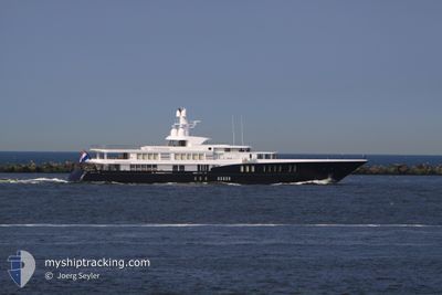
Yacht
Current Trip
| Time Travelled | 7 h, 17 mins |
|---|---|
| Remaining Time | --- |
| Distance Travelled | 1.35 nm |
| Remaining Distance | --- |
| AVG Speed | --- |
| MAX Speed | --- |
| AVG Wind | 13 knots |
| MAX Wind | 14.8 knots |
| MIN Temp | 18.6°C / 65.48°F |
| MAX Temp | 18.9°C / 66.02°F |
| Djupgående | 3.5 m |
| Position mottagen | 3 m sen |
Current Position
| Longitud | -5.37410° |
|---|---|
| Latitude | 36.14664° |
| Status | At anchor |
| Fart | 0.1 Knop |
| Kurs | 111° |
| Område | Strait of Gibraltar |
| Station | T-AIS |
| Position mottagen | 3 m sen |
Info
Information
The current position of AIR is in Strait of Gibraltar with coordinates 36.14664° / -5.37410° as reported on 2024-06-01 23:02 by AIS to our vessel tracker app. The vessel's current speed is 0.1 Knop
The vessel AIR (IMO: 1011472, MMSI: 248879000) is a Yacht that was built in 2011 ( 13 År gammal ). It's sailing under the flag of [MT] Malta.
In this page you can find informations about the vessels current position, last detected port calls, and current voyage information. If the vessels is not in coverage by AIS you will find the latest position.
The current position of AIR is detected by our AIS receivers and we are not responsible for the reliability of the data. The last position was recorded while the vessel was in Coverage by the Ais receivers of our vessel tracking app.
The current draught of AIR as reported by AIS is 3.5 meters
Weather
| Temperature | 18.7°C / 65.66°F |
|---|---|
| Wind Speed | 15 knots |
| Direction | 74° ENE |
| Pressure | 1016.4 hPa |
| Humidity | 89 % |
| Cloud Coverage | 2 % |
Featured Company
Last Port Calls
| Port | Arrival | Departure | Time In Port |
|---|---|---|---|
| 2024-06-01 15:40 | 2024-06-01 15:49 | 8 m | |
| 2024-05-25 06:39 | 2024-05-30 07:40 | 5 d | |
| 2024-05-14 07:37 | |||
| 2024-04-27 04:40 | 2024-04-27 09:35 | 4 h | |
| 2024-04-22 05:46 | 2024-04-25 11:29 | 3 d | |
| 2024-04-15 08:57 | 2024-04-15 12:04 | 3 h |
Last Trips
| Origin | Departure | Destination | Arrival | Distance | |
|---|---|---|---|---|---|
| 2024-05-30 09:40 | 2024-06-01 17:40 | 693.56 nm | |||
| 2024-05-14 09:37 | 2024-05-25 08:39 | 194.86 nm | |||
| 2024-04-25 14:29 | 2024-04-27 07:40 | 174.76 nm | |||
| 2024-04-15 14:04 | 2024-04-22 08:46 | 336.85 nm |
Events
| Tid | Event | Detaljer | Position / Dest | Information |
|---|---|---|---|---|
| 2024-06-01 16:44 | Status ändrad | At anchor Under way using engine |
36.14771 / -5.37398
GIBRALTAR
|
Fart: 0.2 kn Kurs: 111° |
| 2024-06-01 15:49 | AVGÅTT HAMN |
|
36.14659 / -5.37202
GIBRALTAR
|
Fart: 1.3 kn Kurs: 100° |
| 2024-06-01 15:45 | STOPPAR förflyttning |
36.14570 / -5.36973
[GI] GIBRALTAR
|
Fart: 0.3 kn Kurs: 133° |
|
| 2024-06-01 15:40 | ANLÄNDER HAMN |
|
36.14624 / -5.37012
[GI] GIBRALTAR
|
Fart: 1.2 kn Kurs: 81° |
| 2024-06-01 15:11 | Byter havsområde | Gibraltarian part of the Strait of Gibraltar Gibraltarian part of the Alboran Sea |
36.08295 / -5.33607
Strait of Gibraltar
GIBRALTAR
|
Fart: 12.9 kn Kurs: 289.9° |
| 2024-06-01 13:49 | Byter havsområde | Gibraltarian part of the Alboran Sea Spanish part of the Alboran Sea |
36.09821 / -4.97980
Alboran Sea
GIBRALTAR
|
Fart: 12.7 kn Kurs: 251.6° |
| 2024-06-01 12:43 | Byter havsområde | Spanish part of the Alboran Sea Spanish part of the Mediterranean Sea - Western Basin |
36.13919 / -4.69867
Alboran Sea
GIBRALTAR
|
Fart: 12 kn Kurs: 249.1° |
| 2024-06-01 12:41 | Djupgående ändrat | 3.5 3 |
36.14348 / -4.68734
GIBRALTAR
|
Fart: 12.1 kn Kurs: 245.1° |
| 2024-06-01 12:41 | ETA ändrat | 2024/06/01 16:00 |
36.14348 / -4.68734
GIBRALTAR
|
Fart: 12.1 kn Kurs: 245.1° |
| 2024-06-01 12:40 | I täckningsområde |
36.13919 / -4.69867
Alboran Sea
GIBRALTAR
|
Fart: 12 kn Kurs: 249.1° |