
ADA
Ro-Ro/Passenger Ship
Current Trip
HONO
| Time Travelled | 24 mins |
|---|---|
| Remaining Time | --- |
| Distance Travelled | 1.15 nm |
| Remaining Distance | --- |
| AVG Speed | --- |
| MAX Speed | --- |
| AVG Wind | 1 knots |
| MAX Wind | 1 knots |
| MIN Temp | --- |
| MAX Temp | --- |
| Djupgående | 4 m |
| Position mottagen | 2 m sen |
Current Position
| Longitud | --- |
|---|---|
| Latitude | --- |
| Status | Default |
| Fart | 8 Knop |
| Kurs | 239.3° |
| Område | Kattegat |
| Station | T-AIS |
| Position mottagen | 2 m sen |
Info
Information
The current position of ADA is in Kattegat with coordinates 57.70451° / 11.69036° as reported on 2025-12-24 03:14 by AIS to our vessel tracker app. The vessel's current speed is 8 Knop
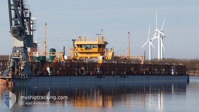
The vessel ADA (IMO: 7932018, MMSI: 265522210) is a Ro-Ro/Passenger Ship that was built in 1980 ( 45 År gammal ). It's sailing under the flag of [SE] Sweden.
In this page you can find informations about the vessels current position, last detected port calls, and current voyage information. If the vessels is not in coverage by AIS you will find the latest position.
The current position of ADA is detected by our AIS receivers and we are not responsible for the reliability of the data. The last position was recorded while the vessel was in Coverage by the Ais receivers of our vessel tracking app.
The current draught of ADA as reported by AIS is 4 meters
Weather
| Temperature | --- |
|---|---|
| Wind Speed | 1 knots |
| Direction | 62° ENE |
| Pressure | 1038.9 hPa |
| Humidity | 74 % |
| Cloud Coverage | 26 % |
Featured Company
Last Port Calls
| Port | Arrival | Departure | Time In Port |
|---|---|---|---|
| 2025-12-24 03:21 | 2025-12-24 03:52 | 31 m | |
| 2025-12-24 02:20 | 2025-12-24 02:49 | 28 m | |
| 2025-12-24 01:21 | 2025-12-24 01:52 | 30 m | |
| 2025-12-24 00:50 | 2025-12-24 00:57 | 6 m | |
| 2025-12-24 00:20 | 2025-12-24 00:27 | 6 m | |
| 2025-12-23 23:51 | 2025-12-23 23:57 | 5 m | |
| 2025-12-23 23:20 | 2025-12-23 23:27 | 6 m | |
| 2025-12-23 22:31 | 2025-12-23 22:52 | 21 m | |
| 2025-12-23 21:51 | 2025-12-23 22:02 | 11 m | |
| 2025-12-23 21:11 | 2025-12-23 21:23 | 11 m |
Most Visited Ports (Last year)
| Port | Arrivals | |
|---|---|---|
| 8410 | ||
| 1 |
Last Trips
| Origin | Departure | Destination | Arrival | Distance | |
|---|---|---|---|---|---|
| 2025-12-24 02:49 | 2025-12-24 03:21 | 2.40 nm | |||
| 2025-12-24 01:52 | 2025-12-24 02:20 | 2.42 nm | |||
| 2025-12-24 00:57 | 2025-12-24 01:21 | 2.23 nm | |||
| 2025-12-24 00:27 | 2025-12-24 00:50 | 2.35 nm | |||
| 2025-12-23 23:57 | 2025-12-24 00:20 | 2.39 nm | |||
| 2025-12-23 23:27 | 2025-12-23 23:51 | 1.87 nm | |||
| 2025-12-23 22:52 | 2025-12-23 23:20 | 1.94 nm | |||
| 2025-12-23 22:02 | 2025-12-23 22:31 | 2.08 nm | |||
| 2025-12-23 21:23 | 2025-12-23 21:51 | 1.99 nm | |||
| 2025-12-23 20:42 | 2025-12-23 21:11 | 2.40 nm |
Events
| Tid | Event | Detaljer | Position / Dest | Information |
|---|---|---|---|---|
| 2025-12-24 03:12 | STARTAR förflyttning | 0.6 nm, South East of KALVSUND |
57.70716 / 11.69915
HONO
|
Fart: 6.9 kn Kurs: 243.4° |
| 2025-12-24 03:02 | STOPPAR förflyttning | 0.68 nm, East of KALVSUND |
57.70815 / 11.70251
HONO
|
Fart: 0.3 kn Kurs: 48° |
| 2025-12-24 02:52 | AVGÅTT HAMN |
|
57.69963 / 11.67203
HONO
|
Fart: 7.8 kn Kurs: 62° |
| 2025-12-24 02:52 | STARTAR förflyttning |
57.69932 / 11.67106
[SE] HEDEN (HONO)
|
Fart: 7.6 kn Kurs: 63° |
|
| 2025-12-24 02:23 | STOPPAR förflyttning |
57.69864 / 11.66761
[SE] HEDEN (HONO)
|
Fart: 0.1 kn Kurs: 257° |
|
| 2025-12-24 02:21 | ANLÄNDER HAMN |
|
57.69889 / 11.66917
[SE] HEDEN (HONO)
|
Fart: 4.2 kn Kurs: 254° |
| 2025-12-24 02:12 | STARTAR förflyttning | 0.61 nm, South East of KALVSUND |
57.70723 / 11.69954
HONO
|
Fart: 6.4 kn Kurs: 244.2° |
| 2025-12-24 01:58 | STOPPAR förflyttning | 0.68 nm, East of KALVSUND |
57.70815 / 11.70250
HONO
|
Fart: 0.1 kn Kurs: 46° |
| 2025-12-24 01:49 | AVGÅTT HAMN |
|
57.69957 / 11.67194
HONO
|
Fart: 10.1 kn Kurs: 66° |
| 2025-12-24 01:49 | STARTAR förflyttning |
57.69932 / 11.67106
[SE] HEDEN (HONO)
|
Fart: 9.8 kn Kurs: 67° |