
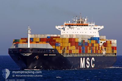
MSC VANESSA
Container Ship
Current Trip
| Time Travelled | 8 days |
|---|---|
| Remaining Time | --- |
| Distance Travelled | 3005.00 nm |
| Remaining Distance | --- |
| AVG Speed | 15.8 Knop |
| MAX Speed | 18 Knop |
| AVG Wind | 15.8 knots |
| MAX Wind | 27 knots |
| MIN Temp | 25.5°C / 77.9°F |
| MAX Temp | 28°C / 82.4°F |
| Djupgående | 13.8 m |
| Position mottagen | 5 d sen |
Current Position
| Longitud | --- |
|---|---|
| Latitude | --- |
| Status | Under way using engine |
| Fart | 17.8 Knop |
| Kurs | 90.9° |
| Område | Caribbean Sea |
| Station | T-AIS |
| Position mottagen | 5 d sen |
Info
Information
The current position of MSC VANESSA is in Caribbean Sea with coordinates 11.63260° / -61.60986° as reported on 2026-01-10 18:28 by AIS to our vessel tracker app. The vessel's current speed is 17.8 Knop and is heading at the port of ABU DHABI.
The vessel MSC VANESSA (IMO: 9251688, MMSI: 356946000) is a Container Ship that was built in 2003 ( 23 År gammal ). It's sailing under the flag of [PA] Panama.
In this page you can find informations about the vessels current position, last detected port calls, and current voyage information. If the vessels is not in coverage by AIS you will find the latest position.
The current position of MSC VANESSA is detected by our AIS receivers and we are not responsible for the reliability of the data. The last position was recorded while the vessel was in Coverage by the Ais receivers of our vessel tracking app.
The current draught of MSC VANESSA as reported by AIS is 13.8 meters
Weather
| Temperature | 26.8°C / 80.24°F |
|---|---|
| Wind Speed | 14 knots |
| Direction | 121° ESE |
| Pressure | 1010.5 hPa |
| Humidity | 79.8 % |
| Cloud Coverage | 70 % |
Featured Company
Last Port Calls
| Port | Arrival | Departure | Time In Port |
|---|---|---|---|
| 2026-01-06 07:15 | 2026-01-07 15:31 | 1 d | |
| 2025-12-30 03:38 | 2026-01-02 02:20 | 2 d | |
| 2025-12-21 17:10 | 2025-12-22 10:21 | 17 h | |
| 2025-12-16 15:14 | 2025-12-17 12:48 | 21 h | |
| 2025-12-15 09:56 | 2025-12-15 23:09 | 13 h | |
| 2025-12-12 07:21 | 2025-12-13 13:45 | 1 d | |
| 2025-12-06 13:40 | 2025-12-08 21:30 | 2 d | |
| 2025-11-06 22:50 |
Most Visited Ports (Last year)
| Port | Arrivals | |
|---|---|---|
| 6 | ||
| 3 | ||
| 3 | ||
| 3 | ||
| 3 | ||
| 3 |
Last Trips
| Origin | Departure | Destination | Arrival | Distance | |
|---|---|---|---|---|---|
| 2026-01-02 02:20 | 2026-01-06 07:15 | 1597.41 nm | |||
| 2025-12-22 10:21 | 2025-12-30 03:38 | 594.68 nm | |||
| 2025-12-17 12:48 | 2025-12-21 17:10 | 1150.83 nm | |||
| 2025-12-15 23:09 | 2025-12-16 15:14 | 122.07 nm | |||
| 2025-12-13 13:45 | 2025-12-15 09:56 | 642.62 nm | |||
| 2025-12-08 21:30 | 2025-12-12 07:21 | 961.01 nm | |||
| 2025-11-06 22:50 | 2025-12-06 13:40 | 11452.51 nm |
Events
| Tid | Event | Detaljer | Position / Dest | Information |
|---|---|---|---|---|
| 2026-01-11 09:32 | STARTAR förflyttning |
10.82236 / -58.86866
ABU DHABI
|
Fart: 3.9 kn Kurs: 116° |
|
| 2026-01-11 05:44 | STOPPAR förflyttning |
10.82200 / -58.81240
ABU DHABI
|
Fart: 0.1 kn Kurs: 67° |
|
| 2026-01-10 18:42 | Status ändrad | Default Under way using engine |
11.63057 / -61.54167
ABU DHABI
|
Fart: 17.8 kn Kurs: 90.9° |
| 2026-01-10 18:28 | UTANFÖR täckningsområde |
11.63260 / -61.60986
Caribbean Sea
|
Fart: 17.8 kn Kurs: 90.9° |
|
| 2026-01-10 17:56 | Status ändrad | Under way using engine Default |
11.63427 / -61.77094
ABU DHABI
|
Fart: 17.1 kn Kurs: 90° |
| 2026-01-10 17:51 | Status ändrad | Default Under way using engine |
11.63404 / -61.79526
ABU DHABI
|
Fart: 16 kn Kurs: 90° |
| 2026-01-10 17:26 | Byter havsområde | Grenadian part of the Caribbean Sea Colombian part of the Caribbean Sea |
11.63636 / -61.91239
Caribbean Sea
|
Fart: 16.3 kn Kurs: 93° |
| 2026-01-10 17:25 | Status ändrad | Under way using engine Default |
11.63647 / -61.91470
ABU DHABI
|
Fart: 16.3 kn Kurs: 91° |
| 2026-01-10 17:25 | I täckningsområde |
11.63636 / -61.91239
Caribbean Sea
|
Fart: 16.3 kn Kurs: 93° |
|
| 2026-01-08 10:13 | UTANFÖR täckningsområde |
10.96848 / -76.68475
Caribbean Sea
|
Fart: 15.4 kn Kurs: 68° |