
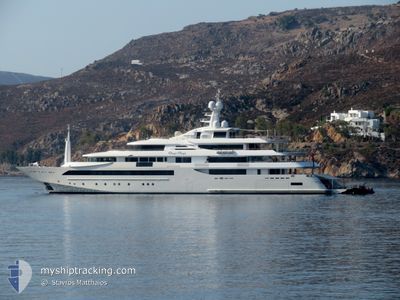
CHOPI CHOPI
Yacht
Current Trip
| Time Travelled | 7 days |
|---|---|
| Remaining Time | --- |
| Distance Travelled | 323.76 nm |
| Remaining Distance | --- |
| AVG Speed | 8.2 Knop |
| MAX Speed | 15.2 Knop |
| AVG Wind | 8 knots |
| MAX Wind | 27 knots |
| MIN Temp | 10.2°C / 50.36°F |
| MAX Temp | 21°C / 69.8°F |
| Djupgående | 3.4 m |
| Position mottagen | 3 m sen |
Current Position
| Longitud | 7.13813° |
|---|---|
| Latitude | 43.58723° |
| Status | At anchor |
| Fart | |
| Kurs | 18° |
| Område | Mediterranean Sea - Western Basin |
| Station | T-AIS |
| Position mottagen | 3 m sen |
Info
Information
The current position of CHOPI CHOPI is in Mediterranean Sea - Western Basin with coordinates 43.58723° / 7.13813° as reported on 2024-05-13 19:54 by AIS to our vessel tracker app. The vessel's current speed is 0 Knop
The vessel CHOPI CHOPI (IMO: 1011343, MMSI: 319318000) is a Yacht that was built in 2013 ( 11 År gammal ). It's sailing under the flag of [KY] Cayman Is.
In this page you can find informations about the vessels current position, last detected port calls, and current voyage information. If the vessels is not in coverage by AIS you will find the latest position.
The current position of CHOPI CHOPI is detected by our AIS receivers and we are not responsible for the reliability of the data. The last position was recorded while the vessel was in Coverage by the Ais receivers of our vessel tracking app.
The current draught of CHOPI CHOPI as reported by AIS is 3.4 meters
Weather
| Temperature | 18.8°C / 65.84°F |
|---|---|
| Wind Speed | 4 knots |
| Direction | 59° ENE |
| Pressure | 1012.2 hPa |
| Humidity | 72.1 % |
| Cloud Coverage | 14 % |
Featured Company
Most Visited Ports (Last year)
| Port | Arrivals | |
|---|---|---|
| 3 | ||
| 2 | ||
| 1 | ||
| 1 | ||
| 1 | ||
| 1 |
Last Trips
| Origin | Departure | Destination | Arrival | Distance |
|---|
Events
| Tid | Event | Detaljer | Position / Dest | Information |
|---|---|---|---|---|
| 2024-05-13 17:15 | STOPPAR förflyttning | 0.44 nm, East of ANTIBES |
43.58763 / 7.13761
ANTIBES
|
Fart: 0.3 kn Kurs: 74° |
| 2024-05-13 17:10 | Status ändrad | At anchor Under way using engine |
43.58794 / 7.13819
ANTIBES
|
Fart: 0.7 kn Kurs: 102° |
| 2024-05-13 15:26 | STARTAR förflyttning | 0.57 nm, East of ANTIBES |
43.58673 / 7.14066
ANTIBES
|
Fart: 5.3 kn Kurs: 88.9° |
| 2024-05-13 15:25 | ETA ändrat | 2024/06/13 17:30 2024/06/11 09:30 |
43.58674 / 7.13918
ANTIBES
|
Fart: 3.7 kn Kurs: 89° |
| 2024-05-13 15:25 | Status ändrad | Under way using engine At anchor |
43.58675 / 7.13896
ANTIBES
|
Fart: 0.2 kn Kurs: 91° |
| 2024-05-12 08:40 | STOPPAR förflyttning | 0.46 nm, East of ANTIBES |
43.58668 / 7.13816
ANTIBES
|
Fart: 0.3 kn Kurs: 65° |
| 2024-05-12 08:39 | Status ändrad | At anchor Under way using engine |
43.58669 / 7.13818
ANTIBES
|
Fart: 0.4 kn Kurs: 65° |
| 2024-05-12 06:02 | Destination ändrad | ANTIBES ST TROPEZ |
43.26559 / 6.97842
ANTIBES
|
Fart: 9.4 kn Kurs: 100.1° |
| 2024-05-12 06:02 | ETA ändrat | 2024/06/11 09:30 2024/05/11 16:00 |
43.26559 / 6.97842
ANTIBES
|
Fart: 9.4 kn Kurs: 100.1° |
| 2024-05-12 04:25 | STARTAR förflyttning | 0.49 nm, North West of SAINT TROPEZ |
43.27796 / 6.62646
ST TROPEZ
|
Fart: 5.6 kn Kurs: 350.8° |