
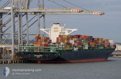
ZIM WILMINGTON
Cargo A
Current Trip
PAPAN
| Time Travelled | 2 days |
|---|---|
| Remaining Time | --- |
| Distance Travelled | 1359.08 морская миля |
| Remaining Distance | --- |
| AVG Speed | 18.4 Узлы |
| MAX Speed | 22 Узлы |
| AVG Wind | 14.8 knots |
| MAX Wind | 22.8 knots |
| MIN Temp | 7.1°C / 44.78°F |
| MAX Temp | 16.3°C / 61.34°F |
| Осадка | 13.6 м |
| Позиция Получена | 1 d тому назад |
Current Position
| Долгота | 141.67394° |
|---|---|
| Широта | 41.63920° |
| Статус | Under way using engine |
| Скорость | 20.7 Узлы |
| Курс | 88.3° |
| Район | North Pacific Ocean |
| Станция | T-AIS |
| Позиция Получена | 1 d тому назад |
Info
Information
The current position of ZIM WILMINGTON is in North Pacific Ocean with coordinates 41.63920° / 141.67394° as reported on 2024-05-02 05:30 by AIS to our vessel tracker app. The vessel's current speed is 20.7 Узлы
The vessel ZIM WILMINGTON (IMO: 9699115, MMSI: 538007097) is a Cargo A It's sailing under the flag of [MH] Marshall Is.
In this page you can find informations about the vessels current position, last detected port calls, and current voyage information. If the vessels is not in coverage by AIS you will find the latest position.
The current position of ZIM WILMINGTON is detected by our AIS receivers and we are not responsible for the reliability of the data. The last position was recorded while the vessel was in Coverage by the Ais receivers of our vessel tracking app.
The current draught of ZIM WILMINGTON as reported by AIS is 13.6 meters
Weather
| Temperature | 9.8°C / 49.64°F |
|---|---|
| Wind Speed | 17 knots |
| Direction | 210° SSW |
| Pressure | 1014.8 hPa |
| Humidity | 85.1 % |
| Cloud Coverage | 56 % |
Featured Company
Last Trips
| Origin | Departure | Destination | Arrival | Distance | |
|---|---|---|---|---|---|
| 2024-03-24 16:18 | 2024-04-24 16:17 | 9628.84 морская миля | |||
| 2024-03-11 22:19 | 2024-03-23 14:31 | 1385.94 морская миля | |||
| 2024-03-07 12:08 | 2024-03-10 03:43 | 417.95 морская миля | |||
| 2024-03-03 13:04 | 2024-03-06 07:02 | 472.46 морская миля |
Events
| Время | Событие | Детали | Позиция / Направление | Информация |
|---|---|---|---|---|
| 2024-05-02 05:37 | Статус изменился | Default Under way using engine |
41.63967 / 141.72203
PAPAN
|
Скорость: 20.7 kn Курс: 88.3° |
| 2024-05-02 05:30 | Вне покрытия |
41.63920 / 141.67394
North Pacific Ocean
PAPAN
|
Скорость: 20.7 kn Курс: 88.3° |
|
| 2024-05-02 05:30 | Статус изменился | Under way using engine Default |
41.63907 / 141.66703
PAPAN
|
Скорость: 20.6 kn Курс: 90° |
| 2024-05-02 05:24 | Статус изменился | Default Under way using engine |
41.63939 / 141.62795
PAPAN
|
Скорость: 21 kn Курс: 95.9° |
| 2024-05-02 05:07 | Статус изменился | Under way using engine Default |
41.64497 / 141.49617
PAPAN
|
Скорость: 20.9 kn Курс: 84° |
| 2024-05-02 05:04 | Статус изменился | Default Under way using engine |
41.64409 / 141.47281
PAPAN
|
Скорость: 21 kn Курс: 86.1° |
| 2024-05-02 04:41 | Изменение морского района | Japanese part of the North Pacific Ocean Japanese part of the Japan Sea |
41.63091 / 141.29178
North Pacific Ocean
PAPAN
|
Скорость: 20.4 kn Курс: 82.8° |
| 2024-05-02 04:07 | Статус изменился | Under way using engine Default |
41.61581 / 141.04447
PAPAN
|
Скорость: 20 kn Курс: 91° |
| 2024-05-02 04:05 | Статус изменился | Default Under way using engine |
41.61596 / 141.02716
PAPAN
|
Скорость: 20.4 kn Курс: 94.1° |
| 2024-05-02 03:54 | Статус изменился | Under way using engine Default |
41.61901 / 140.94982
PAPAN
|
Скорость: 20.4 kn Курс: 95° |