
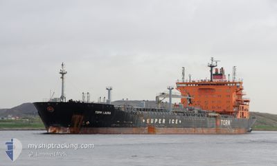
TORM LAURA
Oil/Chemical Tanker
Current Trip
| Time Travelled | 3 days |
|---|---|
| Remaining Time | 10 h, 50 mins |
| Distance Travelled | 434.36 морская миля |
| Remaining Distance | 43.75 морская миля |
| AVG Speed | 7 Узлы |
| MAX Speed | 14.3 Узлы |
| AVG Wind | 19.5 knots |
| MAX Wind | 35 knots |
| MIN Temp | 1.6°C / 34.88°F |
| MAX Temp | 5.8°C / 42.44°F |
| Осадка | 8.2 м |
| Позиция Получена | Сейчас |
Current Position
| Долгота | --- |
|---|---|
| Широта | --- |
| Статус | Under way sailing |
| Скорость | 4 Узлы |
| Курс | 322° |
| Район | North Sea |
| Станция | T-AIS |
| Позиция Получена | Сейчас |
Info
Information
The current position of TORM LAURA is in North Sea with coordinates 53.98374° / 0.41691° as reported on 2026-01-06 01:17 by AIS to our vessel tracker app. The vessel's current speed is 4 Узлы and is heading at the port of IMMINGHAM. The estimated time of arrival as calculated by MyShipTracking vessel tracking app is 2026-01-06 12:08 LT
The vessel TORM LAURA (IMO: 9375616, MMSI: 220603000) is a Oil/Chemical Tanker that was built in 2008 ( 18 лет ). It's sailing under the flag of [DK] Denmark.
In this page you can find informations about the vessels current position, last detected port calls, and current voyage information. If the vessels is not in coverage by AIS you will find the latest position.
The current position of TORM LAURA is detected by our AIS receivers and we are not responsible for the reliability of the data. The last position was recorded while the vessel was in Coverage by the Ais receivers of our vessel tracking app.
The current draught of TORM LAURA as reported by AIS is 8.2 meters
Weather
| Temperature | 4°C / 39.2°F |
|---|---|
| Wind Speed | 18 knots |
| Direction | 307° NW |
| Pressure | 1014.9 hPa |
| Humidity | 71.5 % |
| Cloud Coverage | 53 % |
Featured Company
Last Port Calls
| Port | Arrival | Departure | Time In Port |
|---|---|---|---|
| 2025-12-29 20:14 | 2026-01-02 19:25 | 3 d | |
| 2025-12-22 17:29 | 2025-12-26 00:30 | 3 d | |
| 2025-12-15 07:48 | 2025-12-18 18:20 | 3 d | |
| 2025-11-05 00:10 | 2025-11-06 03:52 | 1 d |
Most Visited Ports (Last year)
| Port | Arrivals | |
|---|---|---|
| 2 | ||
| 2 | ||
| 2 | ||
| 2 | ||
| 2 | ||
| 2 |
Last Trips
| Origin | Departure | Destination | Arrival | Distance | |
|---|---|---|---|---|---|
| 2025-12-26 00:30 | 2025-12-29 20:14 | 796.82 морская миля | |||
| 2025-12-18 18:20 | 2025-12-22 17:29 | 739.10 морская миля | |||
| 2025-11-06 03:52 | 2025-12-15 07:48 | 11547.92 морская миля | |||
| 2025-10-29 14:40 | 2025-11-05 00:10 | 481.08 морская миля |
Events
| Время | Событие | Детали | Позиция / Направление | Информация |
|---|---|---|---|---|
| 2026-01-05 22:54 | Статус изменился | Under way sailing Default |
53.85415 / .58103
GBIMM
|
Скорость: 4 kn Курс: 325° |
| 2026-01-05 22:49 | Статус изменился | Default Under way sailing |
53.84889 / .58645
GBIMM
|
Скорость: 4.2 kn Курс: 326° |
| 2026-01-05 22:34 | Статус изменился | Under way sailing Default |
53.83333 / .60094
GBIMM
|
Скорость: 5.2 kn Курс: 327° |
| 2026-01-05 22:28 | Статус изменился | Default Under way sailing |
53.82565 / .60832
GBIMM
|
Скорость: 5 kn Курс: 327.6° |
| 2026-01-05 22:16 | Статус изменился | Under way sailing Default |
53.81004 / .62384
GBIMM
|
Скорость: 5.2 kn Курс: 334° |
| 2026-01-05 22:00 | Статус изменился | Default Under way sailing |
53.79155 / .64126
GBIMM
|
Скорость: 4.7 kn Курс: 325° |
| 2026-01-05 21:50 | Статус изменился | Under way sailing Default |
53.77965 / .65261
GBIMM
|
Скорость: 4.7 kn Курс: 322° |
| 2026-01-05 21:50 | В покрытии |
53.77965 / .65261
North Sea
|
Скорость: 4.7 kn Курс: 326.6° |
|
| 2026-01-05 17:36 | Статус изменился | Default Under way sailing |
53.93956 / .72745
GBIMM
|
Скорость: 6 kn Курс: 140.4° |
| 2026-01-05 17:31 | Вне покрытия |
53.94601 / .71902
North Sea
|
Скорость: 6 kn Курс: 140.4° |