
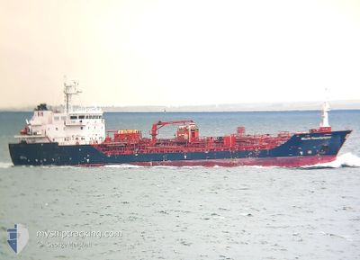
STOLT SANDPIPER
Oil/Chemical Tanker
Current Trip
| Time Travelled | 3 days |
|---|---|
| Remaining Time | --- |
| Distance Travelled | 207.39 морская миля |
| Remaining Distance | --- |
| AVG Speed | 11.7 Узлы |
| MAX Speed | 14.1 Узлы |
| AVG Wind | 18.5 knots |
| MAX Wind | 31 knots |
| MIN Temp | 8.6°C / 47.48°F |
| MAX Temp | 12.8°C / 55.04°F |
| Осадка | 6.4 м |
| Позиция Получена | 3 d тому назад |
Current Position
| Долгота | --- |
|---|---|
| Широта | --- |
| Статус | Under way using engine |
| Скорость | 13.7 Узлы |
| Курс | 315.2° |
| Район | North Sea |
| Станция | T-AIS |
| Позиция Получена | 3 d тому назад |
Info
Information
The current position of STOLT SANDPIPER is in North Sea with coordinates 53.20784° / 1.32716° as reported on 2025-12-07 15:40 by AIS to our vessel tracker app. The vessel's current speed is 13.7 Узлы
The vessel STOLT SANDPIPER (IMO: 9566758, MMSI: 235089284) is a Oil/Chemical Tanker that was built in 2011 ( 14 лет ). It's sailing under the flag of [GB] United Kingdom.
In this page you can find informations about the vessels current position, last detected port calls, and current voyage information. If the vessels is not in coverage by AIS you will find the latest position.
The current position of STOLT SANDPIPER is detected by our AIS receivers and we are not responsible for the reliability of the data. The last position was recorded while the vessel was in Coverage by the Ais receivers of our vessel tracking app.
The current draught of STOLT SANDPIPER as reported by AIS is 6.4 meters
Weather
| Temperature | 9.3°C / 48.74°F |
|---|---|
| Wind Speed | 20 knots |
| Direction | 228° SW |
| Pressure | 1017.5 hPa |
| Humidity | 82.8 % |
| Cloud Coverage | 100 % |
Featured Company
Last Port Calls
| Port | Arrival | Departure | Time In Port |
|---|---|---|---|
| 2025-12-07 03:18 | 2025-12-07 03:42 | 24 m | |
| 2025-12-05 22:47 | 2025-12-07 01:50 | 1 d | |
| 2025-12-05 20:37 | 2025-12-05 21:41 | 1 h | |
| 2025-11-30 06:52 | 2025-12-01 01:37 | 18 h | |
| 2025-11-28 03:14 | 2025-11-29 03:53 | 1 d | |
| 2025-11-20 10:48 | 2025-11-23 05:03 | 2 d | |
| 2025-11-19 01:26 | 2025-11-19 14:13 | 12 h | |
| 2025-11-13 20:56 | 2025-11-14 17:19 | 20 h | |
| 2025-11-12 18:43 | 2025-11-13 14:06 | 19 h | |
| 2025-11-06 15:19 | 2025-11-10 09:19 | 3 d |
Last Trips
| Origin | Departure | Destination | Arrival | Distance | |
|---|---|---|---|---|---|
| 2025-12-07 01:50 | 2025-12-07 03:18 | 10.15 морская миля | |||
| 2025-12-05 21:41 | 2025-12-05 22:47 | 8.19 морская миля | |||
| 2025-12-01 01:37 | 2025-12-05 20:37 | 366.20 морская миля | |||
| 2025-11-29 03:53 | 2025-11-30 06:52 | 311.26 морская миля | |||
| 2025-11-23 05:03 | 2025-11-28 03:14 | 1058.73 морская миля | |||
| 2025-11-19 14:13 | 2025-11-20 10:48 | 209.80 морская миля | |||
| 2025-11-14 17:19 | 2025-11-19 01:26 | 1150.57 морская миля | |||
| 2025-11-13 14:06 | 2025-11-13 20:56 | 84.64 морская миля | |||
| 2025-11-10 09:19 | 2025-11-12 18:43 | 111.40 морская миля | |||
| 2025-11-05 01:21 | 2025-11-06 15:19 | 238.95 морская миля |
Events
| Время | Событие | Детали | Позиция / Направление | Информация |
|---|---|---|---|---|
| 2025-12-07 20:13 | Окончание движения | 17.11 nm, East of GRIMSBY |
53.59220 / .40982
GBIMM
|
Скорость: 0.2 kn Курс: 251° |
| 2025-12-07 15:45 | Статус изменился | Default Under way using engine |
53.22233 / 1.30566
GBIMM
|
Скорость: 13.7 kn Курс: 315.2° |
| 2025-12-07 15:40 | Вне покрытия |
53.20784 / 1.32716
North Sea
GBIMM
|
Скорость: 13.7 kn Курс: 315.2° |
|
| 2025-12-07 13:16 | Изменение морского района | United Kingdom part of the North Sea Dutch part of the North Sea |
52.90852 / 2.06996
North Sea
GBIMM
|
Скорость: 12.5 kn Курс: 303.2° |
| 2025-12-07 13:16 | Статус изменился | Under way using engine Default |
52.90852 / 2.06996
GBIMM
|
Скорость: 12.6 kn Курс: 316° |
| 2025-12-07 13:09 | В покрытии |
52.90852 / 2.06996
North Sea
GBIMM
|
Скорость: 12.5 kn Курс: 303.2° |
|
| 2025-12-07 06:37 | Статус изменился | Default Under way using engine |
51.91435 / 3.10312
GBIMM
|
Скорость: 12 kn Курс: 341.9° |
| 2025-12-07 06:29 | Вне покрытия |
51.88817 / 3.11798
North Sea
GBIMM
|
Скорость: 12 kn Курс: 341.9° |
|
| 2025-12-07 05:38 | ETA изменился | 2025/12/07 20:00 2025/12/07 21:00 |
51.74200 / 3.25133
GBIMM
|
Скорость: 12 kn Курс: 322.8° |
| 2025-12-07 02:42 | ПОРТ ОТПРАВЛЕНИЯ |
|
51.34173 / 3.81183
GBIMM
|
Скорость: 11.4 kn Курс: 347° |