
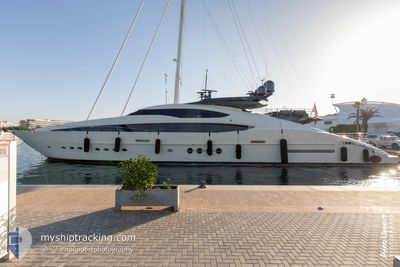
STEALTH
Yacht
Current Trip
GEORGE TOWN
| Time Travelled | 5 days |
|---|---|
| Remaining Time | --- |
| Distance Travelled | 303.26 морская миля |
| Remaining Distance | --- |
| AVG Speed | 10.4 Узлы |
| MAX Speed | 15.1 Узлы |
| AVG Wind | 9.5 knots |
| MAX Wind | 14.9 knots |
| MIN Temp | 25.8°C / 78.44°F |
| MAX Temp | 28.4°C / 83.12°F |
| Осадка | 2.7 м |
| Позиция Получена | 7 h, 19 m тому назад |
Current Position
| Долгота | -75.69848° |
|---|---|
| Широта | 23.49029° |
| Статус | At anchor |
| Скорость | 10.6 Узлы |
| Курс | 89.9° |
| Район | North Atlantic Ocean |
| Станция | T-AIS |
| Позиция Получена | 7 h, 19 m тому назад |
Info
Information
The current position of STEALTH is in North Atlantic Ocean with coordinates 23.49029° / -75.69848° as reported on 2024-06-11 16:27 by AIS to our vessel tracker app. The vessel's current speed is 10.6 Узлы
The vessel STEALTH (IMO: 1011288, MMSI: 319214000) is a Yacht that was built in 2010 ( 14 лет ). It's sailing under the flag of [KY] Cayman Is.
In this page you can find informations about the vessels current position, last detected port calls, and current voyage information. If the vessels is not in coverage by AIS you will find the latest position.
The current position of STEALTH is detected by our AIS receivers and we are not responsible for the reliability of the data. The last position was recorded while the vessel was in Coverage by the Ais receivers of our vessel tracking app.
The current draught of STEALTH as reported by AIS is 2.7 meters
Weather
| Temperature | 28.1°C / 82.58°F |
|---|---|
| Wind Speed | 12 knots |
| Direction | 152° SSE |
| Pressure | 1015.5 hPa |
| Humidity | 82.1 % |
| Cloud Coverage | 100 % |
Featured Company
Last Port Calls
| Port | Arrival | Departure | Time In Port |
|---|---|---|---|
| 2024-06-06 06:36 | 2024-06-06 06:46 | 10 m | |
| 2024-05-31 18:11 | 2024-06-06 06:34 | 5 d | |
| 2024-04-08 20:12 | 2024-05-31 18:07 | ||
| 2024-04-08 19:53 | 2024-04-08 20:00 | 7 m |
Most Visited Ports (Last year)
| Port | Arrivals | |
|---|---|---|
| 6 | ||
| 6 | ||
| 4 | ||
| 2 | ||
| 2 | ||
| 2 |
Last Trips
| Origin | Departure | Destination | Arrival | Distance | |
|---|---|---|---|---|---|
| 2024-06-06 06:34 | 2024-06-06 06:36 | 0.15 морская миля | |||
| 2024-05-31 18:07 | 2024-05-31 18:11 | 0.23 морская миля | |||
| 2024-04-08 20:00 | 2024-04-08 20:12 | 1.19 морская миля | |||
| 2024-03-16 09:01 | 2024-04-08 19:53 | 772.35 морская миля |
Events
| Время | Событие | Детали | Позиция / Направление | Информация |
|---|---|---|---|---|
| 2024-06-11 16:27 | Вне покрытия |
23.49029 / -75.69848
North Atlantic Ocean
|
Скорость: 10.6 kn Курс: 89.9° |
|
| 2024-06-11 16:06 | Начало движения |
23.51159 / -75.75228
GEORGE TOWN
|
Скорость: 7.1 kn Курс: 129.3° |
|
| 2024-06-11 12:07 | Статус изменился | At anchor Under way using engine |
23.51383 / -75.75452
GEORGE TOWN
|
Скорость: 0.2 kn Курс: 197° |
| 2024-06-08 16:49 | Окончание движения |
23.51310 / -75.75405
GEORGE TOWN
|
Скорость: 0.3 kn Курс: 197° |
|
| 2024-06-08 15:19 | В покрытии |
23.59840 / -75.78682
North Atlantic Ocean
|
Скорость: 14.8 kn Курс: 130° |
|
| 2024-06-08 06:51 | Вне покрытия |
24.39699 / -76.77360
North Atlantic Ocean
|
Скорость: 12.3 kn Курс: 131.8° |
|
| 2024-06-08 05:48 | Пункт назначения изменился | GEORGE TOWN CHUB CAY BAHAMAS |
24.48850 / -76.98128
GEORGE TOWN
|
Скорость: 11.8 kn Курс: 92.6° |
| 2024-06-08 05:20 | Обнаружено в море | Bahamas part of the North Atlantic Ocean |
24.49163 / -77.08269
North Atlantic Ocean
|
Скорость: 11.5 kn Курс: 98.1° |
| 2024-06-08 05:20 | В покрытии |
24.49163 / -77.08269
North Atlantic Ocean
|
Скорость: 11.5 kn Курс: 98.1° |
|
| 2024-06-06 12:17 | Вне покрытия |
25.99334 / -79.74887
North Atlantic Ocean
|
Скорость: 12.9 kn Курс: 118.8° |