
SPRIT
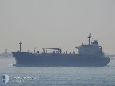
Oil/Chemical Tanker
Current Trip
| Time Travelled | 13 days |
|---|---|
| Remaining Time | --- |
| Distance Travelled | 2137.11 морская миля |
| Remaining Distance | --- |
| AVG Speed | 11.8 Узлы |
| MAX Speed | 11.8 Узлы |
| AVG Wind | 7.3 knots |
| MAX Wind | 19.4 knots |
| MIN Temp | 13°C / 55.4°F |
| MAX Temp | 25.9°C / 78.62°F |
| Осадка | 7.1 м |
| Позиция Получена | 3 m тому назад |
Current Position
| Долгота | 28.83870° |
|---|---|
| Широта | 40.74555° |
| Статус | Not under command |
| Скорость | 1 Узлы |
| Курс | 94° |
| Район | Sea of Marmara |
| Станция | T-AIS |
| Позиция Получена | 3 m тому назад |
Info
Information
The current position of SPRIT is in Sea of Marmara with coordinates 40.74555° / 28.83870° as reported on 2024-06-06 04:28 by AIS to our vessel tracker app. The vessel's current speed is 1 Узлы
The vessel SPRIT (IMO: 9248796, MMSI: 630001102) is a Oil/Chemical Tanker that was built in 2003 ( 21 лет ). It's sailing under the flag of [GW] Guinea-Bissau.
In this page you can find informations about the vessels current position, last detected port calls, and current voyage information. If the vessels is not in coverage by AIS you will find the latest position.
The current position of SPRIT is detected by our AIS receivers and we are not responsible for the reliability of the data. The last position was recorded while the vessel was in Coverage by the Ais receivers of our vessel tracking app.
The current draught of SPRIT as reported by AIS is 7.1 meters
Weather
| Temperature | 20.9°C / 69.62°F |
|---|---|
| Wind Speed | 7 knots |
| Direction | 89° E |
| Pressure | 1013.2 hPa |
| Humidity | 75.7 % |
| Cloud Coverage | 54 % |
Featured Company
Last Port Calls
| Port | Arrival | Departure | Time In Port |
|---|---|---|---|
| 2024-05-21 08:34 | 2024-05-23 04:48 | 1 d | |
| 2024-04-18 21:16 |
Most Visited Ports (Last year)
| Port | Arrivals | |
|---|---|---|
| 2 | ||
| 1 |
Last Trips
| Origin | Departure | Destination | Arrival | Distance | |
|---|---|---|---|---|---|
| 2024-04-19 00:16 | 2024-05-21 11:34 | 3093.82 морская миля |
Events
| Время | Событие | Детали | Позиция / Направление | Информация |
|---|---|---|---|---|
| 2024-06-05 23:44 | Статус изменился | Not under command Under way using engine |
40.80843 / 28.88837
ISTANBUL STRAIT
|
Скорость: 0.7 kn Курс: 35° |
| 2024-06-05 22:25 | Начало движения | 13.46 nm, South of YESILKOY |
40.73926 / 28.90556
ISTANBUL STRAIT
|
Скорость: 3.1 kn Курс: 345° |
| 2024-06-05 22:12 | Статус изменился | Under way using engine Not under command |
40.73166 / 28.91028
ISTANBUL STRAIT
|
Скорость: 0.9 kn Курс: 353° |
| 2024-06-05 18:40 | Статус изменился | Not under command Under way using engine |
40.77980 / 28.94202
ISTANBUL STRAIT
|
Скорость: 1 kn Курс: 344° |
| 2024-06-05 16:39 | Окончание движения | 10.38 nm, South West of MALTEPE |
40.80740 / 28.94975
ISTANBUL STRAIT
|
Скорость: 0.3 kn Курс: 3° |
| 2024-06-05 15:56 | Начало движения | 11.83 nm, South West of MALTEPE |
40.76517 / 28.96006
ISTANBUL STRAIT
|
Скорость: 3.1 kn Курс: 205° |
| 2024-06-05 14:04 | Окончание движения | 11.1 nm, South West of MALTEPE |
40.77616 / 28.96775
ISTANBUL STRAIT
|
Скорость: 0.3 kn Курс: 139° |
| 2024-06-05 11:48 | Начало движения | 11.82 nm, South of YESILKOY |
40.76841 / 28.90763
ISTANBUL STRAIT
|
Скорость: 3.1 kn Курс: 14° |
| 2024-06-05 08:07 | Окончание движения | 10.44 nm, South East of YESILKOY |
40.80091 / 28.93165
ISTANBUL STRAIT
|
Скорость: 0.3 kn Курс: 66° |
| 2024-06-04 22:13 | В покрытии |
40.52296 / 27.03871
Sea of Marmara
ISTANBUL STRAIT
|
Скорость: 9.4 kn Курс: 66.8° |