
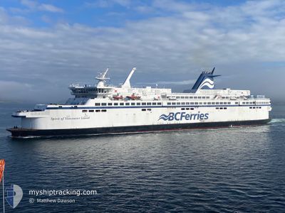
SPIRIT OF VI
Ro-Ro/Passenger Ship
Current Trip
| Trip Time | 1 h, 29 mins |
|---|---|
| Trip Distance | 24.28 морская миля |
| AVG Speed | 18.1 Узлы |
| MAX Speed | 20.5 Узлы |
| Осадка | 4.4 м |
| AVG Wind | 9.5 knots |
| MAX Wind | 11.5 knots |
| MIN Temp | 9.3°C / 48.74°F |
| MAX Temp | 9.8°C / 49.64°F |
| Позиция Получена | 8 m тому назад |
Current Position
| Долгота | --- |
|---|---|
| Широта | --- |
| Статус | Moored |
| Скорость | |
| Курс | 322° |
| Район | The Coastal Waters of Southeast Alaska and British Columbia |
| Станция | T-AIS |
| Позиция Получена | 8 m тому назад |
Info
Information
The current position of SPIRIT OF VI is in The Coastal Waters of Southeast Alaska and British Columbia with coordinates 48.69046° / -123.41268° as reported on 2025-12-13 07:43 by AIS to our vessel tracker app. The vessel's current speed is 0 Узлы and is currently inside the port of SWARTZ BAY.
The vessel SPIRIT OF VI (IMO: 9030682, MMSI: 316001269) is a Ro-Ro/Passenger Ship that was built in 1994 ( 31 лет ). It's sailing under the flag of [CA] Canada.
In this page you can find informations about the vessels current position, last detected port calls, and current voyage information. If the vessels is not in coverage by AIS you will find the latest position.
The current position of SPIRIT OF VI is detected by our AIS receivers and we are not responsible for the reliability of the data. The last position was recorded while the vessel was in Coverage by the Ais receivers of our vessel tracking app.
The current draught of SPIRIT OF VI as reported by AIS is 4.4 meters
Weather
| Temperature | 9.2°C / 48.56°F |
|---|---|
| Wind Speed | 3 knots |
| Direction | 180° S |
| Pressure | 1016.7 hPa |
| Humidity | 93.8 % |
| Cloud Coverage | 100 % |
Featured Company
Last Port Calls
| Port | Arrival | Departure | Time In Port |
|---|---|---|---|
| 2025-12-12 22:36 | |||
| 2025-12-12 20:28 | 2025-12-12 21:07 | 39 m | |
| 2025-12-12 18:29 | 2025-12-12 19:04 | 34 m | |
| 2025-12-12 16:37 | 2025-12-12 17:12 | 35 m | |
| 2025-12-12 14:30 | 2025-12-12 15:14 | 43 m | |
| 2025-12-12 12:33 | 2025-12-12 13:15 | 41 m | |
| 2025-12-12 10:30 | 2025-12-12 11:10 | 39 m | |
| 2025-12-12 08:31 | 2025-12-12 09:12 | 41 m | |
| 2025-12-11 22:24 | 2025-12-12 07:03 | 8 h | |
| 2025-12-11 20:27 | 2025-12-11 21:07 | 40 m |
Most Visited Ports (Last year)
| Port | Arrivals | |
|---|---|---|
| 1266 | ||
| 1263 | ||
| 2 |
Last Trips
| Origin | Departure | Destination | Arrival | Distance | |
|---|---|---|---|---|---|
| 2025-12-12 21:07 | 2025-12-12 22:36 | 24.28 морская миля | |||
| 2025-12-12 19:04 | 2025-12-12 20:28 | 24.58 морская миля | |||
| 2025-12-12 17:12 | 2025-12-12 18:29 | 24.27 морская миля | |||
| 2025-12-12 15:14 | 2025-12-12 16:37 | 25.37 морская миля | |||
| 2025-12-12 13:15 | 2025-12-12 14:30 | 22.47 морская миля | |||
| 2025-12-12 11:10 | 2025-12-12 12:33 | 24.99 морская миля | |||
| 2025-12-12 09:12 | 2025-12-12 10:30 | 23.82 морская миля | |||
| 2025-12-12 07:03 | 2025-12-12 08:31 | 25.07 морская миля | |||
| 2025-12-11 21:07 | 2025-12-11 22:24 | 22.29 морская миля | |||
| 2025-12-11 19:08 | 2025-12-11 20:27 | 24.83 морская миля |
Events
| Время | Событие | Детали | Позиция / Направление | Информация |
|---|---|---|---|---|
| 2025-12-13 06:58 | Статус изменился | Moored Default |
48.69046 / -123.41268
[CA] SWARTZ BAY
|
Скорость: Курс: 321° |
| 2025-12-13 06:52 | Статус изменился | Default Moored |
48.69046 / -123.41267
[CA] SWARTZ BAY
|
Скорость: Курс: 321° |
| 2025-12-13 06:37 | Окончание движения |
48.69046 / -123.41268
[CA] SWARTZ BAY
|
Скорость: Курс: 321° |
|
| 2025-12-13 06:36 | Порт |
|
48.69046 / -123.41268
[CA] SWARTZ BAY
|
Скорость: 0.8 kn Курс: 269° |
| 2025-12-13 06:26 | Статус изменился | Moored Under way using engine |
48.69088 / -123.41228
SWARTZ BAY<>TSA
|
Скорость: 2.3 kn Курс: 244° |
| 2025-12-13 05:23 | Изменение морского района | Canadian part of the The Coastal Waters of Southeast Alaska and British Columbia United States part of the The Coastal Waters of Southeast Alaska and British Columbia |
48.93818 / -123.23491
The Coastal Waters of Southeast Alaska and British Columbia
|
Скорость: 19.3 kn Курс: 220.6° |
| 2025-12-13 05:08 | Изменение морского района | United States part of the The Coastal Waters of Southeast Alaska and British Columbia Canadian part of the The Coastal Waters of Southeast Alaska and British Columbia |
48.99316 / -123.14474
The Coastal Waters of Southeast Alaska and British Columbia
|
Скорость: 18.4 kn Курс: 229.8° |
| 2025-12-13 05:07 | ПОРТ ОТПРАВЛЕНИЯ |
|
48.99535 / -123.14090
SWARTZ BAY<>TSA
|
Скорость: 17.1 kn Курс: 228° |
| 2025-12-13 05:02 | Начало движения |
49.00501 / -123.13557
[CA] TSAWWASSEN
|
Скорость: 6.7 kn Курс: 48° |
|
| 2025-12-13 04:32 | Окончание движения |
49.00657 / -123.13356
[CA] TSAWWASSEN
|
Скорость: 0.3 kn Курс: 49° |