
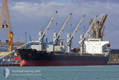
TANAIS DREAM
Bulk Carrier
Current Trip
| Time Travelled | 43 days |
|---|---|
| Remaining Time | --- |
| Distance Travelled | 7291.87 морская миля |
| Remaining Distance | --- |
| AVG Speed | 10.3 Узлы |
| MAX Speed | 14.6 Узлы |
| AVG Wind | 11.4 knots |
| MAX Wind | 30.8 knots |
| MIN Temp | 13.1°C / 55.58°F |
| MAX Temp | 29.6°C / 85.28°F |
| Осадка | 10.2 м |
| Позиция Получена | 2 d тому назад |
Current Position
| Долгота | 0.27551° |
|---|---|
| Широта | 36.78730° |
| Статус | Under way using engine |
| Скорость | 12 Узлы |
| Курс | 75.9° |
| Район | Mediterranean Sea - Western Basin |
| Станция | T-AIS |
| Позиция Получена | 2 d тому назад |
Info
Information
The current position of TANAIS DREAM is in Mediterranean Sea - Western Basin with coordinates 36.78730° / 0.27551° as reported on 2024-05-01 07:26 by AIS to our vessel tracker app. The vessel's current speed is 12 Узлы
The vessel TANAIS DREAM (IMO: 9283899, MMSI: 312124000) is a Bulk Carrier that was built in 2003 ( 21 лет ). It's sailing under the flag of [BZ] Belize.
In this page you can find informations about the vessels current position, last detected port calls, and current voyage information. If the vessels is not in coverage by AIS you will find the latest position.
The current position of TANAIS DREAM is detected by our AIS receivers and we are not responsible for the reliability of the data. The last position was recorded while the vessel was in Coverage by the Ais receivers of our vessel tracking app.
The current draught of TANAIS DREAM as reported by AIS is 10.2 meters
Weather
| Temperature | 16.7°C / 62.06°F |
|---|---|
| Wind Speed | 3 knots |
| Direction | 150° SSE |
| Pressure | 1020.2 hPa |
| Humidity | 53 % |
| Cloud Coverage | --- |
Featured Company
Last Trips
| Origin | Departure | Destination | Arrival | Distance |
|---|
Events
| Время | Событие | Детали | Позиция / Направление | Информация |
|---|---|---|---|---|
| 2024-05-02 05:24 | Окончание движения | 4.58 nm, East of BEJAIA |
36.72333 / 5.18333
DZ BJA
|
Скорость: Курс: -1° |
| 2024-05-01 07:51 | Статус изменился | Default Under way using engine |
36.80833 / .41000
DZ BJA
|
Скорость: 12 kn Курс: 75.9° |
| 2024-05-01 07:26 | Статус изменился | Under way using engine Default |
36.78730 / .27551
DZ BJA
|
Скорость: 11 kn Курс: 77° |
| 2024-05-01 07:26 | Вне покрытия |
36.78730 / .27551
Mediterranean Sea - Western Basin
DZ BJA
|
Скорость: 12 kn Курс: 75.9° |
|
| 2024-05-01 07:00 | Статус изменился | Default Under way using engine |
36.77334 / .20167
DZ BJA
|
Скорость: 11.3 kn Курс: 75.4° |
| 2024-05-01 06:05 | Статус изменился | Under way using engine Default |
36.72878 / -.01317
DZ BJA
|
Скорость: 11 kn Курс: 73° |
| 2024-05-01 05:48 | Статус изменился | Default Under way using engine |
36.71500 / -.06833
DZ BJA
|
Скорость: 10.7 kn Курс: 75° |
| 2024-05-01 05:03 | Статус изменился | Under way using engine Default |
36.67738 / -.23988
DZ BJA
|
Скорость: 10 kn Курс: 74° |
| 2024-05-01 05:00 | Статус изменился | Default Under way using engine |
36.67500 / -.24333
DZ BJA
|
Скорость: 10.9 kn Курс: 75.5° |
| 2024-05-01 04:56 | Статус изменился | Under way using engine Default |
36.67267 / -.26240
DZ BJA
|
Скорость: 10 kn Курс: 76° |