
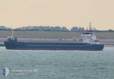
SEA MELODY
General Cargo
Current Trip
| Time Travelled | 11 h, 30 mins |
|---|---|
| Remaining Time | 1 day |
| Distance Travelled | 113.84 морская миля |
| Remaining Distance | 391.72 морская миля |
| AVG Speed | 10 Узлы |
| MAX Speed | 13.1 Узлы |
| AVG Wind | 7.8 knots |
| MAX Wind | 11 knots |
| MIN Temp | 10.8°C / 51.44°F |
| MAX Temp | 13°C / 55.4°F |
| Осадка | 4.8 м |
| Позиция Получена | 18 m тому назад |
Current Position
| Долгота | 1.28307° |
|---|---|
| Широта | 50.98479° |
| Статус | Under way using engine |
| Скорость | 10.5 Узлы |
| Курс | 230° |
| Район | English Channel |
| Станция | T-AIS |
| Позиция Получена | 18 m тому назад |
Info
Information
The current position of SEA MELODY is in English Channel with coordinates 50.98479° / 1.28307° as reported on 2024-04-30 07:24 by AIS to our vessel tracker app. The vessel's current speed is 10.5 Узлы and is heading at the port of CORK. The estimated time of arrival as calculated by MyShipTracking vessel tracking app is 2024-05-02 03:56 LT
The vessel SEA MELODY (IMO: 9195638, MMSI: 314557000) is a General Cargo that was built in 2002 ( 22 лет ). It's sailing under the flag of [BB] Barbados.
In this page you can find informations about the vessels current position, last detected port calls, and current voyage information. If the vessels is not in coverage by AIS you will find the latest position.
The current position of SEA MELODY is detected by our AIS receivers and we are not responsible for the reliability of the data. The last position was recorded while the vessel was in Coverage by the Ais receivers of our vessel tracking app.
The current draught of SEA MELODY as reported by AIS is 4.8 meters
Weather
| Temperature | 10.8°C / 51.44°F |
|---|---|
| Wind Speed | 11 knots |
| Direction | 166° SSE |
| Pressure | 1014 hPa |
| Humidity | 85.5 % |
| Cloud Coverage | 100 % |
Featured Company
Last Port Calls
| Port | Arrival | Departure | Time In Port |
|---|---|---|---|
| 2024-04-29 18:39 | 2024-04-29 20:13 | 1 h | |
| 2024-04-25 08:16 | 2024-04-29 18:13 | 4 d | |
| 2024-04-20 16:30 | 2024-04-23 16:46 | 3 d | |
| 2024-04-18 09:59 | 2024-04-19 00:16 | 14 h | |
| 2024-04-17 12:35 | 2024-04-18 08:43 | 20 h | |
| 2024-04-16 21:18 | 2024-04-16 22:58 | 1 h | |
| 2024-04-15 12:04 | 2024-04-16 20:14 | 1 d | |
| 2024-04-15 09:59 | 2024-04-15 11:42 | 1 h | |
| 2024-04-11 22:51 | 2024-04-13 18:58 | 1 d | |
| 2024-04-09 22:25 | 2024-04-10 18:05 | 19 h |
Last Trips
| Origin | Departure | Destination | Arrival | Distance | |
|---|---|---|---|---|---|
| 2024-04-29 20:13 | 2024-04-29 20:39 | 2.12 морская миля | |||
| 2024-04-23 18:46 | 2024-04-25 10:16 | 349.57 морская миля | |||
| 2024-04-19 02:16 | 2024-04-20 18:30 | 365.38 морская миля | |||
| 2024-04-18 10:43 | 2024-04-18 11:59 | 11.35 морская миля | |||
| 2024-04-17 00:58 | 2024-04-17 14:35 | 115.37 морская миля | |||
| 2024-04-16 22:14 | 2024-04-16 23:18 | 2.53 морская миля | |||
| 2024-04-15 13:42 | 2024-04-15 14:04 | 0.90 морская миля | |||
| 2024-04-13 19:58 | 2024-04-15 11:59 | 330.34 морская миля | |||
| 2024-04-10 19:05 | 2024-04-11 23:51 | 308.83 морская миля | |||
| 2024-04-05 14:31 | 2024-04-09 23:25 | 881.78 морская миля |
Events
| Время | Событие | Детали | Позиция / Направление | Информация |
|---|---|---|---|---|
| 2024-04-30 07:32 | Статус изменился | Default Under way using engine |
50.96965 / 1.25378
IERIN
|
Скорость: 10.5 kn Курс: 230° |
| 2024-04-30 06:32 | Изменение морского района | United Kingdom part of the English Channel United Kingdom part of the North Sea |
51.07332 / 1.46731
English Channel
IERIN
|
Скорость: 9.6 kn Курс: 233.9° |
| 2024-04-30 02:44 | Изменение морского района | United Kingdom part of the North Sea French part of the North Sea |
51.41073 / 2.06266
North Sea
IERIN
|
Скорость: 10.1 kn Курс: 294.2° |
| 2024-04-30 01:38 | Изменение морского района | French part of the North Sea Belgian part of the North Sea |
51.35545 / 2.33485
North Sea
IERIN
|
Скорость: 10.2 kn Курс: 253.3° |
| 2024-04-29 22:08 | Изменение морского района | Belgian part of the North Sea Dutch part of the North Sea |
51.40597 / 3.32733
North Sea
IERIN
|
Скорость: 12.2 kn Курс: 250.9° |
| 2024-04-29 20:13 | ПОРТ ОТПРАВЛЕНИЯ |
|
51.34368 / 3.81230
IERIN
|
Скорость: 8.4 kn Курс: 353° |
| 2024-04-29 20:04 | Начало движения |
51.33050 / 3.81534
[NL] TERNEUZEN
|
Скорость: 4.1 kn Курс: 339° |
|
| 2024-04-29 19:13 | Окончание движения |
51.32852 / 3.81676
[NL] TERNEUZEN
|
Скорость: 0.3 kn Курс: 333° |
|
| 2024-04-29 19:04 | Начало движения |
51.32422 / 3.82091
[NL] TERNEUZEN
|
Скорость: 3.1 kn Курс: 330° |
|
| 2024-04-29 18:44 | Окончание движения |
51.31894 / 3.82509
[NL] TERNEUZEN
|
Скорость: 0.3 kn Курс: 327° |