
PORT FUKUOKA
Cargo
Current Trip
MX VER
| Time Travelled | 36 days |
|---|---|
| Remaining Time | --- |
| Distance Travelled | 1923.95 морская миля |
| Remaining Distance | --- |
| AVG Speed | 11.7 Узлы |
| MAX Speed | 15 Узлы |
| AVG Wind | 12.6 knots |
| MAX Wind | 29.9 knots |
| MIN Temp | 23°C / 73.4°F |
| MAX Temp | 38.5°C / 101.3°F |
| Осадка | 12.7 м |
| Позиция Получена | 7 d тому назад |
Current Position
| Долгота | -96.04628° |
|---|---|
| Широта | 19.16652° |
| Статус | At anchor |
| Скорость | |
| Курс | 80° |
| Район | Gulf of Mexico |
| Станция | T-AIS |
| Позиция Получена | 7 d тому назад |
Info
Information
The current position of PORT FUKUOKA is in Gulf of Mexico with coordinates 19.16652° / -96.04628° as reported on 2024-05-07 00:31 by AIS to our vessel tracker app. The vessel's current speed is 0 Узлы
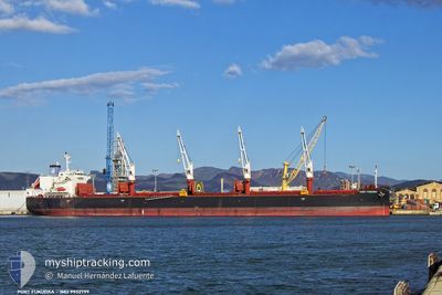
The vessel PORT FUKUOKA (IMO: 9932799, MMSI: 538010081) is a Cargo It's sailing under the flag of [MH] Marshall Is.
In this page you can find informations about the vessels current position, last detected port calls, and current voyage information. If the vessels is not in coverage by AIS you will find the latest position.
The current position of PORT FUKUOKA is detected by our AIS receivers and we are not responsible for the reliability of the data. The last position was recorded while the vessel was in Coverage by the Ais receivers of our vessel tracking app.
The current draught of PORT FUKUOKA as reported by AIS is 12.7 meters
Weather
| Temperature | 28.8°C / 83.84°F |
|---|---|
| Wind Speed | 10 knots |
| Direction | 134° SE |
| Pressure | 1004.4 hPa |
| Humidity | 80.7 % |
| Cloud Coverage | 100 % |
Featured Company
Last Port Calls
| Port | Arrival | Departure | Time In Port |
|---|---|---|---|
| 2024-04-02 12:04 | 2024-04-08 03:04 | 5 d | |
| 2024-03-13 18:40 | |||
| 2024-03-08 15:54 | 2024-03-10 06:12 | 1 d |
Last Trips
| Origin | Departure | Destination | Arrival | Distance | |
|---|---|---|---|---|---|
| 2024-03-10 03:12 | 2024-03-13 15:40 | 891.61 морская миля | |||
| 2024-02-25 21:05 | 2024-03-08 12:54 | 3172.46 морская миля |
Events
| Время | Событие | Детали | Позиция / Направление | Информация |
|---|---|---|---|---|
| 2024-05-13 18:56 | Окончание движения |
19.91167 / -95.69167
MX VER
|
Скорость: Курс: -1° |
|
| 2024-05-13 13:33 | Начало движения | 2.05 nm, North West of VERACRUZ |
19.22637 / -96.15198
MX VER
|
Скорость: 7.9 kn Курс: 52° |
| 2024-05-08 06:01 | Окончание движения | 2.73 nm, North West of VERACRUZ |
19.22667 / -96.16666
MX VER
|
Скорость: Курс: -1° |
| 2024-05-08 04:02 | Начало движения | 5.19 nm, South East of VERACRUZ |
19.16950 / -96.04134
MX VER
|
Скорость: 4.1 kn Курс: 25° |
| 2024-05-07 00:37 | Статус изменился | Default At anchor |
19.16500 / -96.04500
MX VER
|
Скорость: Курс: 80° |
| 2024-05-07 00:31 | Статус изменился | At anchor Default |
19.16652 / -96.04628
MX VER
|
Скорость: Курс: -1° |
| 2024-05-07 00:31 | Вне покрытия |
19.16652 / -96.04628
Gulf of Mexico
|
Скорость: Курс: 150.9° |
|
| 2024-05-07 00:25 | В покрытии |
19.16652 / -96.04628
Gulf of Mexico
|
Скорость: Курс: 150.9° |