
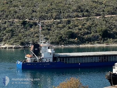
NS THOR
General Cargo
Current Trip
| Trip Time | 3 days |
|---|---|
| Trip Distance | 256.38 морская миля |
| AVG Speed | 6.3 Узлы |
| MAX Speed | 9.7 Узлы |
| Осадка | 3.5 м |
| AVG Wind | 7.8 knots |
| MAX Wind | 22 knots |
| MIN Temp | 7.9°C / 46.22°F |
| MAX Temp | 16.1°C / 60.98°F |
| Позиция Получена | 6 d тому назад |
Current Position
| Долгота | --- |
|---|---|
| Широта | --- |
| Статус | Under way using engine |
| Скорость | 9.5 Узлы |
| Курс | 12.3° |
| Район | Black Sea |
| Станция | T-AIS |
| Позиция Получена | 6 d тому назад |
Info
Information
The current position of NS THOR is in Black Sea with coordinates 43.38083° / 28.68307° as reported on 2025-11-30 20:19 by AIS to our vessel tracker app. The vessel's current speed is 9.5 Узлы and is currently inside the port of MANGALIA.
The vessel NS THOR (IMO: 8915744, MMSI: 312558000) is a General Cargo that was built in 1991 ( 34 лет ). It's sailing under the flag of [BZ] Belize.
In this page you can find informations about the vessels current position, last detected port calls, and current voyage information. If the vessels is not in coverage by AIS you will find the latest position.
The current position of NS THOR is detected by our AIS receivers and we are not responsible for the reliability of the data. The last position was recorded while the vessel was in Coverage by the Ais receivers of our vessel tracking app.
The current draught of NS THOR as reported by AIS is 3.5 meters
Weather
| Temperature | 9.9°C / 49.82°F |
|---|---|
| Wind Speed | 15 knots |
| Direction | 20° NNE |
| Pressure | 1012.9 hPa |
| Humidity | 84.6 % |
| Cloud Coverage | 100 % |
Featured Company
Last Port Calls
| Port | Arrival | Departure | Time In Port |
|---|---|---|---|
| 2025-12-02 07:24 | |||
| 2025-11-27 13:27 | 2025-11-29 04:30 | 1 d | |
| 2025-11-18 08:28 | 2025-11-25 16:54 | 7 d | |
| 2025-11-15 08:28 | 2025-11-17 14:08 | 2 d | |
| 2025-11-12 17:03 | 2025-11-12 19:02 | 1 h | |
| 2025-11-10 09:34 | |||
| 2025-11-03 17:36 | 2025-11-05 11:32 | 1 d | |
| 2025-10-20 08:24 | 2025-10-30 19:16 | 10 d | |
| 2025-10-16 10:36 | 2025-10-18 09:24 | 1 d |
Last Trips
| Origin | Departure | Destination | Arrival | Distance | |
|---|---|---|---|---|---|
| 2025-11-29 04:30 | 2025-12-02 07:24 | 256.38 морская миля | |||
| 2025-11-25 16:54 | 2025-11-27 13:27 | 174.19 морская миля | |||
| 2025-11-17 14:08 | 2025-11-18 08:28 | 123.45 морская миля | |||
| 2025-11-12 19:02 | 2025-11-15 08:28 | 209.56 морская миля | |||
| 2025-11-10 09:34 | 2025-11-12 17:03 | 266.37 морская миля | |||
| 2025-10-30 19:16 | 2025-11-03 17:36 | 282.52 морская миля | |||
| 2025-10-18 09:24 | 2025-10-20 08:24 | 287.27 морская миля | |||
| 2025-09-27 13:11 | 2025-10-16 10:36 | 779.54 морская миля |
Events
| Время | Событие | Детали | Позиция / Направление | Информация |
|---|---|---|---|---|
| 2025-12-02 05:53 | Окончание движения |
43.79973 / 28.57397
[RO] MANGALIA
|
Скорость: 0.1 kn Курс: 306° |
|
| 2025-12-02 05:24 | Порт |
|
43.79776 / 28.59852
[RO] MANGALIA
|
Скорость: 4.7 kn Курс: 305° |
| 2025-12-02 04:25 | Начало движения | 3.94 nm, North East of MANGALIA |
43.83852 / 28.65697
ROMAG
|
Скорость: 3.2 kn Курс: 215° |
| 2025-12-01 00:04 | Окончание движения | 4.07 nm, North East of MANGALIA |
43.83760 / 28.66149
ROMAG
|
Скорость: 0.2 kn Курс: 324° |
| 2025-11-30 20:19 | Вне покрытия |
43.38083 / 28.68307
Black Sea
ROMAG
|
Скорость: 9.5 kn Курс: 12.3° |
|
| 2025-11-30 17:15 | Статус изменился | Under way using engine Default |
42.96073 / 28.56398
ROMAG
|
Скорость: 8.2 kn Курс: 18° |
| 2025-11-30 17:06 | Статус изменился | Default Under way using engine |
42.94040 / 28.55558
ROMAG
|
Скорость: 8.2 kn Курс: 18.1° |
| 2025-11-30 17:03 | Статус изменился | Under way using engine Default |
42.93446 / 28.55281
ROMAG
|
Скорость: 8 kn Курс: 19° |
| 2025-11-30 16:43 | Статус изменился | Default Under way using engine |
42.89160 / 28.53303
ROMAG
|
Скорость: 8.1 kn Курс: 17.5° |
| 2025-11-30 16:40 | Статус изменился | Under way using engine Default |
42.88518 / 28.53016
ROMAG
|
Скорость: 7.9 kn Курс: 17° |