
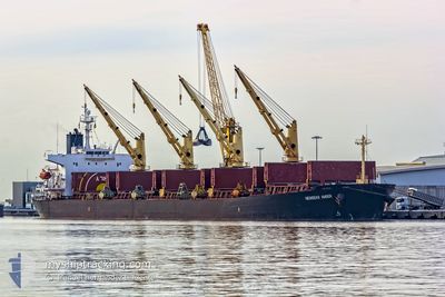
NEWSEAS AMBER
Bulk Carrier
Current Trip
SANTOPK VA USA
| Time Travelled | 17 days |
|---|---|
| Remaining Time | --- |
| Distance Travelled | 3749.67 морская миля |
| Remaining Distance | --- |
| AVG Speed | 12.4 Узлы |
| MAX Speed | 14.3 Узлы |
| AVG Wind | 11.1 knots |
| MAX Wind | 21.9 knots |
| MIN Temp | 22.7°C / 72.86°F |
| MAX Temp | 32.9°C / 91.22°F |
| Осадка | 6.5 м |
| Позиция Получена | 2 d тому назад |
Current Position
| Долгота | -46.22402° |
|---|---|
| Широта | -24.11952° |
| Статус | At anchor |
| Скорость | |
| Курс | 243° |
| Район | South Atlantic Ocean |
| Станция | T-AIS |
| Позиция Получена | 2 d тому назад |
Info
Information
The current position of NEWSEAS AMBER is in South Atlantic Ocean with coordinates -24.11952° / -46.22402° as reported on 2024-05-02 11:06 by AIS to our vessel tracker app. The vessel's current speed is 0 Узлы
The vessel NEWSEAS AMBER (IMO: 9317119, MMSI: 371247000) is a Bulk Carrier that was built in 2005 ( 19 лет ). It's sailing under the flag of [PA] Panama.
In this page you can find informations about the vessels current position, last detected port calls, and current voyage information. If the vessels is not in coverage by AIS you will find the latest position.
The current position of NEWSEAS AMBER is detected by our AIS receivers and we are not responsible for the reliability of the data. The last position was recorded while the vessel was in Coverage by the Ais receivers of our vessel tracking app.
The current draught of NEWSEAS AMBER as reported by AIS is 6.5 meters
Weather
| Temperature | 25.6°C / 78.08°F |
|---|---|
| Wind Speed | 3 knots |
| Direction | 162° SSE |
| Pressure | 1013.2 hPa |
| Humidity | 79.1 % |
| Cloud Coverage | --- |
Featured Company
Last Port Calls
| Port | Arrival | Departure | Time In Port |
|---|---|---|---|
| 2024-04-11 08:24 | 2024-04-17 11:48 | 6 d | |
| 2024-04-06 08:01 | 2024-04-08 15:25 | 2 d | |
| 2024-03-29 20:34 | 2024-04-02 21:45 | 4 d | |
| 2024-03-02 20:19 |
Most Visited Ports (Last year)
| Port | Arrivals | |
|---|---|---|
| 2 | ||
| 2 | ||
| 1 | ||
| 1 | ||
| 1 | ||
| 1 |
Events
| Время | Событие | Детали | Позиция / Направление | Информация |
|---|---|---|---|---|
| 2024-05-02 11:09 | Статус изменился | Default At anchor |
-24.11954 / -46.22404
SANTOPK VA USA
|
Скорость: Курс: 243° |
| 2024-05-02 11:06 | Вне покрытия |
-24.11952 / -46.22402
South Atlantic Ocean
|
Скорость: Курс: 174.5° |
|
| 2024-05-02 10:30 | Статус изменился | At anchor Default |
-24.11976 / -46.22396
SANTOPK VA USA
|
Скорость: 0.2 kn Курс: 263° |
| 2024-05-02 10:30 | В покрытии |
-24.11976 / -46.22396
South Atlantic Ocean
|
Скорость: Курс: 308.9° |
|
| 2024-05-02 05:30 | Статус изменился | Default At anchor |
-24.11959 / -46.22512
SANTOPK VA USA
|
Скорость: 0.2 kn Курс: 267° |
| 2024-05-02 05:24 | Статус изменился | At anchor Default |
-24.11955 / -46.22518
SANTOPK VA USA
|
Скорость: 0.1 kn Курс: 275° |
| 2024-05-02 05:24 | Вне покрытия |
-24.11955 / -46.22518
South Atlantic Ocean
|
Скорость: 0.2 kn Курс: 3.4° |
|
| 2024-05-02 05:15 | В покрытии |
-24.11955 / -46.22518
South Atlantic Ocean
|
Скорость: 0.2 kn Курс: 3.4° |
|
| 2024-04-30 20:46 | Окончание движения | 10.49 nm, South East of SANTOS |
-24.11793 / -46.22588
SANTOPK VA USA
|
Скорость: 0.2 kn Курс: 207° |
| 2024-04-30 19:31 | Начало движения | 5.9 nm, South of SANTOS |
-24.06377 / -46.34638
SANTOPK VA USA
|
Скорость: 3.7 kn Курс: 118° |