
NAGUAL
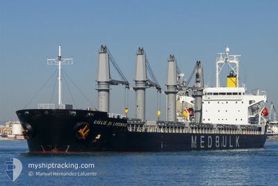
Bulk Carrier
Current Trip
| Time Travelled | 1 day |
|---|---|
| Remaining Time | 1 h, 17 mins |
| Distance Travelled | 55.54 морская миля |
| Remaining Distance | 30.69 морская миля |
| AVG Speed | 8 Узлы |
| MAX Speed | 12.9 Узлы |
| AVG Wind | 6.4 knots |
| MAX Wind | 12 knots |
| MIN Temp | 10.5°C / 50.9°F |
| MAX Temp | 13.1°C / 55.58°F |
| Осадка | 6.1 м |
| Позиция Получена | 1 m тому назад |
Current Position
| Долгота | --- |
|---|---|
| Широта | --- |
| Статус | Under way using engine |
| Скорость | 0.5 Узлы |
| Курс | 130° |
| Район | Sea of Marmara |
| Станция | T-AIS |
| Позиция Получена | 1 m тому назад |
Info
Information
The current position of NAGUAL is in Sea of Marmara with coordinates 40.71323° / 29.19307° as reported on 2025-12-13 11:29 by AIS to our vessel tracker app. The vessel's current speed is 0.5 Узлы and is heading at the port of DERINCE. The estimated time of arrival as calculated by MyShipTracking vessel tracking app is 2025-12-13 15:48 LT
The vessel NAGUAL (IMO: 9380829, MMSI: 538007314) is a Bulk Carrier that was built in 2008 ( 17 лет ). It's sailing under the flag of [MH] Marshall Is.
In this page you can find informations about the vessels current position, last detected port calls, and current voyage information. If the vessels is not in coverage by AIS you will find the latest position.
The current position of NAGUAL is detected by our AIS receivers and we are not responsible for the reliability of the data. The last position was recorded while the vessel was in Coverage by the Ais receivers of our vessel tracking app.
The current draught of NAGUAL as reported by AIS is 6.1 meters
Weather
| Temperature | 13°C / 55.4°F |
|---|---|
| Wind Speed | 10 knots |
| Direction | 52° NE |
| Pressure | 1025.5 hPa |
| Humidity | 67 % |
| Cloud Coverage | 73 % |
Featured Company
Last Port Calls
| Port | Arrival | Departure | Time In Port |
|---|---|---|---|
| 2025-12-03 16:24 | 2025-12-11 21:41 | 8 d | |
| 2025-11-28 08:16 | 2025-11-28 17:18 | 9 h | |
| 2025-10-27 20:38 | 2025-11-07 14:31 | 10 d |
Most Visited Ports (Last year)
| Port | Arrivals | |
|---|---|---|
| 2 | ||
| 1 | ||
| 1 | ||
| 1 | ||
| 1 | ||
| 1 |
Events
| Время | Событие | Детали | Позиция / Направление | Информация |
|---|---|---|---|---|
| 2025-12-13 10:25 | Окончание движения | 4.91 nm, North West of YALOVA |
40.71972 / 29.19875
TR DRC
|
Скорость: 0.3 kn Курс: 75° |
| 2025-12-13 09:09 | Начало движения | 12.05 nm, West of YALOVA |
40.71493 / 29.02055
TR DRC
|
Скорость: 3.3 kn Курс: 89° |
| 2025-12-13 08:58 | Пункт назначения изменился | TR DRC ORDER |
40.71580 / 29.01627
TR DRC
|
Скорость: 0.2 kn Курс: 108° |
| 2025-12-13 08:58 | ETA изменился | 2025/12/13 11:00 2025/12/13 23:00 |
40.71580 / 29.01627
TR DRC
|
Скорость: 0.2 kn Курс: 108° |
| 2025-12-13 05:18 | Окончание движения | 11.45 nm, South West of MALTEPE |
40.74367 / 29.01885
ORDER
|
Скорость: 0.2 kn Курс: 92° |
| 2025-12-13 03:54 | Начало движения | 10.62 nm, South West of MALTEPE |
40.77312 / 28.98943
ORDER
|
Скорость: 3.1 kn Курс: 132° |
| 2025-12-12 00:27 | Окончание движения | 11.41 nm, South West of MALTEPE |
40.77226 / 28.96320
ORDER
|
Скорость: 0.3 kn Курс: 53° |
| 2025-12-11 18:51 | Статус изменился | Under way using engine Moored |
40.75755 / 29.58352
ORDER
|
Скорость: 9.5 kn Курс: 245° |
| 2025-12-11 18:41 | ПОРТ ОТПРАВЛЕНИЯ |
|
40.77228 / 29.60595
ORDER
|
Скорость: 4.3 kn Курс: 200° |
| 2025-12-11 18:36 | Начало движения |
40.77653 / 29.60388
[TR] HEREKE
|
Скорость: 3.4 kn Курс: 139° |