
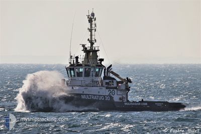
MULTRATUG 20
Tug
Current Trip
| Time Travelled | 1 day |
|---|---|
| Remaining Time | --- |
| Distance Travelled | 193.63 морская миля |
| Remaining Distance | --- |
| AVG Speed | 6.2 Узлы |
| MAX Speed | 8.6 Узлы |
| AVG Wind | 12.9 knots |
| MAX Wind | 20.7 knots |
| MIN Temp | 7°C / 44.6°F |
| MAX Temp | 12.9°C / 55.22°F |
| Осадка | 5.8 м |
| Позиция Получена | Сейчас |
Current Position
| Долгота | 10.89500° |
|---|---|
| Широта | 56.84017° |
| Статус | Restricted manoeuverability |
| Скорость | 5.5 Узлы |
| Курс | 331.7° |
| Район | Kattegat |
| Станция | T-AIS |
| Позиция Получена | Сейчас |
Info
Information
The current position of MULTRATUG 20 is in Kattegat with coordinates 56.84017° / 10.89500° as reported on 2024-04-28 13:08 by AIS to our vessel tracker app. The vessel's current speed is 5.5 Узлы and is heading at the port of NEWCASTLE. The estimated time of arrival as calculated by MyShipTracking vessel tracking app is 2024-05-04 07:00 LT
The vessel MULTRATUG 20 (IMO: 9572006, MMSI: 244790899) is a Tug that was built in 2010 ( 14 лет ). It's sailing under the flag of [NL] Netherlands.
In this page you can find informations about the vessels current position, last detected port calls, and current voyage information. If the vessels is not in coverage by AIS you will find the latest position.
The current position of MULTRATUG 20 is detected by our AIS receivers and we are not responsible for the reliability of the data. The last position was recorded while the vessel was in Coverage by the Ais receivers of our vessel tracking app.
The current draught of MULTRATUG 20 as reported by AIS is 5.8 meters
Weather
| Temperature | 11.1°C / 51.98°F |
|---|---|
| Wind Speed | 21 knots |
| Direction | 136° SE |
| Pressure | 1010.6 hPa |
| Humidity | 76.8 % |
| Cloud Coverage | 100 % |
Featured Company
Last Port Calls
| Port | Arrival | Departure | Time In Port |
|---|---|---|---|
| 2024-04-15 14:58 | 2024-04-27 05:59 | 11 d | |
| 2024-03-20 05:42 | 2024-04-15 14:22 | 26 d | |
| 2024-03-15 05:21 | 2024-03-15 06:34 | 1 h | |
| 2024-03-09 20:13 | 2024-03-15 05:18 | 5 d | |
| 2024-03-04 04:00 | 2024-03-09 11:18 | 5 d | |
| 2024-03-03 17:39 | 2024-03-03 18:21 | 41 m | |
| 2024-03-02 16:25 | 2024-03-03 07:14 | 14 h | |
| 2024-03-02 14:09 | 2024-03-02 15:15 | 1 h | |
| 2024-03-01 23:18 | 2024-03-02 10:34 | 11 h | |
| 2024-03-01 22:22 | 2024-03-01 23:00 | 37 m |
Most Visited Ports (Last year)
| Port | Arrivals | |
|---|---|---|
| 52 | ||
| 10 | ||
| 7 | ||
| 5 | ||
| 4 | ||
| 3 |
Last Trips
| Origin | Departure | Destination | Arrival | Distance | |
|---|---|---|---|---|---|
| 2024-04-15 16:22 | 2024-04-15 16:58 | 6.86 морская миля | |||
| 2024-03-15 07:34 | 2024-03-20 06:42 | 725.86 морская миля | |||
| 2024-03-15 06:18 | 2024-03-15 06:21 | 0.28 морская миля | |||
| 2024-03-09 12:18 | 2024-03-09 21:13 | 89.24 морская миля | |||
| 2024-03-03 19:21 | 2024-03-04 05:00 | 73.79 морская миля | |||
| 2024-03-03 08:14 | 2024-03-03 18:39 | 72.27 морская миля | |||
| 2024-03-02 16:15 | 2024-03-02 17:25 | 9.85 морская миля | |||
| 2024-03-02 11:34 | 2024-03-02 15:09 | 17.95 морская миля | |||
| 2024-03-02 00:00 | 2024-03-02 00:18 | 2.36 морская миля | |||
| 2024-03-01 21:50 | 2024-03-01 23:22 | 7.46 морская миля |
Events
| Время | Событие | Детали | Позиция / Направление | Информация |
|---|---|---|---|---|
| 2024-04-27 15:59 | Изменение морского района | Danish part of the Kattegat Danish part of the Baltic Sea |
54.74550 / 10.87683
Kattegat
NEWCASTLE
|
Скорость: 5.7 kn Курс: 0.9° |
| 2024-04-27 14:11 | Изменение морского района | Danish part of the Baltic Sea German part of the Baltic Sea |
54.63333 / 11.10267
Baltic Sea
NEWCASTLE
|
Скорость: 6.6 kn Курс: 297.5° |
| 2024-04-27 13:02 | Изменение морского района | German part of the Baltic Sea Danish part of the Baltic Sea |
54.57547 / 11.29965
Baltic Sea
NEWCASTLE
|
Скорость: 7 kn Курс: 292.1° |
| 2024-04-27 08:47 | Изменение морского района | Danish part of the Baltic Sea German part of the Baltic Sea |
54.36883 / 11.85667
Baltic Sea
NEWCASTLE
|
Скорость: 4.5 kn Курс: 339.8° |
| 2024-04-27 05:59 | ПОРТ ОТПРАВЛЕНИЯ |
|
54.19000 / 12.08783
NEWCASTLE
|
Скорость: 6.3 kn Курс: 343° |
| 2024-04-27 05:42 | Начало движения |
54.16233 / 12.10317
[DE] ROSTOCK
|
Скорость: 3.2 kn Курс: 347° |
|
| 2024-04-27 04:51 | Пункт назначения изменился | NEWCASTLE ROSTOCK |
54.15459 / 12.10702
[DE] ROSTOCK
|
Скорость: Курс: 168° |
| 2024-04-27 04:51 | ETA изменился | 2024/05/04 07:00 2025/03/20 05:00 |
54.15459 / 12.10702
[DE] ROSTOCK
|
Скорость: Курс: 168° |
| 2024-04-27 04:45 | Статус изменился | Restricted manoeuverability Moored |
54.15467 / 12.10700
[DE] ROSTOCK
|
Скорость: Курс: 168° |
| 2024-04-26 11:45 | Статус изменился | Moored Default |
54.15467 / 12.10700
[DE] ROSTOCK
|
Скорость: Курс: 168° |