
RUSADER
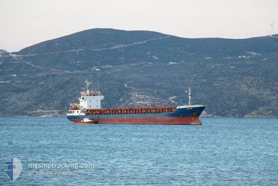
General Cargo
Current Trip
| Time Travelled | 17 days |
|---|---|
| Remaining Time | 1 h, 3 mins |
| Distance Travelled | 3541.93 морская миля |
| Remaining Distance | 37.98 морская миля |
| AVG Speed | 8.5 Узлы |
| MAX Speed | 8.5 Узлы |
| AVG Wind | 14.2 knots |
| MAX Wind | 29.8 knots |
| MIN Temp | 10.4°C / 50.72°F |
| MAX Temp | 22°C / 71.6°F |
| Осадка | 5.4 м |
| Позиция Получена | 1 m тому назад |
Current Position
| Долгота | 35.53592° |
|---|---|
| Широта | 36.36693° |
| Статус | Under way using engine |
| Скорость | 9 Узлы |
| Курс | 82.2° |
| Район | Mediterranean Sea - Eastern Basin |
| Станция | T-AIS |
| Позиция Получена | 1 m тому назад |
Info
Information
The current position of RUSADER is in Mediterranean Sea - Eastern Basin with coordinates 36.36693° / 35.53592° as reported on 2024-04-28 08:32 by AIS to our vessel tracker app. The vessel's current speed is 9 Узлы and is heading at the port of ISKENDERUN. The estimated time of arrival as calculated by MyShipTracking vessel tracking app is 2024-04-28 09:36 LT
The vessel RUSADER (IMO: 9006368, MMSI: 351053000) is a General Cargo that was built in 1994 ( 30 лет ). It's sailing under the flag of [PA] Panama.
In this page you can find informations about the vessels current position, last detected port calls, and current voyage information. If the vessels is not in coverage by AIS you will find the latest position.
The current position of RUSADER is detected by our AIS receivers and we are not responsible for the reliability of the data. The last position was recorded while the vessel was in Coverage by the Ais receivers of our vessel tracking app.
The current draught of RUSADER as reported by AIS is 5.4 meters
Weather
| Temperature | 21.5°C / 70.7°F |
|---|---|
| Wind Speed | 2 knots |
| Direction | 48° NE |
| Pressure | 1011.4 hPa |
| Humidity | 80.9 % |
| Cloud Coverage | 100 % |
Featured Company
Last Port Calls
| Port | Arrival | Departure | Time In Port |
|---|---|---|---|
| 2024-04-09 16:13 | 2024-04-10 22:08 | 1 d | |
| 2024-03-26 19:23 | 2024-04-02 23:29 | 7 d | |
| 2024-03-02 16:14 | |||
| 2024-02-28 12:34 | 2024-02-29 22:31 | 1 d | |
| 2024-02-19 10:01 | 2024-02-19 10:21 | 19 m | |
| 2024-02-14 05:56 | 2024-02-19 09:41 | 5 d | |
| 2024-02-13 20:45 | 2024-02-14 05:40 | 8 h | |
| 2024-02-09 10:10 | 2024-02-13 10:49 | 4 d | |
| 2024-02-05 15:30 |
Last Trips
| Origin | Departure | Destination | Arrival | Distance | |
|---|---|---|---|---|---|
| 2024-04-03 00:29 | 2024-04-09 18:13 | 298.70 морская миля | |||
| 2024-02-29 23:31 | 2024-03-02 17:14 | 382.17 морская миля | |||
| 2024-02-19 12:21 | 2024-02-28 13:34 | 1446.56 морская миля | |||
| 2024-02-19 11:41 | 2024-02-19 12:01 | 1.77 морская миля | |||
| 2024-02-14 07:40 | 2024-02-14 07:56 | 1.90 морская миля | |||
| 2024-02-13 12:49 | 2024-02-13 22:45 | 107.39 морская миля | |||
| 2024-02-05 17:30 | 2024-02-09 12:10 | 540.66 морская миля |
Events
| Время | Событие | Детали | Позиция / Направление | Информация |
|---|---|---|---|---|
| 2024-04-28 08:01 | Изменение морского района | Turkish part of the Mediterranean Sea - Eastern Basin Cypriote part of the Mediterranean Sea - Eastern Basin |
36.34206 / 35.44537
Mediterranean Sea - Eastern Basin
TRISK
|
Скорость: 30.9 kn Курс: 342° |
| 2024-04-28 08:00 | В покрытии |
36.34206 / 35.44537
Mediterranean Sea - Eastern Basin
TRISK
|
Скорость: 30.9 kn Курс: 342° |
|
| 2024-04-28 02:56 | Вне покрытия |
36.08086 / 34.54936
Mediterranean Sea - Eastern Basin
TRISK
|
Скорость: 9.2 kn Курс: 67.7° |
|
| 2024-04-28 02:56 | Изменение морского района | Cypriote part of the Mediterranean Sea - Eastern Basin Turkish part of the Mediterranean Sea - Eastern Basin |
36.08086 / 34.54936
Mediterranean Sea - Eastern Basin
TRISK
|
Скорость: 9.2 kn Курс: 67.7° |
| 2024-04-28 02:56 | В покрытии |
36.08086 / 34.54936
Mediterranean Sea - Eastern Basin
TRISK
|
Скорость: 9.2 kn Курс: 67.7° |
|
| 2024-04-28 01:18 | Вне покрытия |
35.99976 / 34.26510
Mediterranean Sea - Eastern Basin
TRISK
|
Скорость: 8.9 kn Курс: 69° |
|
| 2024-04-28 01:18 | Окончание движения |
35.99969 / 34.26350
TRISK
|
Скорость: Курс: 72° |
|
| 2024-04-27 23:15 | Начало движения |
35.94612 / 33.90205
TRISK
|
Скорость: 10.6 kn Курс: 89.6° |
|
| 2024-04-27 23:10 | Окончание движения |
35.94595 / 33.88481
TRISK
|
Скорость: Курс: 87° |
|
| 2024-04-27 20:10 | В покрытии |
35.93344 / 33.34561
Mediterranean Sea - Eastern Basin
TRISK
|
Скорость: 8.8 kn Курс: 86° |