
LINDE G
Other Type
Current Trip
| Time Travelled | 11 days |
|---|---|
| Remaining Time | 2 h, 9 mins |
| Distance Travelled | 3177.67 морская миля |
| Remaining Distance | 19.80 морская миля |
| AVG Speed | 13.2 Узлы |
| MAX Speed | 15.3 Узлы |
| AVG Wind | 11.4 knots |
| MAX Wind | 19 knots |
| MIN Temp | 15.6°C / 60.08°F |
| MAX Temp | 26.9°C / 80.42°F |
| Осадка | 3.1 м |
| Позиция Получена | Сейчас |
Current Position
| Долгота | -42.88891° |
|---|---|
| Широта | -23.09528° |
| Статус | Under way using engine |
| Скорость | 6.6 Узлы |
| Курс | 295.4° |
| Район | South Atlantic Ocean |
| Станция | T-AIS |
| Позиция Получена | Сейчас |
Info
Information
The current position of LINDE G is in South Atlantic Ocean with coordinates -23.09528° / -42.88891° as reported on 2024-04-30 08:19 by AIS to our vessel tracker app. The vessel's current speed is 6.6 Узлы and is heading at the port of RIO DE JANEIRO. The estimated time of arrival as calculated by MyShipTracking vessel tracking app is 2024-04-30 10:29 LT
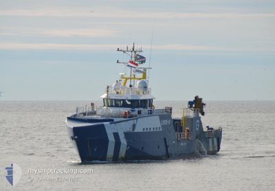
The vessel LINDE G (IMO: 9731298, MMSI: 538008216) is a Other Type It's sailing under the flag of [MH] Marshall Is.
In this page you can find informations about the vessels current position, last detected port calls, and current voyage information. If the vessels is not in coverage by AIS you will find the latest position.
The current position of LINDE G is detected by our AIS receivers and we are not responsible for the reliability of the data. The last position was recorded while the vessel was in Coverage by the Ais receivers of our vessel tracking app.
The current draught of LINDE G as reported by AIS is 3.1 meters
Weather
| Temperature | 23.1°C / 73.58°F |
|---|---|
| Wind Speed | 5 knots |
| Direction | 21° NNE |
| Pressure | 1013.6 hPa |
| Humidity | 91.4 % |
| Cloud Coverage | --- |
Featured Company
Last Port Calls
| Port | Arrival | Departure | Time In Port |
|---|---|---|---|
| 2024-04-04 09:12 | 2024-04-19 08:18 | 14 d | |
| 2024-02-03 06:13 | 2024-02-03 13:21 | 7 h |
Most Visited Ports (Last year)
| Port | Arrivals | |
|---|---|---|
| 10 | ||
| 4 | ||
| 3 | ||
| 3 | ||
| 1 | ||
| 1 |
Last Trips
| Origin | Departure | Destination | Arrival | Distance | |
|---|---|---|---|---|---|
| 2024-02-03 15:21 | 2024-04-04 11:12 | 115.06 морская миля | |||
| 2023-11-29 19:44 | 2024-02-03 08:13 | 1948.80 морская миля |
Events
| Время | Событие | Детали | Позиция / Направление | Информация |
|---|---|---|---|---|
| 2024-04-30 06:58 | Пункт назначения изменился | BR RIO OFFSHORE NAMIBIA |
-23.16330 / -42.72977
BR RIO
|
Скорость: 8.6 kn Курс: 290.3° |
| 2024-04-30 06:58 | ETA изменился | 2024/04/30 08:00 2023/11/13 09:00 |
-23.16330 / -42.72977
BR RIO
|
Скорость: 8.6 kn Курс: 290.3° |
| 2024-04-30 06:36 | Статус изменился | Under way using engine Default |
-23.18417 / -42.67977
OFFSHORE NAMIBIA
|
Скорость: 8 kn Курс: 295° |
| 2024-04-30 06:24 | Статус изменился | Default Under way using engine |
-23.19547 / -42.65299
OFFSHORE NAMIBIA
|
Скорость: 7.9 kn Курс: 292.6° |
| 2024-04-30 06:12 | Статус изменился | Under way using engine Default |
-23.20611 / -42.62646
OFFSHORE NAMIBIA
|
Скорость: 8 kn Курс: 293° |
| 2024-04-30 05:49 | Статус изменился | Default Under way using engine |
-23.22667 / -42.57500
OFFSHORE NAMIBIA
|
Скорость: 8.5 kn Курс: 290.4° |
| 2024-04-30 05:26 | Изменение морского района | Brazilian part of the South Atlantic Ocean Namibian part of the South Atlantic Ocean |
-23.24671 / -42.52233
South Atlantic Ocean
|
Скорость: 8.7 kn Курс: 289.7° |
| 2024-04-30 05:25 | Статус изменился | Under way using engine Default |
-23.24810 / -42.51870
OFFSHORE NAMIBIA
|
Скорость: 8.7 kn Курс: 292° |
| 2024-04-30 05:20 | В покрытии |
-23.24671 / -42.52233
South Atlantic Ocean
|
Скорость: 8.7 kn Курс: 289.7° |
|
| 2024-04-20 12:19 | Начало движения | 3.33 nm, North of WALVIS BAY |
-22.88806 / 14.47779
OFFSHORE NAMIBIA
|
Скорость: 4.7 kn Курс: 17° |