
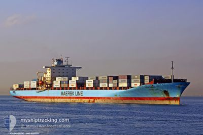
LICA MAERSK
Container Ship
Current Trip
| Time Travelled | 2 days |
|---|---|
| Remaining Time | 1 day |
| Distance Travelled | 1099.77 морская миля |
| Remaining Distance | 803.55 морская миля |
| AVG Speed | 17.7 Узлы |
| MAX Speed | 21.4 Узлы |
| AVG Wind | 7.6 knots |
| MAX Wind | 18 knots |
| MIN Temp | 14.4°C / 57.92°F |
| MAX Temp | 24.9°C / 76.82°F |
| Осадка | 11.1 м |
| Позиция Получена | 1 h, 54 m тому назад |
Current Position
| Долгота | 10.85880° |
|---|---|
| Широта | 37.52386° |
| Статус | Under way using engine |
| Скорость | 19.4 Узлы |
| Курс | 274.2° |
| Район | Mediterranean Sea - Western Basin |
| Станция | T-AIS |
| Позиция Получена | 1 h, 54 m тому назад |
Info
Information
The current position of LICA MAERSK is in Mediterranean Sea - Western Basin with coordinates 37.52386° / 10.85880° as reported on 2024-05-10 05:47 by AIS to our vessel tracker app. The vessel's current speed is 19.4 Узлы and is heading at the port of TANGER MED. The estimated time of arrival as calculated by MyShipTracking vessel tracking app is 2024-05-11 23:21 LT
The vessel LICA MAERSK (IMO: 9190779, MMSI: 477714300) is a Container Ship that was built in 2001 ( 23 лет ). It's sailing under the flag of [HK] Hong Kong.
In this page you can find informations about the vessels current position, last detected port calls, and current voyage information. If the vessels is not in coverage by AIS you will find the latest position.
The current position of LICA MAERSK is detected by our AIS receivers and we are not responsible for the reliability of the data. The last position was recorded while the vessel was in Coverage by the Ais receivers of our vessel tracking app.
The current draught of LICA MAERSK as reported by AIS is 11.1 meters
Weather
| Temperature | 17.3°C / 63.14°F |
|---|---|
| Wind Speed | 14 knots |
| Direction | 297° WNW |
| Pressure | 1017.5 hPa |
| Humidity | 86.1 % |
| Cloud Coverage | 14 % |
Featured Company
Last Port Calls
| Port | Arrival | Departure | Time In Port |
|---|---|---|---|
| 2024-05-06 13:46 | 2024-05-07 18:37 | 1 d | |
| 2024-05-04 15:04 | 2024-05-06 05:36 | 1 d | |
| 2024-05-01 04:31 | 2024-05-03 17:13 | 2 d | |
| 2024-04-29 12:39 | 2024-04-30 12:59 | 1 d | |
| 2024-04-25 10:57 | 2024-04-26 07:14 | 20 h | |
| 2024-04-24 13:44 | 2024-04-25 06:09 | 16 h | |
| 2024-04-12 01:17 | 2024-04-13 21:34 | 1 d | |
| 2024-04-08 23:42 | 2024-04-09 02:03 | 2 h | |
| 2024-04-08 03:54 | |||
| 2024-04-07 23:09 | 2024-04-08 03:33 | 4 h |
Most Visited Ports (Last year)
| Port | Arrivals | |
|---|---|---|
| 15 | ||
| 11 | ||
| 11 | ||
| 9 | ||
| 6 | ||
| 6 |
Last Trips
| Origin | Departure | Destination | Arrival | Distance | |
|---|---|---|---|---|---|
| 2024-05-06 08:36 | 2024-05-06 16:46 | 62.55 морская миля | |||
| 2024-05-03 20:13 | 2024-05-04 18:04 | 326.81 морская миля | |||
| 2024-04-30 15:59 | 2024-05-01 07:31 | 277.83 морская миля | |||
| 2024-04-26 09:14 | 2024-04-29 15:39 | 1520.38 морская миля | |||
| 2024-04-25 07:09 | 2024-04-25 12:57 | 38.31 морская миля | |||
| 2024-04-13 16:34 | 2024-04-24 14:44 | 4341.62 морская миля | |||
| 2024-04-08 21:03 | 2024-04-11 20:17 | 826.43 морская миля | |||
| 2024-04-07 22:33 | 2024-04-08 18:42 | 2.91 морская миля | |||
| 2024-04-07 22:33 | 2024-04-07 22:54 | 0.17 морская миля | |||
| 2024-04-06 18:57 | 2024-04-07 18:09 | 69.45 морская миля |
Events
| Время | Событие | Детали | Позиция / Направление | Информация |
|---|---|---|---|---|
| 2024-05-10 05:47 | Статус изменился | Default Under way using engine |
37.52415 / 10.85394
MAPTM
|
Скорость: 19.4 kn Курс: 274.2° |
| 2024-05-10 05:47 | Вне покрытия |
37.52386 / 10.85880
Mediterranean Sea - Western Basin
MAPTM
|
Скорость: 19.4 kn Курс: 274.2° |
|
| 2024-05-10 05:41 | Изменение морского района | Tunisian part of the Mediterranean Sea - Western Basin Italian part of the Mediterranean Sea - Eastern Basin |
37.51988 / 10.89597
Mediterranean Sea - Western Basin
MAPTM
|
Скорость: 19.5 kn Курс: 280.2° |
| 2024-05-10 05:41 | Статус изменился | Under way using engine Default |
37.51988 / 10.89597
MAPTM
|
Скорость: 19.8 kn Курс: 279° |
| 2024-05-10 05:41 | В покрытии |
37.51988 / 10.89597
Mediterranean Sea - Western Basin
MAPTM
|
Скорость: 19.5 kn Курс: 280.2° |
|
| 2024-05-10 01:34 | Статус изменился | Default Under way using engine |
36.99333 / 12.43167
MAPTM
|
Скорость: 20.2 kn Курс: 286° |
| 2024-05-10 01:16 | Вне покрытия |
36.96690 / 12.55176
Mediterranean Sea - Eastern Basin
MAPTM
|
Скорость: 20.2 kn Курс: 286° |
|
| 2024-05-10 01:02 | Статус изменился | Under way using engine Default |
36.94523 / 12.64424
MAPTM
|
Скорость: 20 kn Курс: 278° |
| 2024-05-10 00:55 | Статус изменился | Default Under way using engine |
36.93849 / 12.69250
MAPTM
|
Скорость: 20 kn Курс: 278.3° |
| 2024-05-10 00:44 | Статус изменился | Under way using engine Default |
36.92903 / 12.77131
MAPTM
|
Скорость: 19 kn Курс: 278° |