
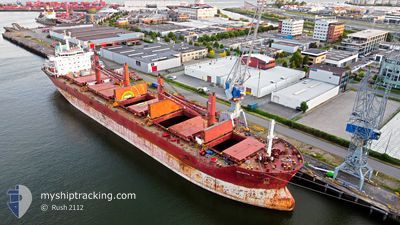
JULIETTA D
Bulk Carrier
Current Trip
US LGB>JP HIB
| Time Travelled | 3 h, 16 mins |
|---|---|
| Remaining Time | --- |
| Distance Travelled | 30.39 морская миля |
| Remaining Distance | --- |
| AVG Speed | 10.8 Узлы |
| MAX Speed | 12.2 Узлы |
| AVG Wind | 7 knots |
| MAX Wind | 8 knots |
| MIN Temp | 4.1°C / 39.38°F |
| MAX Temp | 7°C / 44.6°F |
| Осадка | 9.8 м |
| Позиция Получена | 18 m тому назад |
Current Position
| Долгота | --- |
|---|---|
| Широта | --- |
| Статус | Under way using engine |
| Скорость | 9.5 Узлы |
| Курс | 252.8° |
| Район | Inland Sea |
| Станция | T-AIS |
| Позиция Получена | 18 m тому назад |
Info
Information
The current position of JULIETTA D is in Inland Sea with coordinates 34.24350° / 133.35850° as reported on 2026-01-06 01:34 by AIS to our vessel tracker app. The vessel's current speed is 9.5 Узлы
The vessel JULIETTA D (IMO: 9590618, MMSI: 215536000) is a Bulk Carrier that was built in 2013 ( 13 лет ). It's sailing under the flag of [MT] Malta.
In this page you can find informations about the vessels current position, last detected port calls, and current voyage information. If the vessels is not in coverage by AIS you will find the latest position.
The current position of JULIETTA D is detected by our AIS receivers and we are not responsible for the reliability of the data. The last position was recorded while the vessel was in Coverage by the Ais receivers of our vessel tracking app.
The current draught of JULIETTA D as reported by AIS is 9.8 meters
Weather
| Temperature | 6.4°C / 43.52°F |
|---|---|
| Wind Speed | 4 knots |
| Direction | 308° NW |
| Pressure | 1022.5 hPa |
| Humidity | 60.5 % |
| Cloud Coverage | 6 % |
Featured Company
Last Port Calls
| Port | Arrival | Departure | Time In Port |
|---|---|---|---|
| 2026-01-04 11:08 | 2026-01-06 07:36 | 1 d | |
| 2025-12-05 21:39 | 2025-12-06 07:40 | 10 h | |
| 2025-11-27 08:43 | 2025-12-01 02:03 | 3 d | |
| 2025-11-16 19:16 | 2025-11-19 14:20 | 2 d |
Most Visited Ports (Last year)
| Port | Arrivals | |
|---|---|---|
| 3 | ||
| 2 | ||
| 2 | ||
| 1 | ||
| 1 | ||
| 1 |
Last Trips
| Origin | Departure | Destination | Arrival | Distance | |
|---|---|---|---|---|---|
| 2025-12-06 07:40 | 2026-01-04 11:08 | 5545.79 морская миля | |||
| 2025-12-01 02:03 | 2025-12-05 21:39 | 1204.82 морская миля | |||
| 2025-11-19 14:20 | 2025-11-27 08:43 | 1624.18 морская миля | |||
| 2025-10-24 22:04 | 2025-11-16 19:16 | 442.84 морская миля |
Events
| Время | Событие | Детали | Позиция / Направление | Информация |
|---|---|---|---|---|
| 2026-01-06 01:41 | Статус изменился | Default Under way using engine |
34.23835 / 133.33818
US LGB>JP HIB
|
Скорость: 9.5 kn Курс: 252.8° |
| 2026-01-06 01:34 | Статус изменился | Under way using engine Default |
34.24350 / 133.35850
US LGB>JP HIB
|
Скорость: 9.6 kn Курс: 253° |
| 2026-01-06 01:29 | Статус изменился | Default Under way using engine |
34.24724 / 133.37338
US LGB>JP HIB
|
Скорость: 10 kn Курс: 252.9° |
| 2026-01-06 01:15 | Статус изменился | Under way using engine Default |
34.25861 / 133.41812
US LGB>JP HIB
|
Скорость: 10.6 kn Курс: 254° |
| 2026-01-06 00:45 | Статус изменился | Default Under way using engine |
34.28294 / 133.51865
US LGB>JP HIB
|
Скорость: 10 kn Курс: 255.2° |
| 2026-01-06 00:38 | Статус изменился | Under way using engine Default |
34.28726 / 133.53855
US LGB>JP HIB
|
Скорость: 10 kn Курс: 251° |
| 2026-01-06 00:29 | В покрытии |
34.28726 / 133.53855
Inland Sea
|
Скорость: 10 kn Курс: 255.2° |
|
| 2026-01-05 22:37 | Начало движения | 0.49 nm, South West of HIBI |
34.44736 / 133.92219
US LGB>JP HIB
|
Скорость: 4.3 kn Курс: 205° |
| 2026-01-05 22:36 | ПОРТ ОТПРАВЛЕНИЯ |
|
34.44736 / 133.92219
US LGB>JP HIB
|
Скорость: Курс: 261° |
| 2026-01-04 02:08 | Окончание движения |
34.45057 / 133.92683
[JP] HIBI
|
Скорость: 0.1 kn Курс: 261° |