
JASMINE
General Cargo
Current Trip
| Time Travelled | 7 days |
|---|---|
| Remaining Time | --- |
| Distance Travelled | 1392.45 морская миля |
| Remaining Distance | --- |
| AVG Speed | 7.6 Узлы |
| MAX Speed | 10.2 Узлы |
| AVG Wind | 17.8 knots |
| MAX Wind | 35 knots |
| MIN Temp | 8.1°C / 46.58°F |
| MAX Temp | 19.8°C / 67.64°F |
| Осадка | 4.9 м |
| Позиция Получена | 1 d тому назад |
Current Position
| Долгота | --- |
|---|---|
| Широта | --- |
| Статус | Under way using engine |
| Скорость | 7.8 Узлы |
| Курс | 175° |
| Район | North Atlantic Ocean |
| Станция | T-AIS |
| Позиция Получена | 1 d тому назад |
Info
Information
The current position of JASMINE is in North Atlantic Ocean with coordinates 38.37912° / -10.04018° as reported on 2025-12-05 01:06 by AIS to our vessel tracker app. The vessel's current speed is 7.8 Узлы
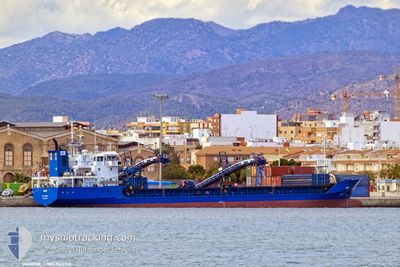
The vessel JASMINE (IMO: 9413341, MMSI: 305040000) is a General Cargo that was built in 2007 ( 18 лет ). It's sailing under the flag of [AG] Antigua Barbuda.
In this page you can find informations about the vessels current position, last detected port calls, and current voyage information. If the vessels is not in coverage by AIS you will find the latest position.
The current position of JASMINE is detected by our AIS receivers and we are not responsible for the reliability of the data. The last position was recorded while the vessel was in Coverage by the Ais receivers of our vessel tracking app.
The current draught of JASMINE as reported by AIS is 4.9 meters
Weather
| Temperature | 19.4°C / 66.92°F |
|---|---|
| Wind Speed | 13 knots |
| Direction | 28° NNE |
| Pressure | 1021.9 hPa |
| Humidity | 63.4 % |
| Cloud Coverage | 72 % |
Featured Company
Last Trips
| Origin | Departure | Destination | Arrival | Distance | |
|---|---|---|---|---|---|
| 2025-11-26 15:44 | 2025-11-26 23:52 | 69.10 морская миля | |||
| 2025-10-28 15:22 | 2025-11-16 09:24 | 3192.67 морская миля | |||
| 2025-10-16 11:36 | 2025-10-20 09:58 | 183.12 морская миля | |||
| 2025-10-03 11:48 | 2025-10-13 14:05 | 1016.61 морская миля |
Events
| Время | Событие | Детали | Позиция / Направление | Информация |
|---|---|---|---|---|
| 2025-12-06 13:26 | Окончание движения | 5.51 nm, South West of JORF LASFAR |
33.09280 / -8.73394
GB IPS >MA JFL
|
Скорость: 0.2 kn Курс: 100° |
| 2025-12-05 01:15 | Статус изменился | Default Under way using engine |
38.36055 / -10.03901
GB IPS >MA JFL
|
Скорость: 7.8 kn Курс: 175° |
| 2025-12-05 01:06 | Вне покрытия |
38.37912 / -10.04018
North Atlantic Ocean
GB IPS >MA JFL
|
Скорость: 7.8 kn Курс: 175° |
|
| 2025-12-05 01:03 | Статус изменился | Under way using engine Default |
38.38574 / -10.04050
GB IPS >MA JFL
|
Скорость: 7.9 kn Курс: 182° |
| 2025-12-05 00:47 | Статус изменился | Default Under way using engine |
38.42216 / -10.04107
GB IPS >MA JFL
|
Скорость: 7.9 kn Курс: 170.6° |
| 2025-12-04 22:59 | Статус изменился | Under way using engine Default |
38.68538 / -10.07503
GB IPS >MA JFL
|
Скорость: 9 kn Курс: 173° |
| 2025-12-04 22:30 | Статус изменился | Default Under way using engine |
38.75967 / -10.08067
GB IPS >MA JFL
|
Скорость: 8.4 kn Курс: 174.4° |
| 2025-12-04 20:12 | Статус изменился | Under way using engine Default |
39.06996 / -10.08083
GB IPS >MA JFL
|
Скорость: 8.9 kn Курс: 188° |
| 2025-12-04 20:11 | Статус изменился | Default Under way using engine |
39.07355 / -10.08061
GB IPS >MA JFL
|
Скорость: 8.4 kn Курс: 180.8° |
| 2025-12-04 19:54 | Статус изменился | Under way using engine Default |
39.11450 / -10.07875
GB IPS >MA JFL
|
Скорость: 8.3 kn Курс: 177° |