
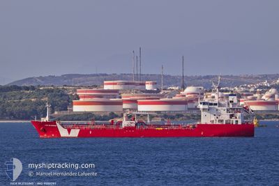
IVER BLESSING
Asphalt/Bitumen Tanker
Current Trip
FOR ORDERS
| Time Travelled | 23 h, 32 mins |
|---|---|
| Remaining Time | --- |
| Distance Travelled | 218.24 морская миля |
| Remaining Distance | --- |
| AVG Speed | 11.4 Узлы |
| MAX Speed | 12.6 Узлы |
| AVG Wind | 6.7 knots |
| MAX Wind | 12 knots |
| MIN Temp | 15.8°C / 60.44°F |
| MAX Temp | 19.4°C / 66.92°F |
| Осадка | 7 м |
| Позиция Получена | 21 h, 9 m тому назад |
Current Position
| Долгота | --- |
|---|---|
| Широта | --- |
| Статус | Under way using engine |
| Скорость | 12 Узлы |
| Курс | 222.6° |
| Район | Mediterranean Sea - Eastern Basin |
| Станция | T-AIS |
| Позиция Получена | 21 h, 9 m тому назад |
Info
Information
The current position of IVER BLESSING is in Mediterranean Sea - Eastern Basin with coordinates 36.42983° / 34.40158° as reported on 2025-12-10 11:20 by AIS to our vessel tracker app. The vessel's current speed is 12 Узлы
The vessel IVER BLESSING (IMO: 9588287, MMSI: 236623000) is a Asphalt/Bitumen Tanker that was built in 2011 ( 14 лет ). It's sailing under the flag of [GI] Gibraltar.
In this page you can find informations about the vessels current position, last detected port calls, and current voyage information. If the vessels is not in coverage by AIS you will find the latest position.
The current position of IVER BLESSING is detected by our AIS receivers and we are not responsible for the reliability of the data. The last position was recorded while the vessel was in Coverage by the Ais receivers of our vessel tracking app.
The current draught of IVER BLESSING as reported by AIS is 7 meters
Weather
| Temperature | 18.6°C / 65.48°F |
|---|---|
| Wind Speed | 5 knots |
| Direction | 345° NNW |
| Pressure | 1013.5 hPa |
| Humidity | 60.9 % |
| Cloud Coverage | 68 % |
Featured Company
Last Port Calls
| Port | Arrival | Departure | Time In Port |
|---|---|---|---|
| 2025-12-09 06:54 | 2025-12-10 11:58 | 1 d | |
| 2025-12-01 09:05 | 2025-12-03 11:20 | 2 d | |
| 2025-11-27 02:21 | 2025-11-28 19:49 | 1 d | |
| 2025-11-16 16:36 | 2025-11-17 00:58 | 8 h | |
| 2025-11-02 00:35 | 2025-11-02 18:12 | 17 h | |
| 2025-10-26 12:36 | 2025-10-27 13:49 | 1 d | |
| 2025-10-16 11:13 | 2025-10-17 09:20 | 22 h | |
| 2025-10-11 15:52 | 2025-10-12 21:27 | 1 d |
Last Trips
| Origin | Departure | Destination | Arrival | Distance | |
|---|---|---|---|---|---|
| 2025-12-03 11:20 | 2025-12-09 06:54 | 1099.57 морская миля | |||
| 2025-11-28 19:49 | 2025-12-01 09:05 | 505.97 морская миля | |||
| 2025-11-17 00:58 | 2025-11-27 02:21 | 14.35 морская миля | |||
| 2025-11-02 18:12 | 2025-11-16 16:36 | 1057.03 морская миля | |||
| 2025-10-27 13:49 | 2025-11-02 00:35 | 1181.72 морская миля | |||
| 2025-10-17 09:20 | 2025-10-26 12:36 | 1198.04 морская миля | |||
| 2025-10-12 21:27 | 2025-10-16 11:13 | 943.35 морская миля | |||
| 2025-09-30 16:16 | 2025-10-11 15:52 | 951.10 морская миля |
Events
| Время | Событие | Детали | Позиция / Направление | Информация |
|---|---|---|---|---|
| 2025-12-10 11:22 | Статус изменился | Default Under way using engine |
36.42494 / 34.39592
FOR ORDERS
|
Скорость: 12 kn Курс: 222.6° |
| 2025-12-10 11:20 | Статус изменился | Under way using engine Default |
36.42983 / 34.40158
FOR ORDERS
|
Скорость: 11.6 kn Курс: 224° |
| 2025-12-10 11:20 | Вне покрытия |
36.42983 / 34.40158
Mediterranean Sea - Eastern Basin
FOR ORDERS
|
Скорость: 12 kn Курс: 222.6° |
|
| 2025-12-10 11:04 | Статус изменился | Default Under way using engine |
36.46587 / 34.44453
FOR ORDERS
|
Скорость: 11.7 kn Курс: 223.9° |
| 2025-12-10 09:15 | Осадка изменилась | 7 5.2 |
36.73981 / 34.66806
FOR ORDERS
|
Скорость: 10.9 kn Курс: 167.1° |
| 2025-12-10 09:15 | ETA изменился | 2025/12/17 23:00 2025/12/08 17:00 |
36.73981 / 34.66806
FOR ORDERS
|
Скорость: 10.9 kn Курс: 167.1° |
| 2025-12-10 08:58 | ПОРТ ОТПРАВЛЕНИЯ |
|
36.78052 / 34.64984
FOR ORDERS
|
Скорость: 6 kn Курс: 136° |
| 2025-12-10 08:43 | Начало движения |
36.80074 / 34.65297
[TR] MERSIN
|
Скорость: 3.2 kn Курс: 223° |
|
| 2025-12-10 08:38 | Статус изменился | Under way using engine Default |
36.80183 / 34.65464
[TR] MERSIN
|
Скорость: 0.1 kn Курс: 57° |
| 2025-12-10 08:21 | В покрытии |
36.80172 / 34.65432
Mediterranean Sea - Eastern Basin
[TR] MERSIN
|
Скорость: 1.7 kn Курс: 249.9° |