
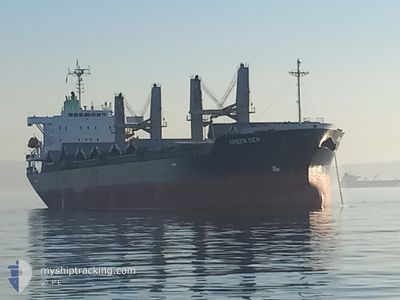
GREEN GEM
Cargo
Current Trip
| Time Travelled | 2 days |
|---|---|
| Remaining Time | 2 h, 20 mins |
| Distance Travelled | 315.06 морская миля |
| Remaining Distance | 332.80 морская миля |
| AVG Speed | 12.2 Узлы |
| MAX Speed | 13.7 Узлы |
| AVG Wind | 7.2 knots |
| MAX Wind | 24.8 knots |
| MIN Temp | 22.3°C / 72.14°F |
| MAX Temp | 28.1°C / 82.58°F |
| Осадка | 10 м |
| Позиция Получена | 2025-10-25 11:18 |
Current Position
| Долгота | --- |
|---|---|
| Широта | --- |
| Статус | Under way using engine |
| Скорость | 12.8 Узлы |
| Курс | 139.6° |
| Район | North Pacific Ocean |
| Станция | T-AIS |
| Позиция Получена | 2025-10-25 11:18 |
Info
Information
The current position of GREEN GEM is in North Pacific Ocean with coordinates 23.53549° / -112.11171° as reported on 2025-10-25 11:18 by AIS to our vessel tracker app. The vessel's current speed is 12.8 Узлы and is heading at the port of ACAJUTLA. The estimated time of arrival as calculated by MyShipTracking vessel tracking app is 2025-12-05 06:46 LT
The vessel GREEN GEM (IMO: 9831517, MMSI: 355922000) is a Cargo It's sailing under the flag of [PA] Panama.
In this page you can find informations about the vessels current position, last detected port calls, and current voyage information. If the vessels is not in coverage by AIS you will find the latest position.
The current position of GREEN GEM is detected by our AIS receivers and we are not responsible for the reliability of the data. The last position was recorded while the vessel was in Coverage by the Ais receivers of our vessel tracking app.
The current draught of GREEN GEM as reported by AIS is 10 meters
Weather
| Temperature | 27.3°C / 81.14°F |
|---|---|
| Wind Speed | 4 knots |
| Direction | --- N |
| Pressure | 1012.8 hPa |
| Humidity | 72.8 % |
| Cloud Coverage | 100 % |
Featured Company
Last Port Calls
| Port | Arrival | Departure | Time In Port |
|---|---|---|---|
| 2025-12-01 00:41 | 2025-12-02 19:39 | 1 d | |
| 2025-11-25 12:17 | 2025-11-27 13:05 | 2 d | |
| 2025-10-16 02:20 | 2025-10-18 10:48 | 2 d |
Most Visited Ports (Last year)
| Port | Arrivals | |
|---|---|---|
| 2 | ||
| 1 | ||
| 1 | ||
| 1 | ||
| 1 | ||
| 1 |
Last Trips
| Origin | Departure | Destination | Arrival | Distance | |
|---|---|---|---|---|---|
| 2025-11-27 13:05 | 2025-12-01 00:41 | 420.26 морская миля | |||
| 2025-10-18 10:48 | 2025-11-25 12:17 | 3528.75 морская миля | |||
| 2025-09-29 14:35 | 2025-10-16 02:20 | 992.02 морская миля |
Events
| Время | Событие | Детали | Позиция / Направление | Информация |
|---|---|---|---|---|
| 2025-12-04 02:27 | Начало движения | 2.31 nm, West of PUERTO CALDERA |
9.92805 / -84.75651
SV AQJ
|
Скорость: 4.3 kn Курс: 183° |
| 2025-12-03 02:11 | Окончание движения | 2.44 nm, North West of PUERTO CALDERA |
9.93207 / -84.75729
SV AQJ
|
Скорость: 0.3 kn Курс: 315° |
| 2025-12-03 01:39 | ПОРТ ОТПРАВЛЕНИЯ |
|
9.91809 / -84.72619
SV AQJ
|
Скорость: 3.6 kn Курс: 289° |
| 2025-12-03 01:35 | Начало движения |
9.91642 / -84.72150
[CR] PUERTO CALDERA
|
Скорость: 3.6 kn Курс: 289° |
|
| 2025-12-01 06:42 | Окончание движения |
9.91167 / -84.71833
[CR] PUERTO CALDERA
|
Скорость: Курс: -1° |
|
| 2025-12-01 06:41 | Порт |
|
9.91167 / -84.71833
[CR] PUERTO CALDERA
|
Скорость: 4 kn Курс: 107° |
| 2025-12-01 06:11 | Начало движения | 1.15 nm, West of PUERTO CALDERA |
9.92155 / -84.73811
SV AQJ
|
Скорость: 4.7 kn Курс: 116° |
| 2025-11-29 08:54 | Окончание движения | 1.98 nm, North West of PUERTO CALDERA |
9.92737 / -84.75086
SV AQJ
|
Скорость: 0.2 kn Курс: 82° |
| 2025-11-27 19:14 | Начало движения | 0.98 nm, South West of ACAJUTLA |
13.56953 / -89.85255
SV AQJ
|
Скорость: 8 kn Курс: 211° |
| 2025-11-27 19:05 | ПОРТ ОТПРАВЛЕНИЯ |
|
13.57833 / -89.84500
SV AQJ
|
Скорость: 1 kn Курс: 220° |